Skip to content

Cold Mountain Overlook

VerifiedOpenStreetMap + National Park Service
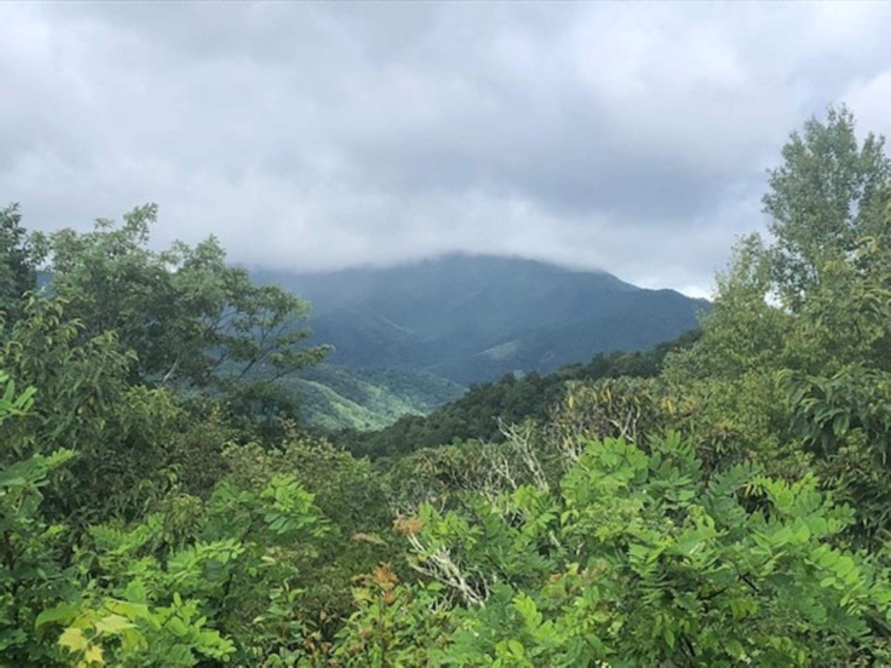
Looking west from Cold Mountain Overlook. Terrain and imagery at true elevation.

Cold Mountain Overlook sits at 4,551 feet on the Blue Ridge Parkway, facing west (270°) across terrain that drops 740 feet within 600 meters. The view takes in a line of peaks to the west and west-southwest: Old Butt Knob at 3.0 miles, Dog Loser Knob at 3.6 miles, Shining Rock at 4.1 miles, Flower Knob at 4.3 miles, and Stairs Mountain at 4.4 miles, with elevations ranging from 5,524 to 5,978 feet. Because the overlook faces directly toward the sunset direction, sunsets align with this view; on the June solstice the sun sets at 20:50, on the equinoxes around 19:30-19:43, and on the December solstice at 17:23. Asheville is 20.3 miles to the northeast, while Greenville and Greer lie roughly 42-44 miles to the south-southeast and southeast. The overlook falls between Wagon Road Gap Overlook and The Cradle of Forestry Overlook along the parkway route.

Access
On the byway
Elevation
4,551 ft
View
West · 270°
Light
Best at sunset
Relief
740 ft drop
In view
5 named features
Cold Mountain
NPS Photo / Shalyn Yost · Public domain (NPS) · NPS
Nine red spruce ( picea rubens ) cones from Pisgah National Forest. This image comprises nine individual USFWS images of cones.
Derivative: Rhododendrites Original photographs: Gary Peeples/USFWS · CC BY 2.0 · source
Barnett Branch Trail Waterfall
Will Thomas · CC BY-SA 3.0 · source
The Pisgah National Forest, NC. (USDA Photo by Lance Cheung)
USDAgov · Public domain · source
The Pisgah National Forest, NC. (USDA Photo by Lance Cheung)
USDAgov · Public domain · source
Cold Mountain (the title character of Charles Frazier 's 1997 debut novel Cold Mountain ) in the Shining Rock Wilderness area , as seen from mile marker 412 on the Blue Ridge Parkway . Photo taken with a Panasonic Lumix DMC-FZ50 in Haywood County, NC, USA .
Ken Thomas · Public domain · source

What you’re looking at

Named terrain inside the view from this overlook, nearest first.

  • Old Butt Knob5,524 ftwest · 3.0 mi
  • Dog Loser Knob5,730 ftwest · 3.6 mi
  • Shining Rock5,978 ftwest · 4.1 mi
  • Flower Knob5,893 ftwest-southwest · 4.3 mi
  • Stairs Mountain5,878 ftwest · 4.4 mi

Light

This overlook faces sunset 0° off square to it.

DateSunriseSunsetGolden hour
March equinox07:3619:4319:10
June solstice06:1720:5020:12
September equinox07:2019:3018:56
December solstice07:3717:2316:44

Local time (America/New_York). Computed for this exact position.

Where it is

  • Asheville20.3 mi northeast
  • Greenville42.4 mi south-southeast
  • Greer43.8 mi southeast
Loading map…
Private beta · Free to join

Take the scenic way to Cold Mountain Overlook.

Byway plans around your taste, verified places, real weather and opening hours — then opens every leg in Google Maps with one tap.

Private beta · Free to join · No card · Invite when a spot opens

Cold Mountain Overlook · National Park Service

Cold Mountain Overlook sits 6,039 feet above sea level. It faces west and is named for the prominent peak it faces, Cold Mountain. It is located at Wagon Road Gap and the junction of Hwy 276 at Milepost 411.9. Part of the Great Balsam Mountains within the Appalachian Mountain chain, Cold Mountain is also part of the Shining Rock Wilderness. Cold Mountain is known for inspiring a bestseller book and movie, Cold Mountain, written by Charles Frazier. Check the conditions of the area before you visit.

Read it at National Park Service

Old Butt Knob · WikipediaCC BY-SA

Old Butt Knob is a summit in Haywood County, North Carolina, in the United States. It is located within Pisgah National Forest. With an elevation of 5,522 feet (1,683 m), Old Butt Knob is the 114th highest mountain in North Carolina.

Read it at Wikipedia

Shining Rock · WikipediaCC BY-SA

Shining Rock is a mountain in western North Carolina, United States. The mountain is one of the Great Balsam Mountains which are a part of the Blue Ridge Mountains within the Appalachian Mountains. It is the 38th tallest mountain in the eastern United States.

Read it at Wikipedia

How high is Cold Mountain Overlook?

Cold Mountain Overlook sits at about 4,551 feet (1,387 m).

What can you see from Cold Mountain Overlook?

From Cold Mountain Overlook: Old Butt Knob (W, 3.0 mi); Dog Loser Knob (W, 3.6 mi); Shining Rock (W, 4.1 mi); Flower Knob (WSW, 4.3 mi).

Is Cold Mountain Overlook better at sunrise or sunset?

Sunset. The land falls away from Cold Mountain Overlook toward the sunset, so at sunrise the light is behind you. Exact times shift through the year; the page shows the current window.

What is the nearest town to Cold Mountain Overlook?

Asheville, 20 miles NE of Cold Mountain Overlook.

What is the next lookout after Cold Mountain Overlook?

The Cradle of Forestry Overlook is the next surfaced lookout along the same route after Cold Mountain Overlook.

Drive to Cold Mountain Overlook with Byway

Byway plans the scenic way there — real places along Blue Ridge Parkway, real weather, zero hallucinations — and hands the turns to the navigation you already use.

Byways with this lookout

Day trips start here

Locals make it Verified.

Cold Mountain Overlook — confirmed, rated, and photographed by people who actually pulled over. A local confirmation is what upgrades a lookout from Discovered to Verified. Zero hallucinations.

Confirmed by locals

No local confirmations yet. Stood here? Yours is the one that upgrades this lookout to Verified.

Ratings

No ratings yet. Stood at this lookout? Be the first to rate it.

No written reviews yet.

Field notes

No field notes yet. Know the gate hours or the best pull-in? Leave the note you wish you'd had.

Photos

No photos yet.

Sign in to confirm this lookout, rate it, add photos, and leave field notes.

More lookouts on Blue Ridge Parkway

Named places near this lookout