Onion Mountain Overlook
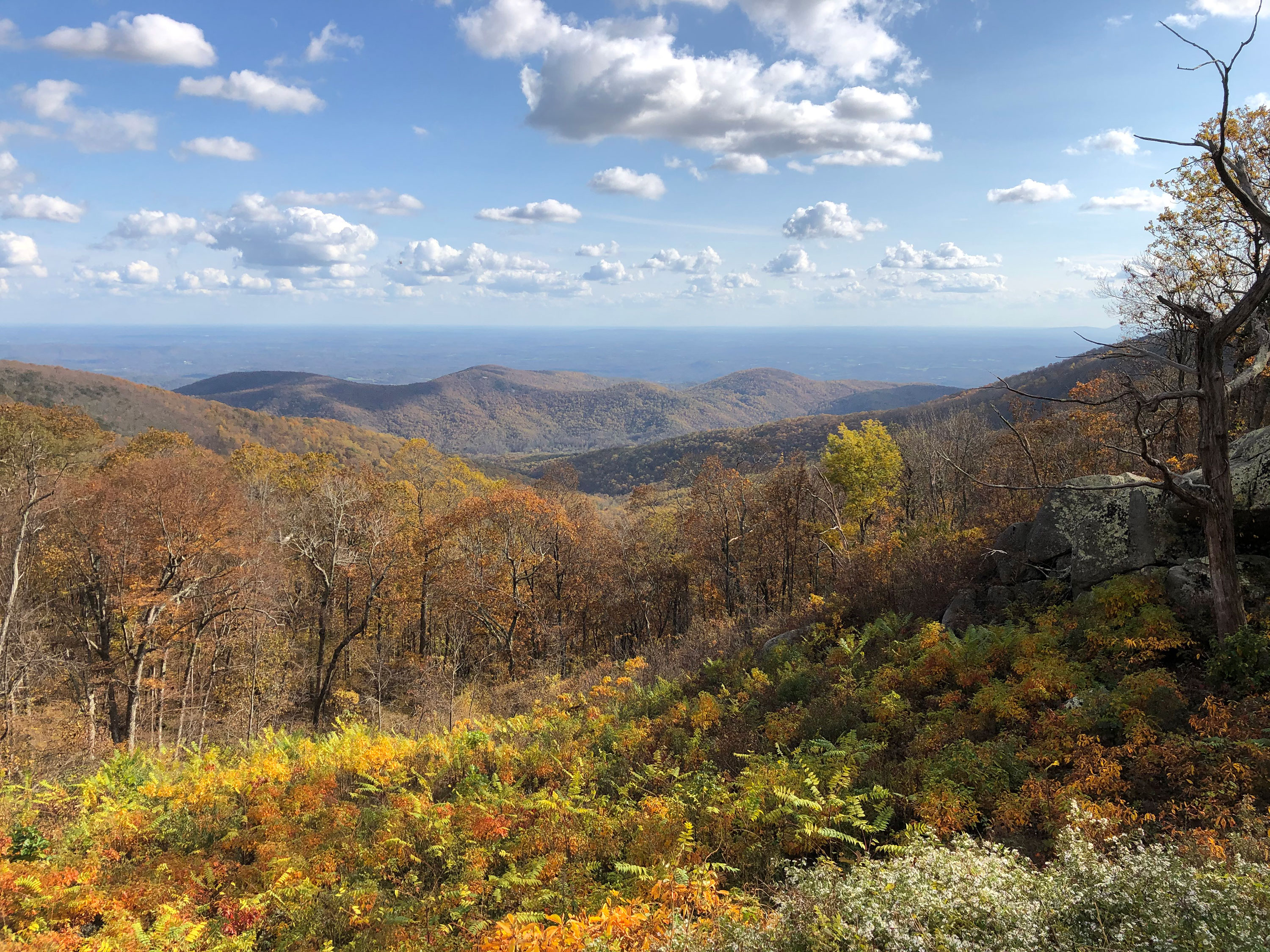
Onion Mountain Overlook sits at 3,196 feet on the Blue Ridge Parkway, facing 150 degrees toward the south-southeast. The land drops 793 feet within 600 meters of the viewpoint, giving an open view across the terrain below. Suck Mountain is visible to the south-southeast at 3.2 miles, reaching 2,177 feet, while Lone Pine Mountain sits farther southeast at 8.0 miles and 1,390 feet. Lynchburg lies 22.4 miles east-southeast, with Roanoke 27.1 miles southwest and Cave Spring 31.7 miles southwest. The Small Waterfall lookout precedes this stop along the byway, and Black Rock Hill Overlook follows. On the June solstice, sunrise occurs at 05:58 and sunset at 20:43; the December solstice brings a shorter day, with sunrise at 07:30 and sunset at 17:04. The equinox days fall close to 12 hours, with sunrise near 07:07–07:23 and sunset near 19:17–19:30. The approach road to this overlook closes seasonally between August 1 and January 10, so travelers planning a visit in that window should check access before arriving.
What you’re looking at
Named terrain inside the view from this overlook, nearest first.
- Suck Mountain2,177 ftsouth-southeast · 3.2 mi
- Lone Pine Mountain1,390 ftsoutheast · 8.0 mi
Light
| Date | Sunrise | Sunset | Golden hour |
|---|---|---|---|
| March equinox | 07:23 | 19:30 | 18:56 |
| June solstice | 05:58 | 20:43 | 20:04 |
| September equinox | 07:07 | 19:17 | 18:42 |
| December solstice | 07:30 | 17:04 | 16:23 |
Local time (America/New_York). Computed for this exact position.
Where it is
- Lynchburg22.4 mi east-southeast
- Roanoke27.1 mi southwest
- Cave Spring31.7 mi southwest
The approach closes seasonally. Source: OpenStreetMap (access:conditional=yes @ (Aug 01-Jan 10)). Check the road authority before travelling.
Take the scenic way to Onion Mountain Overlook.
Byway plans around your taste, verified places, real weather and opening hours — then opens every leg in Google Maps with one tap.
How high is Onion Mountain Overlook?
Onion Mountain Overlook sits at about 3,196 feet (974 m).
What can you see from Onion Mountain Overlook?
From Onion Mountain Overlook: Suck Mountain (SSE, 3.2 mi); Lone Pine Mountain (SE, 8.0 mi).
Is the road to Onion Mountain Overlook open year-round?
No. The approach to Onion Mountain Overlook closes seasonally. The source records: access:conditional=yes @ (Aug 01-Jan 10). Check the managing agency before setting out.
What is the nearest town to Onion Mountain Overlook?
Lynchburg, 22 miles ESE of Onion Mountain Overlook.
What is the next lookout after Onion Mountain Overlook?
Black Rock Hill Overlook is the next surfaced lookout along the same route after Onion Mountain Overlook.
Drive to Onion Mountain Overlook with Byway
Byway plans the scenic way there — real places along Blue Ridge Parkway, real weather, zero hallucinations — and hands the turns to the navigation you already use.
Byways with this lookout
Day trips start here
Locals make it Verified.
Onion Mountain Overlook — confirmed, rated, and photographed by people who actually pulled over. A local confirmation is what upgrades a lookout from Discovered to Verified. Zero hallucinations.
Confirmed by locals
No local confirmations yet. Stood here? Yours is the one that upgrades this lookout to Verified.
Ratings
No ratings yet. Stood at this lookout? Be the first to rate it.
No written reviews yet.
Field notes
No field notes yet. Know the gate hours or the best pull-in? Leave the note you wish you'd had.
Photos
No photos yet.
Sign in to confirm this lookout, rate it, add photos, and leave field notes.