Skip to content

Panorama Point Overlook

OpenStreetMap
Looking south from Panorama Point Overlook. Terrain and imagery at true elevation.

Panorama Point Overlook sits at 6,198 feet along the Capitol Reef Country Scenic Byway, at mile 26 of 65, facing south. The terrain drops 291 feet within 600 meters of the point, and a short walk from the parking area brings visitors to a 360-degree view of sandstone cliffs. Nearby viewpoints include Goosenecks Overlook to the south-southwest at 0.5 miles and Sunset Point Overlook to the south at 0.6 miles, both slightly higher in elevation than the overlook itself. Farther off, Fruita Point rises to the south at 2.3 miles, with Danish Hill to the southeast at 3.8 miles and Ferns Nipple, whose runoff drains toward the Fremont River, at 6.1 miles southeast. Loa lies 20 miles west-northwest, Escalante is 40.6 miles south-southwest, and Sigurd is 51.8 miles northwest. Goosenecks Overlook is the previous stop along the byway, with Sunset Point Overlook next. Sunrise and sunset times vary through the year, from a 6:03 a.m. sunrise at the June solstice to a 7:39 a.m. sunrise at the December solstice, with sunsets ranging from 5:09 p.m. in December to 8:53 p.m. in June.

Position
Mile ~26 of 65
Access
On the byway
Elevation
6,198 ft
View
South · 180°
Relief
291 ft drop
In view
5 named features
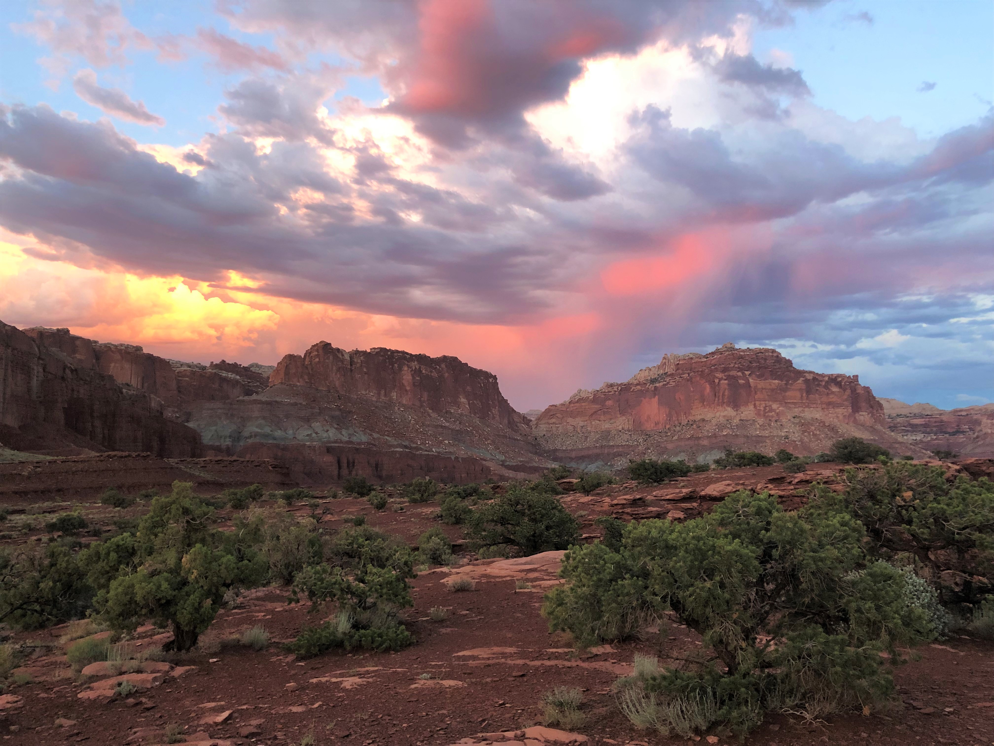
Panorama Point is an excellent place to watch the sunset.
NPS / Emily Van Ness · Public domain (NPS) · NPS
View east from the trail to Panorama Point in Capitol Reef National Park
Famartin · CC BY-SA 3.0 · source
Pinus edulis near Panorama Point in Capitol Reef National Park
Famartin · CC BY-SA 3.0 · source
Pinus edulis near Panorama Point in Capitol Reef National Park
Famartin · CC BY-SA 3.0 · source
View north-northeast from Panorama Point in Capitol Reef National Park
Famartin · CC BY-SA 3.0 · source
Pinus edulis near Panorama Point in Capitol Reef National Park
Famartin · CC BY-SA 3.0 · source

What you’re looking at

Named terrain inside the view from this overlook, nearest first.

  • Goosenecks Overlook6,377 ftsouth-southwest · 0.5 mi
  • Sunset Point Overlook6,382 ftsouth · 0.6 mi
  • Fruita Point7,196 ftsouth · 2.3 mi
  • Danish Hill5,845 ftsoutheast · 3.8 mi
  • Ferns Nipple7,018 ftsoutheast · 6.1 mi

Light

DateSunriseSunsetGolden hour
March equinox07:2919:3719:03
June solstice06:0320:5320:13
September equinox07:1419:2418:49
December solstice07:3917:0916:27

Local time (America/Denver). Computed for this exact position.

Where it is

Mile 26 of 65 along Capitol Reef Country Scenic Byway.

  • Loa20.0 mi west-northwest
  • Escalante40.6 mi south-southwest
  • Sigurd51.8 mi northwest
Loading map…
Private beta · Free to join

Take the scenic way to Panorama Point Overlook.

Byway plans around your taste, verified places, real weather and opening hours — then opens every leg in Google Maps with one tap.

Private beta · Free to join · No card · Invite when a spot opens

Panorama Point · National Park Service

Panorama Point features sweeping views of huge sandstone cliffs. This vista is easy to access from HWY 24, just 2.5 miles (4km) west of the visitor center. From the parking area, a very brief walk leads visitors to a 360-degree view. The breathtaking landscape can be viewed any time of day, although colored cliffs become particularly vibrant as sunset approaches. This high point also provides stargazers with an excellent view of the night sky.

Read it at National Park Service

Ferns Nipple · WikipediaCC BY-SA

Ferns Nipple is a 7,065-foot (2,153-meter) elevation summit located in Capitol Reef National Park, in Wayne County of Utah, United States. This iconic landmark is situated four miles (6.4 km) southeast of the park's visitor center. Precipitation runoff from this feature is drained by tributaries of the Fremont River, which in turn is within the Colorado River drainage basin. Folklore attributes this geological feature's naming to outlaw Butch Cassidy and his favored girlfriend named Fern.

Read it at Wikipedia

How high is Panorama Point Overlook?

Panorama Point Overlook sits at about 6,198 feet (1,889 m).

What can you see from Panorama Point Overlook?

From Panorama Point Overlook: Goosenecks Overlook (SSW, 0.5 mi); Sunset Point Overlook (S, 0.6 mi); Fruita Point (S, 2.3 mi); Danish Hill (SE, 3.8 mi).

What is the nearest town to Panorama Point Overlook?

Loa, 20 miles WNW of Panorama Point Overlook.

What is the next lookout after Panorama Point Overlook?

Sunset Point Overlook is the next surfaced lookout along the same route after Panorama Point Overlook.

Drive to Panorama Point Overlook with Byway

Byway plans the scenic way there — real places along Capitol Reef Country Scenic Byway, real weather, zero hallucinations — and hands the turns to the navigation you already use.

Byways with this lookout

Day trips start here

Locals make it Verified.

Panorama Point Overlook — confirmed, rated, and photographed by people who actually pulled over. A local confirmation is what upgrades a lookout from Discovered to Verified. Zero hallucinations.

Confirmed by locals

No local confirmations yet. Stood here? Yours is the one that upgrades this lookout to Verified.

Ratings

No ratings yet. Stood at this lookout? Be the first to rate it.

No written reviews yet.

Field notes

No field notes yet. Know the gate hours or the best pull-in? Leave the note you wish you'd had.

Photos

No photos yet.

Sign in to confirm this lookout, rate it, add photos, and leave field notes.

More lookouts on Capitol Reef Country Scenic Byway

Named places near this lookout