Skip to content

Tower Point

OpenStreetMap
Looking south-east from Tower Point. Terrain and imagery at true elevation.

Tower Point sits at mile 389 of the Trail of the Ancients, at 5,217 feet, with the terrain facing 120° and dropping 107 feet over the next 600 meters. The view takes in the canyon and its side canyon, along with Sleeping Ute Mountain and the surrounding landscape. In the side canyon, alcoves are visible just below the rim, some open rock and others with stonework remains, once used as granary rooms for storing crops such as corn, beans, and squash. Because the orientation faces roughly toward sunrise, sunrise and sunset times shift with the season, from a 05:57 sunrise at the June solstice to a 07:28 sunrise at the December solstice. Cortez lies 27.2 miles east, Blanding 27.5 miles northwest, and Monticello 36.8 miles north-northwest. Canyon Overlook precedes this stop, and Muley Point Overlook follows. Visitors are asked to remain on marked trails, avoid entering or touching any structure, and leave all artifacts, including pottery sherds, arrow points, and rock art, undisturbed, since the stonework and towers in this area are fragile and easily damaged.

Position
Mile ~389 of 600
Access
0.4 mi detour
Elevation
5,217 ft
View
Southeast · 120°
Light
Best at sunrise
Relief
107 ft drop
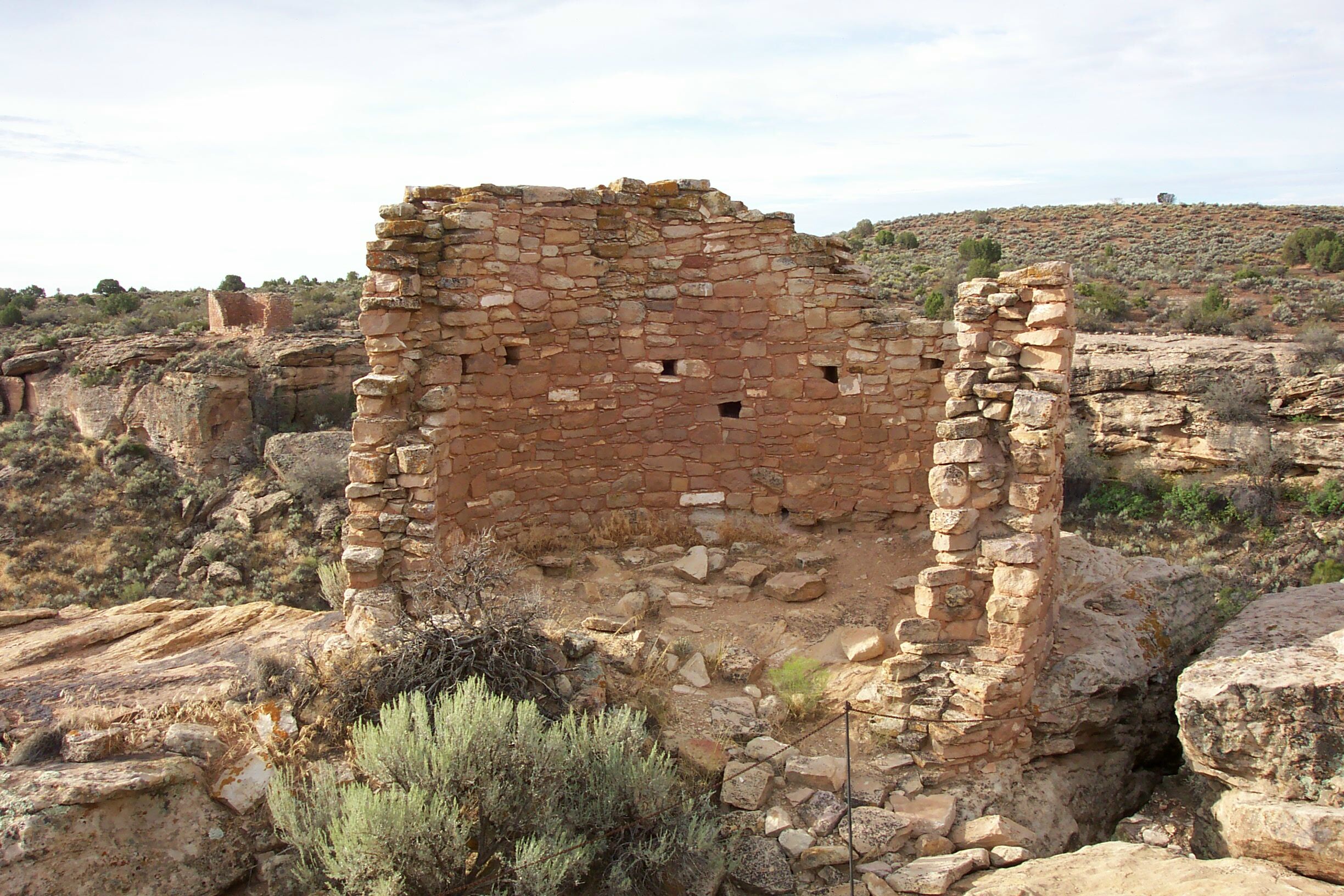
Tower Point is perfectly placed at the junction of two canyons, providing excellent views.
NPS photo · Public domain (NPS) · NPS
Hovenweep National Monument
Greg Willis from Denver, CO, usa · CC BY-SA 2.0 · source
Little Ruin Canyon
runt35 · CC BY 3.0 · source
Little Ruin Canyon
runt35 · CC BY 3.0 · source
Hovenweep National Monument
Greg Willis from Denver, CO, usa · CC BY-SA 2.0 · source
Hovenweep NM
Greg Willis from Denver, CO, usa · CC BY-SA 2.0 · source

Light

This overlook faces sunrise 30° off square to it.

DateSunriseSunsetGolden hour
March equinox07:2119:2818:54
June solstice05:5720:4120:02
September equinox07:0519:1518:40
December solstice07:2817:0316:22

Local time (America/Denver). Computed for this exact position.

Where it is

Mile 389 of 600 along Trail of the Ancients.

  • Cortez27.2 mi east
  • Blanding27.5 mi northwest
  • Monticello36.8 mi north-northwest
Loading map…
Private beta · Free to join

Take the scenic way to Tower Point.

Byway plans around your taste, verified places, real weather and opening hours — then opens every leg in Google Maps with one tap.

Private beta · Free to join · No card · Invite when a spot opens

Tower Point · National Park Service

The most striking feature of Tower Point itself is the commanding view of the canyon and side canyon, Sleeping Ute Mountain, and surrounding landscape. For that reason, Tower Point is often a must-see for visitors.

In the side canyon, look for alcoves just below the rim. Some are open rock, others have remains of stonework nearby - rooms where people stored crops such as corn, beans, and squash. A surplus harvest was essential to the ancestral Puebloans because they had to get through the inevitable bad years when crops failed. We believe they kept at least 1 years’ surplus crops for every person in the community. These granaries had to be tight and secure against rodents and seeping water.

The unique stone towers and other buildings at Hovenweep are extremely fragile. To help preserve them, observe proper site etiquette.

Remain on marked trails.

Do not enter or touch any structure.

Do not touch or disturb any artifacts, including pottery sherds, arrow points, or rock art. Once removed from context, the story they tell is gone forever.

Read it at National Park Service

How high is Tower Point?

Tower Point sits at about 5,217 feet (1,590 m).

Is Tower Point better at sunrise or sunset?

Sunrise. The land falls away from Tower Point toward the sunrise, so at sunset the light is behind you. Exact times shift through the year; the page shows the current window.

What is the nearest town to Tower Point?

Cortez, 27 miles E of Tower Point.

What is the next lookout after Tower Point?

Muley Point Overlook is the next surfaced lookout along the same route after Tower Point.

Drive to Tower Point with Byway

Byway plans the scenic way there — real places along Trail of the Ancients, real weather, zero hallucinations — and hands the turns to the navigation you already use.

Byways with this lookout

Locals make it Verified.

Tower Point — confirmed, rated, and photographed by people who actually pulled over. A local confirmation is what upgrades a lookout from Discovered to Verified. Zero hallucinations.

Confirmed by locals

No local confirmations yet. Stood here? Yours is the one that upgrades this lookout to Verified.

Ratings

No ratings yet. Stood at this lookout? Be the first to rate it.

No written reviews yet.

Field notes

No field notes yet. Know the gate hours or the best pull-in? Leave the note you wish you'd had.

Photos

No photos yet.

Sign in to confirm this lookout, rate it, add photos, and leave field notes.

More lookouts on Trail of the Ancients

Named places near this lookout