Skip to content

Wilson Creek Valley Overlook

VerifiedOpenStreetMap + National Park Service
Looking south-east from Wilson Creek Valley Overlook. Terrain and imagery at true elevation.

Wilson Creek Valley Overlook sits at 4,338 feet on the Blue Ridge Parkway, facing south-southeast, with the land dropping 520 feet within 600 meters of the pullout. The view spans a stretch of terrain including Walker Hollow Falls to the southeast at 2.9 miles, and several peaks arranged to the south and southwest: Marks Mountain and Ned Mountain at 2,896 and 2,846 feet respectively, along with Laurel Mountain and Polecat Knob. Barn Ridge Creek Falls lies farther out at 4.2 miles, also to the southeast. The overlook is positioned between Boulder Field Overlook and Pilot Ridge Overlook along the byway. Johnson City is 35.1 miles to the west-northwest, Hickory is roughly the same distance to the southeast, and Bristol lies 41.1 miles north-northwest. Daylight hours shift with the seasons: sunrise comes as early as 6:11 a.m. around the June solstice and as late as 7:35 a.m. near the December solstice, with sunset ranging from 5:17 p.m. in December to 8:48 p.m. in June. Visitors should check current conditions before heading out, as access and visibility can vary.

Access
On the byway
Elevation
4,338 ft
View
Southeast · 150°
Relief
520 ft drop
In view
6 named features
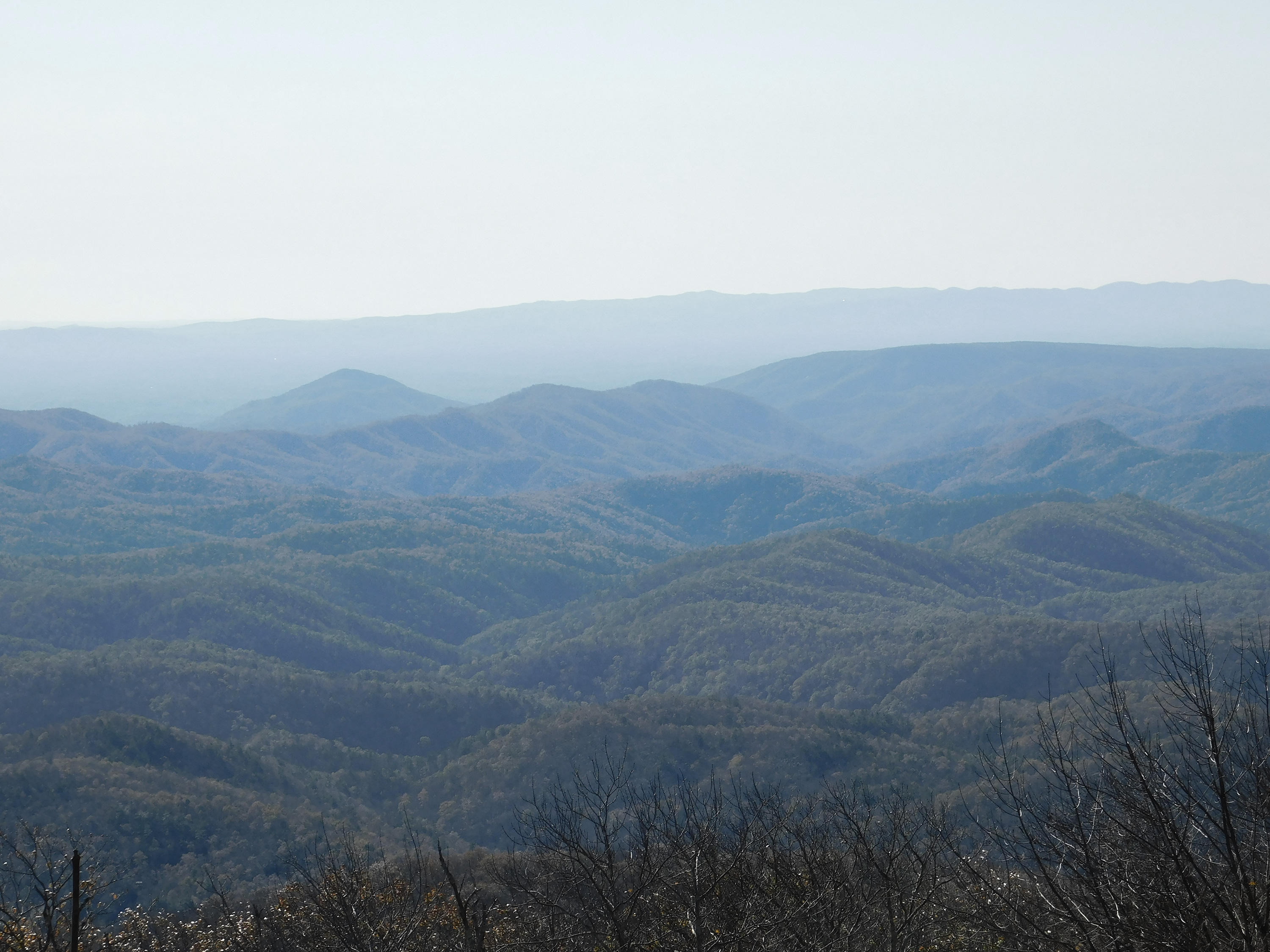
Mountains stretch to the horizon at Wilson Creek Valley Overlook
NPS Photo · Public domain (NPS) · NPS
Abies fraseri , Grandfather Mountain, Cherokee Woods, North Carolina, USA.
Claire Powers from Fairfax, VA, USA · CC BY 2.0 · source
Abies fraseri and Picea rubens , Grandfather Mountain, Cherokee Woods, North Carolina, USA.
Claire Powers from Fairfax, VA, USA · CC BY 2.0 · source
Picea rubens , Flat Rock, Grandfather Mountain, Cherokee Woods, North Carolina, USA.
Claire Powers from Fairfax, VA, USA · CC BY 2.0 · source
Rough Ridge Lookout - Grandfather Mountain, Linville, United States
Andrew Neel andrewtneel · CC0 · source
View of Earth taken during ISS Expedition 47.
Earth Science and Remote Sensing Unit , Lyndon B. Johnson Space Center · Public domain · source

What you’re looking at

Named terrain inside the view from this overlook, nearest first.

  • Walker Hollow Falls1,984 ftsoutheast · 2.9 mi
  • Polecat Knob2,690 ftsoutheast · 3.7 mi
  • Marks Mountain2,896 ftsouth-southwest · 3.9 mi
  • Laurel Mountain2,465 ftsouth-southeast · 4.0 mi
  • Barn Ridge Creek Falls2,225 ftsoutheast · 4.2 mi
  • Ned Mountain2,846 ftsouth-southwest · 4.8 mi

Light

DateSunriseSunsetGolden hour
March equinox07:3219:3919:05
June solstice06:1120:4820:10
September equinox07:1619:2618:52
December solstice07:3517:1716:37

Local time (America/New_York). Computed for this exact position.

Where it is

  • Johnson City35.1 mi west-northwest
  • Hickory35.2 mi southeast
  • Bristol41.1 mi north-northwest
Loading map…
Private beta · Free to join

Take the scenic way to Wilson Creek Valley Overlook.

Byway plans around your taste, verified places, real weather and opening hours — then opens every leg in Google Maps with one tap.

Private beta · Free to join · No card · Invite when a spot opens

Wilson Creek Valley Overlook · National Park Service

This overlook provides a scenic view to the south toward South Mountain State Park and the South Carolina border. On a clear day, downtown Charlotte and Kings Mountain are visible on the horizon. To the west MacRae’s Peak offers more photo opportunities. Check the conditions of the area before you visit.

Read it at National Park Service

How high is Wilson Creek Valley Overlook?

Wilson Creek Valley Overlook sits at about 4,338 feet (1,322 m).

What can you see from Wilson Creek Valley Overlook?

From Wilson Creek Valley Overlook: Walker Hollow Falls (SE, 2.9 mi); Polecat Knob (SE, 3.7 mi); Marks Mountain (SSW, 3.9 mi); Laurel Mountain (SSE, 4.0 mi).

What is the nearest town to Wilson Creek Valley Overlook?

Johnson City, 35 miles WNW of Wilson Creek Valley Overlook.

What is the next lookout after Wilson Creek Valley Overlook?

Pilot Ridge Overlook is the next surfaced lookout along the same route after Wilson Creek Valley Overlook.

Drive to Wilson Creek Valley Overlook with Byway

Byway plans the scenic way there — real places along Blue Ridge Parkway, real weather, zero hallucinations — and hands the turns to the navigation you already use.

Byways with this lookout

Locals make it Verified.

Wilson Creek Valley Overlook — confirmed, rated, and photographed by people who actually pulled over. A local confirmation is what upgrades a lookout from Discovered to Verified. Zero hallucinations.

Confirmed by locals

No local confirmations yet. Stood here? Yours is the one that upgrades this lookout to Verified.

Ratings

No ratings yet. Stood at this lookout? Be the first to rate it.

No written reviews yet.

Field notes

No field notes yet. Know the gate hours or the best pull-in? Leave the note you wish you'd had.

Photos

No photos yet.

Sign in to confirm this lookout, rate it, add photos, and leave field notes.

More lookouts on Blue Ridge Parkway

Named places near this lookout