Dunewood Campground
41.6720, -86.9838 · Park boundary: National Park Service
Make Dunewood Campground part of the drive.
Byway plans around your taste, verified places, real weather and opening hours — then opens every leg in Google Maps with one tap.
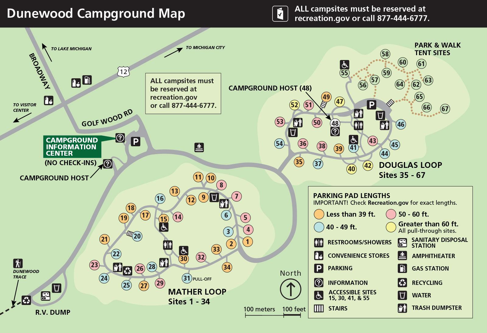
Reservation detailsCampground consists of two loops containing 66 camp-sites (53 conventional drive-in sites and 13 walk/carry-in sites). Four sites are wheelchair accessible (numbers 15, 30, 41 and 55). Each loop has modern restrooms and hot/cold showers. Some sites have limited recreational vehicle length. Convenience stores and a gas station are located 1/4 mile north of the campground at the intersection of U.S. Highway 12 and Broadway Ave. in the town of Beverly Shores. Campground closed during winter, Nov 2 - Mar 31.
- Every day
- All Day
Open April 1 through October 31.
- Winter Closure · Nov 2, 2026 – Mar 31, 2027 · Closed
$25.00 per night.
The Access Pass provides a 50% each night.
Senior Lifetime and Senior Annual
All campsites are reserved on Recreation.gov. Check-out time is noon. New "check-ins" cannot occupy your site until noon, unless the site is vacant.
- Amphitheater
- Yes - seasonal
- Cell reception
- Yes - year round
- Drinking water
- Yes - seasonal
- Dump station
- Yes - seasonal
- Host on site
- Yes - seasonal
- Showers
- Hot - Seasonal · Cold- Seasonal · Free - Seasonal
- Toilets
- Flush Toilets - seasonal
- Trash & recycling
- Yes - seasonal
- Camp store
- No
- Firewood for sale
- No
- Food storage lockers
- No
- Ice for sale
- No
- Internet
- No
- Laundry
- No
- RVs
- Allowed
- Trailers
- Allowed
- Access roads
- Paved Roads - All vehicles OK
- Classification
- Limited Development Campground
Most sites are packed gravel. Accessible sites 15,30,41, and 55 are paved. Some walk-in sites have stairs.
The campground loop is paced. Sites 15, 30, 41, and 55 are accessible. Facilities, located in the center of both loops, are also accessible.
Fires must be in camping rings only. Camping stoves are permitted.
From I-94 Depart I-94 at exit 26B, take ramp right and follow signs for IN-49 North 1.0 mi Keep left to stay on IN-49 / N State Road 49 0.8 mi Take ramp left 338 ft Turn sharp right onto US-12 E / W Dunes Hwy 4.7 mi Turn right onto Broadway at gas station on the corner 322 ft . Turn left onto Golf Wood Rd
On average, the warmest month is July and the highest recorded temperature was 105F in 1934. The coolest month is January, with the lowest recorded temperature of -25F in 1985. June sees the most precipitation with an average rainfall of 4.66 Inches.
Stays are limited to 14 days in a 30-day period. Quiet hours are daily, 10:00 pm to 6:00 am. Please be considerate of others. All tents and equipment must be set up on the camping pad. A maximum of 8 people per site. All vehicles and RV campers must remain completely on the pavement. Bikes can be walked to the tent sites. Pets must be attended and on a leash of 6 foot or less. Prohibited Activities Driving over 15 MPH on campground roads Bicycles / vehicles off of paved roads Campfires outside of the provided grates Damaging of trees especially cutting or driving nails in trees Digging / leveling the campsite Bathing / washing at water outlets Disturbing / hunting / capturing wildlife or plants Fireworks See campground for a complete list of regulations
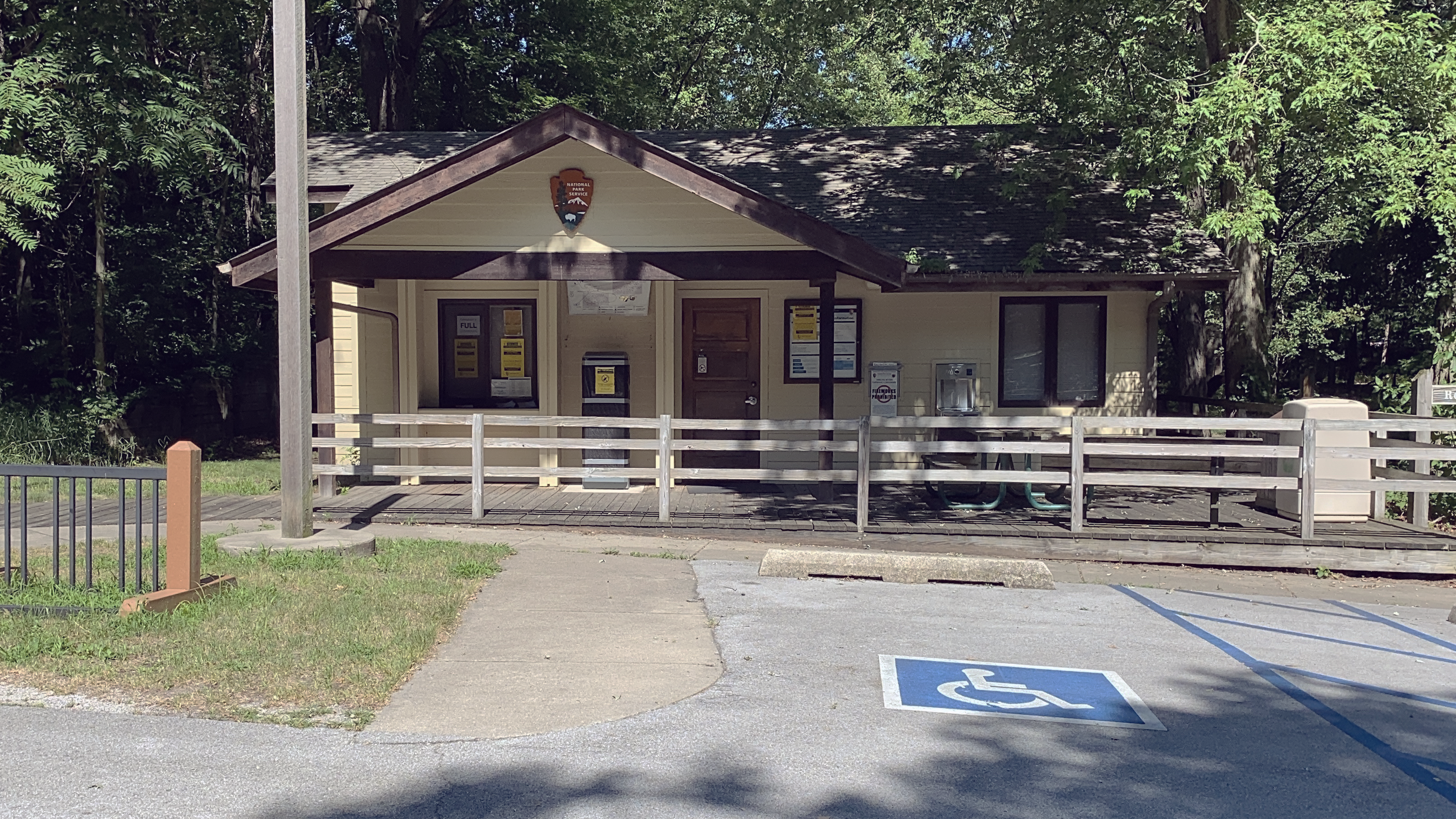
Location, hours, and facility details confirmed against the National Park Service registry.
National Park Service registryChecked 2026-08-04
Can you reserve a campsite at Dunewood Campground?
Yes. Dunewood Campground in Indiana Dunes National Park has 66 sites that can be reserved in advance.
How many campsites does Dunewood Campground have?
Dunewood Campground in Indiana Dunes National Park has 66 campsites.
What is the maximum RV length at Dunewood Campground?
Dunewood Campground takes RVs, but the National Park Service does not publish a maximum length for it. Call the park before booking a long rig.
How much does it cost to camp at Dunewood Campground?
Dunewood Campground in Indiana Dunes National Park charges between $12.50 and $25 per night, depending on the site type.
Are there showers at Dunewood Campground?
Yes. Dunewood Campground in Indiana Dunes National Park lists showers: Hot - Seasonal · Cold- Seasonal · Free - Seasonal.
Is there drinking water at Dunewood Campground?
Yes. Dunewood Campground in Indiana Dunes National Park lists drinking water: Yes - seasonal.
Is there cell service at Dunewood Campground?
Yes. Dunewood Campground in Indiana Dunes National Park lists cell reception: Yes - year round.
Is there a dump station at Dunewood Campground?
Yes. Dunewood Campground in Indiana Dunes National Park lists dump station: Yes - seasonal.
Is Dunewood Campground wheelchair accessible?
Dunewood Campground in Indiana Dunes National Park: Most sites are packed gravel. Accessible sites 15,30,41, and 55 are paved. Some walk-in sites have stairs.
Drive to Dunewood Campground
Byway plans the scenic way in — real places, real weather, every stop verified. Zero hallucinations. Google Maps for turns. Byway for soul.