Kings Canyon National Park

Official park boundary · National Park Service
Take the scenic way to Kings Canyon National Park.
Byway plans around your taste, verified places, real weather and opening hours — then opens every leg in Google Maps with one tap.
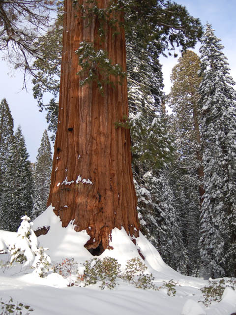
Huge mountains, rugged foothills, deep canyons, vast caverns, and the world’s largest trees exemplify the diversity of landscapes, life, and beauty here. Explore these pages to plan your visit or to learn about the plants and animals here and the threats they face. Ancient giant sequoias may seem invincible, but they, too are vulnerable.
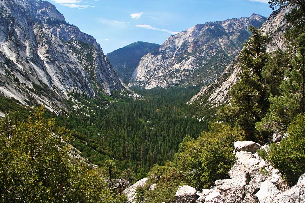
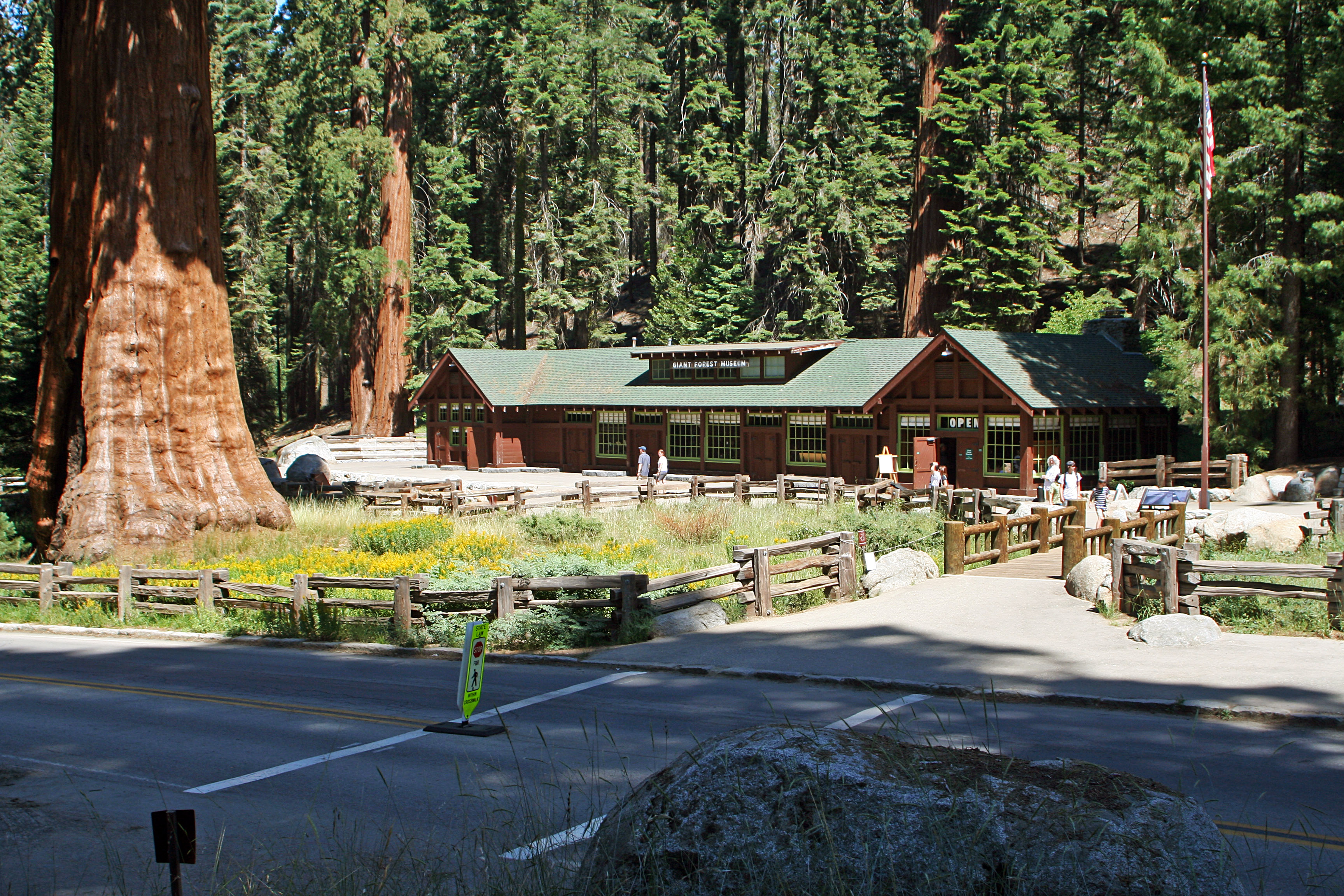
Kings Canyon National Park is a national park of the United States in the southern Sierra Nevada, in Fresno and Tulare Counties, California. Originally established in 1890 as General Grant National Park, the park was greatly expanded and renamed on March 4, 1940. The park's namesake, Kings Canyon, is a rugged glacier-carved valley more than a mile (1,600 m) deep. Other natural features include multiple 14,000-foot (4,300 m) peaks, high mountain meadows, swift-flowing rivers, and some of the world's largest stands of giant sequoia trees. Kings Canyon is north of and contiguous with Sequoia National Park, and both parks are jointly administered by the National Park Service as the Sequoia and Kings Canyon National Parks.
Two highways enter the parks. Hwy 180 from Fresno leads east to Kings Canyon National Park, then continues 30 miles east to Cedar Grove. Hwy 198 from Visalia leads east to Sequoia National Park via Three Rivers. Inside the parks, Highway 198 becomes the Generals Highway, which connects 198 to 180. Vehicles over 22-feet long should enter the parks via Highway 180. In winter, the Generals Highway between the parks often closes. Chains may be required on park roads. No roads cross the parks east to west.
Because of the extreme elevation range in the parks, weather conditions vary widely between areas. In summer, the sequoia groves have comfortable temperatures and the foothills are hot and dry. Snow lingers on high-mountain passes well into summer. In fall, conditions can range from summer-like to winter-like. Winter brings snow to sequoia groves and rain to the foothills. Be prepared for tire chain requirements. Spring is a great time to hike in the foothills and snow begins to melt at higher elevations.
Source: National Park Service
This pass is valid for 1-7 days and includes everyone traveling in a single vehicle for Sequoia & Kings Canyon National Parks and Hume Lake District of Sequoia National Forest/Giant Sequoia National Monument.
This entry fee is for a single person traveling on foot or by bicycle. It is valid for 1-7 days in Sequoia & Kings Canyon National Parks and Hume Lake District of Sequoia National Forest/Giant Sequoia National Monument.
Valid for 7 days. Admits up to 2 private, non-commercial motorcycles, scooters, or similar motorized vehicles with up to 4 total passengers to Sequoia & Kings Canyon National Parks and Hume Lake District of Sequoia National Forest/Giant Seq…
Non-commercial groups traveling in vehicles that have a capacity of up to 15 passengers pay a $35 vehicle entrance fee or use a park pass.
Park facts, fees, and activities confirmed against the National Park Service registry.
National Park Service registryChecked 2026-08-04
- Monarch Lake
Upper and Lower Monarch Lakes are gorgeous alpine lakes that lie at the base of Sawtooth Peak. You can hike this 10-mile route as a day hike or an as an overnight backpacking trip, but be aware that camping is only allowed several miles into your route. There is an elevation gain of 2,867 feet.
- Eagle and Mosquito Lakes
Both Eagle and Mosquito lakes offer beautiful views of Mineral Kings alpine landscape. Eagle and Mosquito Lakes trails share the same route for the first 2 miles. The trail for both is 10 miles out and back with over 3,000 feet of elevation change.
- Cold Springs Nature Trail
The Cold Springs Nature Trail is a great option for visitors looking for an easier trail and staying at the Cold Springs Campground. Many of the hikes in the Mineral King area are long and steep.
- Roaring River Falls
This is a short, paved walk to a cool waterfall (literally and figuratively!) On a hot day, it’s a great place to stop because the powerful falling water creates its own wind! Watch the mist swirl through the treetops as you take a moment to relax and cool off.
- Road's End
Road's End is the last stop in the Cedar Grove area, at the literal end of Highway 180. This area is the jumping off point for many high Sierra hiking trails, but also is an access point for easy trails in the valley.
- Mist Falls
An 8-mile round-trip walk to this spectacular cascade makes a great all-day walk. The first miles are relatively flat and open; in the last mile the wooded trail gains 600' in elevation. Be careful once there: Mist and spray make the surrounding rocks slippery and treacherous.
- Zumwalt Meadow
Zumwalt Meadow is one of the park's most iconic, scenic meadows. Explore a 1 - 3 mile trail that begins near the Kings River, crosses a riparian corridor, and then climbs gently along a rocky hillside.
- Big Stump
The first resting spot after the park entrance station on Highway 180, this picnic area makes this a perfect stop to get your bearings after the drive from the San Joaquin Valley.
Source: National Park Service
Where is Kings Canyon National Park?
Kings Canyon National Park is in California.
When was Kings Canyon National Park established?
Kings Canyon National Park was established in 1940.
How big is Kings Canyon National Park?
Kings Canyon National Park covers 722 square miles (461,901 acres).
How much does it cost to enter Kings Canyon National Park?
Kings Canyon National Park charges $35 per private vehicle. Other rates apply to motorcycles, cyclists and walk-ins, and some parks add their own reservation or surcharge on top.
Can you camp in Kings Canyon National Park?
Yes. The National Park Service runs 8 campgrounds in Kings Canyon National Park, with 647 campsites between them.
Does Kings Canyon National Park have a visitor center?
Yes. Kings Canyon National Park has 2 visitor centers: Cedar Grove Visitor Center, Kings Canyon Visitor Center.
Day trips start here
Drive Kings Canyon with Byway
Byway plans the scenic day around Kings Canyon — real places, real weather, every stop verified. Zero hallucinations. Google Maps for turns. Byway for soul.