Skip to content

Buck Spring Gap Overlook

National Park Service
Looking east from Buck Spring Gap Overlook. Terrain at true elevation.

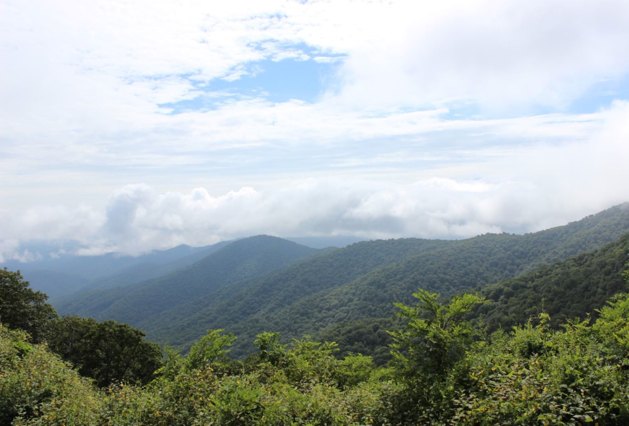
Buck Spring Gap Overlook sits at 4,981 feet on the Blue Ridge Parkway, facing east-southeast toward sunrise, with the land dropping 733 feet within 600 meters of the overlook. From this vantage, Johnson Knob is visible 1.9 miles away at 4,409 feet, and Rich Gap Mountain lies 2.7 miles out at 4,039 feet, both to the east-southeast. The facing direction aligns closely with sunrise, which occurs at 06:17 near the June solstice and as late as 07:37 near the December solstice, with sunset ranging from 17:23 in December to 20:50 in June. Asheville is 16.7 miles to the northeast, while Taylors and Greer lie farther southeast at 42.7 and 44.2 miles respectively. View Funnel Top is the previous stop along the byway, and Mills River Valley Overlook follows next. Wide stone steps near the overlook sign lead up to the Mountains-to-Sea Trail, a short walk from the site of Buck Spring Lodge, a summer retreat built by George Vanderbilt in 1896. The lodge buildings no longer stand, but visitors can walk the grounds, pass through the former stable entryway, and descend into an old storage area.

Access
On the byway
Elevation
4,981 ft
View
East · 90°
Light
Best at sunrise
Relief
733 ft drop
In view
2 named features
View from Buck Spring Gap Overlook
NPS Photo / CM Garrison · Public domain (NPS) · NPS
Viewed from a Blue Ridge Parkway overlook
Thomson200 · CC0 · source
Cold Mountain seen from Mount Pisgah Overlook
Thomson200 · CC0 · source
Rising to an elevation of 5,721 feet (1,744 meters), Mount Pisgah is a prominent mountain near Asheville, North Carolina. The mountain was acquired by the Vanderbilt family in the late 19th Century, and was sold to the United States Federal Government in 1914-1916, creating the Pisgah National Fores
w_lemay · CC BY-SA 2.0 · source
Rising to an elevation of 5,721 feet (1,744 meters), Mount Pisgah is a prominent mountain near Asheville, North Carolina. The mountain was acquired by the Vanderbilt family in the late 19th Century, and was sold to the United States Federal Government in 1914-1916, creating the Pisgah National Fores
w_lemay · CC BY-SA 2.0 · source
Rising to an elevation of 5,721 feet (1,744 meters), Mount Pisgah is a prominent mountain near Asheville, North Carolina. The mountain was acquired by the Vanderbilt family in the late 19th Century, and was sold to the United States Federal Government in 1914-1916, creating the Pisgah National Fores
w_lemay · CC BY-SA 2.0 · source

What you’re looking at

Named terrain inside the view from this overlook, nearest first.

  • Johnson Knob4,409 fteast-southeast · 1.9 mi
  • Rich Gap Mountain4,039 fteast-southeast · 2.7 mi

Light

This overlook faces sunrise — 0° off square to it.

DateSunriseSunsetGolden hour
March equinox07:3619:4319:09
June solstice06:1720:5020:12
September equinox07:2019:2918:56
December solstice07:3717:2316:43

Local time (America/New_York). Computed for this exact position.

Where it is

  • Asheville16.7 mi northeast
  • Taylors42.7 mi southeast
  • Greer44.2 mi southeast
Loading map…
Private beta · Free to join

Take the scenic way to Buck Spring Gap Overlook.

Byway plans around your taste, verified places, real weather and opening hours — then opens every leg in Google Maps with one tap.

Private beta · Free to join · No card · Invite when a spot opens

Buck Spring Gap Overlook · National Park Service

Tucked up on the side road to the Mount Pisgah parking area, the Buck Spring Gap Overlook is a hidden gem. Sure, it has a beautiful view down into the valley. And yes, that imposing mountain looming behind you is Mount Pisgah. But did you know you’re right next to the site of an old hunting lodge? Seriously! Have a look to the right of the overlook sign. See those wide stone steps? If you go up them, you’ll be on the Mountains-to-Sea Trail and it’s a quick walk to where George Vanderbilt built the magnificent Buck Spring Lodge in 1896. It was a summer retreat that really put the “glam” in “glamping” (that’s glamour camping to you). The buildings may be gone, but you can still walk around the site, stride through the large entryway where the stables once were, and even go down the steps into one of the old storage areas. Depending on weather and road conditions, the average driving time to the Buck Spring Gap Overlook is approximately 45 minutes south from Asheville or 2 hours, 15 minutes north from the end of the Parkway near Cherokee. Check the conditions of the area before you visit.

Read it at National Park Service →

How high is Buck Spring Gap Overlook?

Buck Spring Gap Overlook sits at about 4,981 feet (1,518 m).

What can you see from Buck Spring Gap Overlook?

From Buck Spring Gap Overlook: Johnson Knob (ESE, 1.9 mi); Rich Gap Mountain (ESE, 2.7 mi).

Is Buck Spring Gap Overlook better at sunrise or sunset?

Sunrise. The land falls away from Buck Spring Gap Overlook toward the sunrise, so at sunset the light is behind you. Exact times shift through the year; the page shows the current window.

What is the nearest town to Buck Spring Gap Overlook?

Asheville, 17 miles NE of Buck Spring Gap Overlook.

What is the next lookout after Buck Spring Gap Overlook?

Mills River Valley Overlook is the next surfaced lookout along the same route after Buck Spring Gap Overlook.

Drive to Buck Spring Gap Overlook with Byway

Byway plans the scenic way there — real places along Blue Ridge Parkway, real weather, zero hallucinations — and hands the turns to the navigation you already use.

Byways with this lookout

Day trips start here

Locals make it Verified.

Buck Spring Gap Overlook — confirmed, rated, and photographed by people who actually pulled over. A local confirmation is what upgrades a lookout from Discovered to Verified. Zero hallucinations.

Confirmed by locals

No local confirmations yet. Stood here? Yours is the one that upgrades this lookout to Verified.

Ratings

No ratings yet. Stood at this lookout? Be the first to rate it.

No written reviews yet.

Field notes

No field notes yet. Know the gate hours or the best pull-in? Leave the note you wish you'd had.

Photos

No photos yet.

Sign in to confirm this lookout, rate it, add photos, and leave field notes.

More lookouts on Blue Ridge Parkway

Named places near this lookout