Skip to content

Mills River Overlook

National Park Service
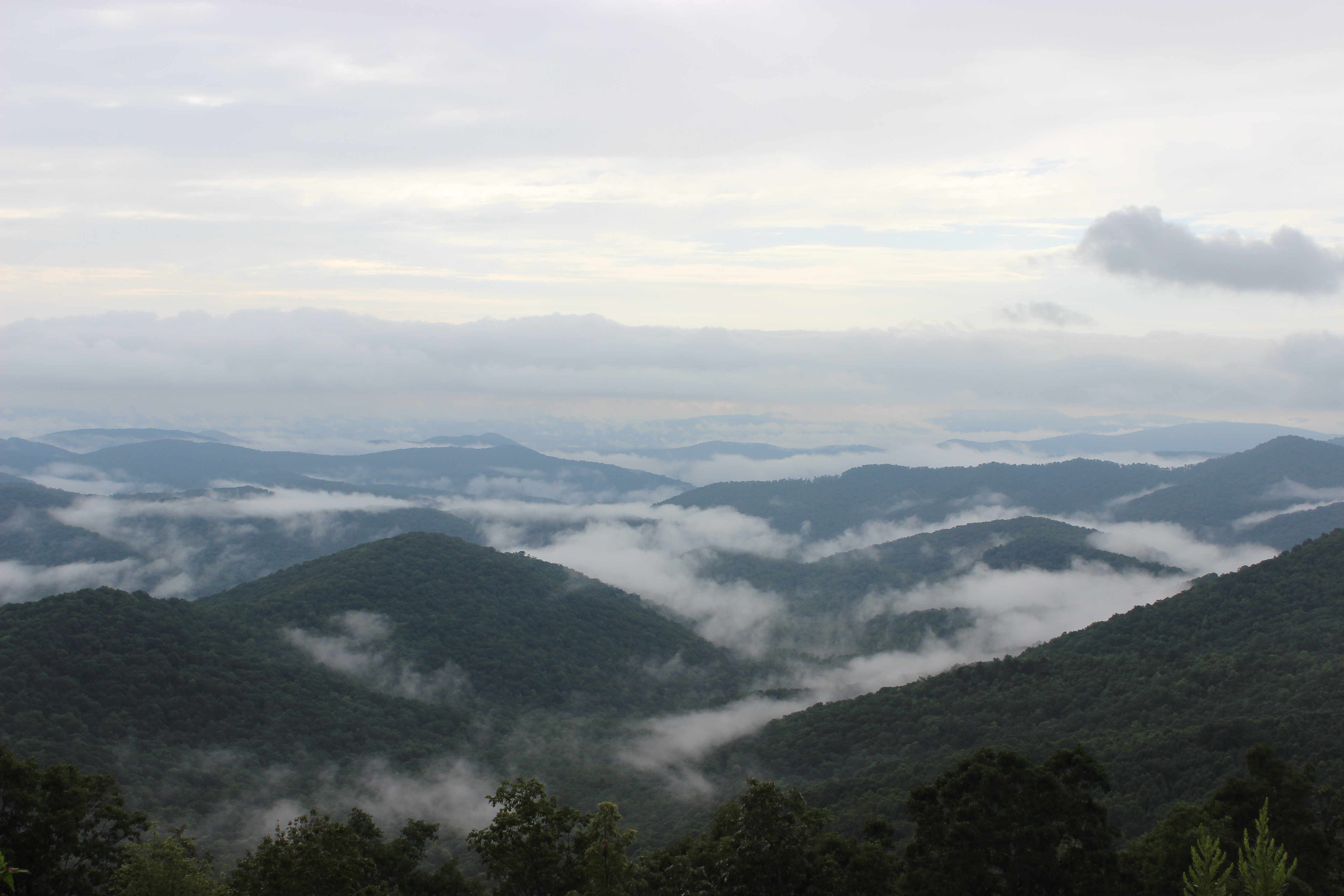
Looking south-east from Mills River Overlook. Terrain and imagery at true elevation.

Mills River Overlook sits at 4,073 feet on the Blue Ridge Parkway, with the terrain dropping 696 feet within 600 meters of the pullout. The view faces 120 degrees, roughly toward sunrise, oriented about 30 degrees off due east. To the south, Johnson Knob rises to 4,409 feet at 2.4 miles, with Rich Gap Mountain at 4,039 feet farther southeast. Lower ridgelines appear to the east-northeast, including Beaver Dam Overlook Parking and Beaver Dam Gap Overlook, both around 3,600 feet and 2.4 miles out, along with Ferrin Knob and Cold Knob at similar bearings. Coffee Pot Mountain and Kramers Vista lie to the east and east-southeast at lower elevations near 3,100 to 3,300 feet. Asheville is 14.2 miles to the northeast, while Taylors and Greer lie much farther south-southeast and southeast. Because the overlook faces toward sunrise, morning light comes from roughly 07:35 near the equinoxes, 06:17 at the June solstice, and 07:37 at the December solstice. The previous stop along the route is Mills River Valley Overlook, and the next is View Hominy Valley.

Access
On the byway
Elevation
4,073 ft
View
Southeast · 120°
Light
Best at sunrise
Relief
696 ft drop
In view
8 named features
Looking east from Mills River Overlook
NPS Photo / C.M. Garrison · Public domain (NPS) · NPS
Candler, North Carolina
w_lemay · CC BY-SA 2.0 · source
Candler, North Carolina
w_lemay · CC BY-SA 2.0 · source
Candler, North Carolina
w_lemay · CC BY-SA 2.0 · source
Candler, North Carolina
w_lemay · CC BY-SA 2.0 · source
Candler, North Carolina
w_lemay · CC BY-SA 2.0 · source

What you’re looking at

Named terrain inside the view from this overlook, nearest first.

  • Beaver Dam Overlook Parking3,618 fteast-northeast · 2.4 mi
  • Beaver Dam Gap Overlook (MP 401.7)3,597 fteast-northeast · 2.4 mi
  • Johnson Knob4,409 ftsouth · 2.4 mi
  • Coffee Pot Mountain3,143 fteast-southeast · 2.5 mi
  • Rich Gap Mountain4,039 ftsouth-southeast · 2.7 mi
  • Ferrin Knob3,987 fteast-northeast · 2.9 mi
  • Kramers Vista3,253 fteast · 3.5 mi
  • Cold Knob3,602 fteast-northeast · 3.9 mi

Light

This overlook faces sunrise 30° off square to it.

DateSunriseSunsetGolden hour
March equinox07:3519:4319:09
June solstice06:1720:5020:12
September equinox07:2019:2918:56
December solstice07:3717:2316:43

Local time (America/New_York). Computed for this exact position.

Where it is

  • Asheville14.2 mi northeast
  • Taylors43.3 mi south-southeast
  • Greer44.6 mi southeast
Loading map…
Private beta · Free to join

Take the scenic way to Mills River Overlook.

Byway plans around your taste, verified places, real weather and opening hours — then opens every leg in Google Maps with one tap.

Private beta · Free to join · No card · Invite when a spot opens

Mills River Overlook · National Park Service

While most overlooks on the Blue Ridge Parkway open the view on one side, the Mills River Overlook allows visitors to see the bigger picture. With clear views into the valleys on either edge, it’s a beautiful reminder that the scenic motorway was designed as a ridge ride. Views on both sides of the Parkway make Mills River a popular overlook for both sunrise and sunset. And since this overlook has very little canopy cover, it’s an excellent place to observe the autumn hawk migration. As a bonus, hikers can pick up the Mountains-to-Sea Trail, traveling a rocky trail as far as they want in either direction. Just remember to wear sturdy shoes and bring plenty of water! Depending on weather and road conditions, the average driving time to the Mills River Overlook is approximately 35-40 minutes from Asheville or 2 hours 20 minutes from the end of the Parkway near Cherokee. Check the conditions of the area before you visit.

Read it at National Park Service

How high is Mills River Overlook?

Mills River Overlook sits at about 4,073 feet (1,241 m).

What can you see from Mills River Overlook?

From Mills River Overlook: Beaver Dam Overlook Parking (ENE, 2.4 mi); Beaver Dam Gap Overlook (MP 401.7) (ENE, 2.4 mi); Johnson Knob (S, 2.4 mi); Coffee Pot Mountain (ESE, 2.5 mi).

Is Mills River Overlook better at sunrise or sunset?

Sunrise. The land falls away from Mills River Overlook toward the sunrise, so at sunset the light is behind you. Exact times shift through the year; the page shows the current window.

What is the nearest town to Mills River Overlook?

Asheville, 14 miles NE of Mills River Overlook.

What is the next lookout after Mills River Overlook?

View Hominy Valley is the next surfaced lookout along the same route after Mills River Overlook.

Drive to Mills River Overlook with Byway

Byway plans the scenic way there — real places along Blue Ridge Parkway, real weather, zero hallucinations — and hands the turns to the navigation you already use.

Byways with this lookout

Day trips start here

Locals make it Verified.

Mills River Overlook — confirmed, rated, and photographed by people who actually pulled over. A local confirmation is what upgrades a lookout from Discovered to Verified. Zero hallucinations.

Confirmed by locals

No local confirmations yet. Stood here? Yours is the one that upgrades this lookout to Verified.

Ratings

No ratings yet. Stood at this lookout? Be the first to rate it.

No written reviews yet.

Field notes

No field notes yet. Know the gate hours or the best pull-in? Leave the note you wish you'd had.

Photos

No photos yet.

Sign in to confirm this lookout, rate it, add photos, and leave field notes.

More lookouts on Blue Ridge Parkway

Named places near this lookout