Skip to content

Camp Creek Overlook

VerifiedOpenStreetMap + National Park Service
Looking north-west from Camp Creek Overlook. Terrain at true elevation.

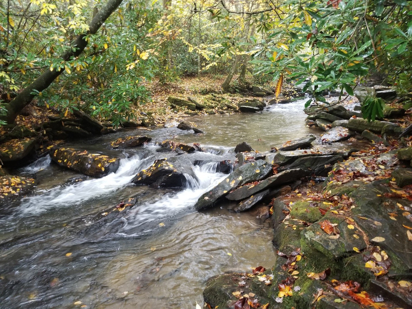
Camp Creek Overlook sits on the Blue Ridge Parkway at 3,443 feet, with the terrain dropping 89 feet over the next 600 meters. Buck Hill rises to the west-northwest at 4.3 miles and 4,255 feet. The overlook faces 300 degrees, an orientation angled toward the sunset rather than squared to it. A narrow dirt trail beside the overlook sign descends steeply for just under 400 feet through rhododendron thickets to Camp Creek, with openings in the vegetation providing clear access to the water. The creek originates near Camp Creek Mountain to the northeast and flows east to west below the overlook on its way to the Linville River, broken in places by large rocks. Galax grows along the slope next to the curb, and the surrounding forest of large trees and shrubs continues beyond the creek into the Pisgah National Forest. Fishing is permitted in these waters under parkway regulations. The nearest towns are Johnson City, 33.4 miles northwest; Hickory, 36.6 miles east-southeast; and Asheville, 44.1 miles southwest. North Toe River Valley lies before this stop, with Lost Cove Cliffs Overlook next along the route.

Access
On the byway
Elevation
3,443 ft
View
Northwest · 300°
Light
Best at sunset
Relief
89 ft drop
In view
1 named features
Camp Creek
NPS Photo · Public domain (NPS) · NPS
The Linville River is a popular recreational stream that flows from the southern face of Grandfather Mountain in the Blue Ridge Mountains . The river flows over Linville Falls and through the Linville Gorge before joining Lake James . Photo taken with a Panasonic Lumix DMC-FZ50 in Avery County, NC,
Ken Thomas · Public domain · source
The Linville Falls Visitor's Center is located on a spur of the Blue Ridge Parkway , and is managed by the National Park Service . Photo taken with a Panasonic Lumix DMC-FZ50 in Burke County, NC, USA .
Ken Thomas · Public domain · source
Blue Ridge Parkway, Linville, United States
Ashley Knedler aknedler · CC0 · source
Linville Falls is a waterfall 39; water located in the Blue Ridge Mountains, North Carolina United States. Linville Falls marks the beginning of the Linville Gorge, which is formed by the Linville River, which continues on after the fall before finally ending near Lake James. According to staff at L
Hemant bhor · CC BY-SA 4.0 · source
Front of the former Linville Falls Tavern , located along U.S. Route 221 in Linville Falls , North Carolina , United States . Built in 1929, it is listed on the National Register of Historic Places .
Nyttend · Public domain · source

What you’re looking at

Named terrain inside the view from this overlook, nearest first.

  • Buck Hill4,255 ftwest-northwest · 4.3 mi

Light

This overlook faces sunset — 30° off square to it.

DateSunriseSunsetGolden hour
March equinox07:3219:4019:06
June solstice06:1220:4820:10
September equinox07:1619:2618:52
December solstice07:3517:1816:38

Local time (America/New_York). Computed for this exact position.

Where it is

  • Johnson City33.4 mi northwest
  • Hickory36.6 mi east-southeast
  • Asheville44.1 mi southwest
Loading map…
Private beta · Free to join

Take the scenic way to Camp Creek Overlook.

Byway plans around your taste, verified places, real weather and opening hours — then opens every leg in Google Maps with one tap.

Private beta · Free to join · No card · Invite when a spot opens

Camp Creek Overlook · National Park Service

Camp Creek Overlook is located around a mile north of the Linville Falls Recreation Area. It derives its name from the Camp brothers, who logged parts of this area in the early 1900s.  The small paved overlook does not seem particularly remarkable at first. It is surrounded by a thick forest consisting of a variety of large trees and shrubs. Galax lines much of the slope next to the curb. This vegetation is broken up only by a narrow dirt trail that lies to the right of the overlook sign. This trail descends steeply into the forest for just under 400 feet through rhododendron thickets and ultimately ends at Camp Creek. A couple of openings in the thickets provide clear access to the creek. The creek originates near Camp Creek Mountain a short distance northeast of the overlook. Below the overlook, it runs steadily from east to west flowing into the Linville River. Sections of the creek are broken up by large rocks with water rushing and churning around them. This makes for a beautiful sight as the creek flows under the shading branches that hang out over the banks.  Shortly beyond the creek, the dense woods become part of the Pisgah National Forest that surrounds much of the parkway in this area. Fishing is allowed in these waters. Please consult the Fishing page to learn more about the fishing regulations on the parkway. Check the conditions of the area before you visit.

Read it at National Park Service →

How high is Camp Creek Overlook?

Camp Creek Overlook sits at about 3,443 feet (1,049 m).

What can you see from Camp Creek Overlook?

From Camp Creek Overlook: Buck Hill (WNW, 4.3 mi).

Is Camp Creek Overlook better at sunrise or sunset?

Sunset. The land falls away from Camp Creek Overlook toward the sunset, so at sunrise the light is behind you. Exact times shift through the year; the page shows the current window.

What is the nearest town to Camp Creek Overlook?

Johnson City, 33 miles NW of Camp Creek Overlook.

What is the next lookout after Camp Creek Overlook?

Lost Cove Cliffs Overlook is the next surfaced lookout along the same route after Camp Creek Overlook.

Drive to Camp Creek Overlook with Byway

Byway plans the scenic way there — real places along Blue Ridge Parkway, real weather, zero hallucinations — and hands the turns to the navigation you already use.

Byways with this lookout

Locals make it Verified.

Camp Creek Overlook — confirmed, rated, and photographed by people who actually pulled over. A local confirmation is what upgrades a lookout from Discovered to Verified. Zero hallucinations.

Confirmed by locals

No local confirmations yet. Stood here? Yours is the one that upgrades this lookout to Verified.

Ratings

No ratings yet. Stood at this lookout? Be the first to rate it.

No written reviews yet.

Field notes

No field notes yet. Know the gate hours or the best pull-in? Leave the note you wish you'd had.

Photos

No photos yet.

Sign in to confirm this lookout, rate it, add photos, and leave field notes.

More lookouts on Blue Ridge Parkway

Named places near this lookout