


Circle Creek Overlook Parking Area · National Park Service
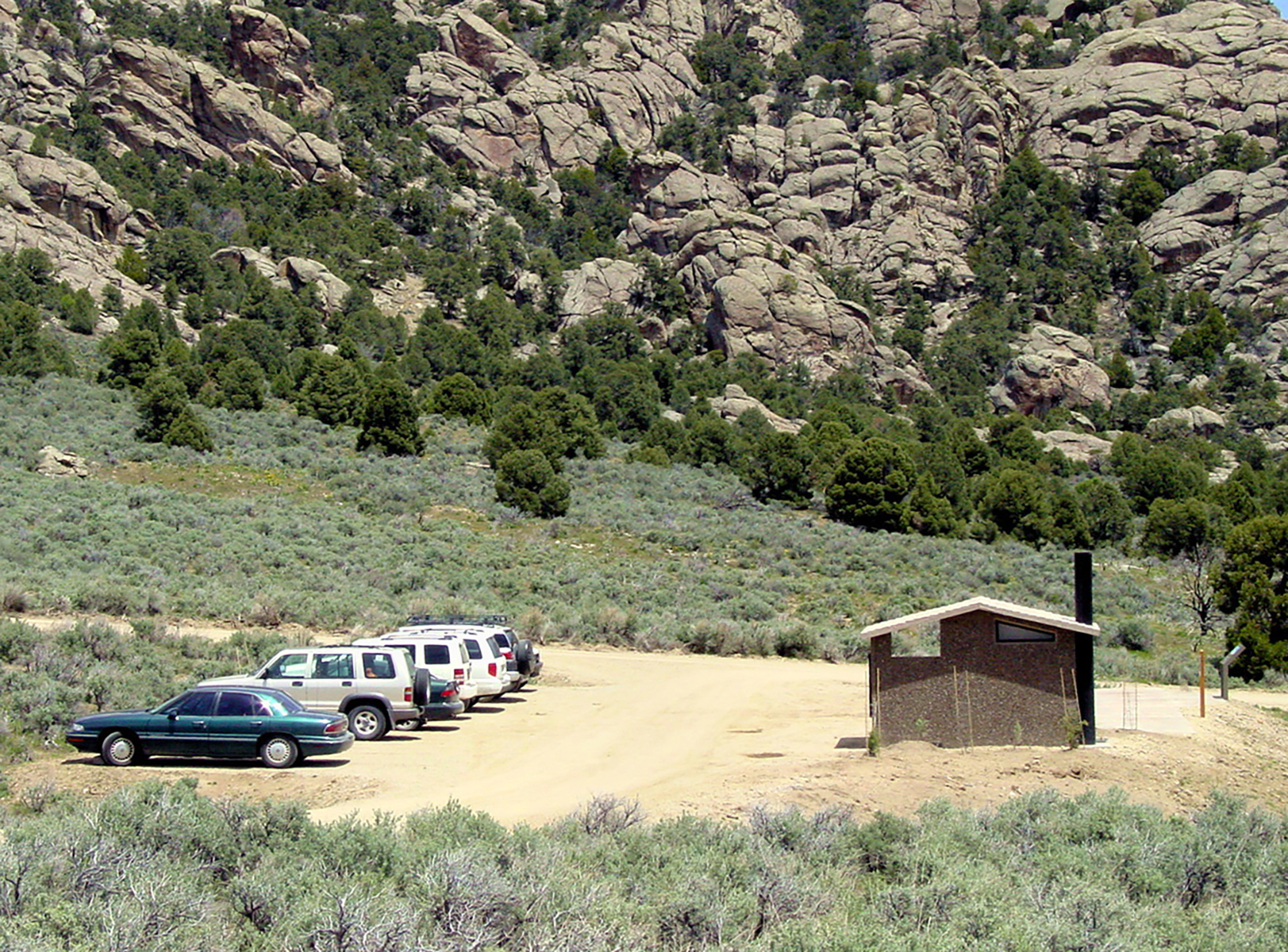
Dirt parking area with a vault toilet building, information boards, and an interpretive wayside exhibit. Many trails are accessed from this area.
Circle Creek Overlook Parking Area sits at 6,139 feet along the City of Rocks Back Country Byway, on the site of a dirt parking area with a vault toilet building, information boards, and an interpretive wayside exhibit. Many trails are accessed from this area. The land drops 201 feet within 600 meters of the overlook, and the view faces 120°, toward the south-southeast. Smoky Mountain is visible to the south at a distance of 2.0 miles, reaching 7,568 feet. Farther off, to the southeast, George Peak rises to 9,538 feet at 17.2 miles, with Pine Creek Spring at 17.7 miles and Right Fork Spring at 18.4 miles also in view. The facing looks toward sunrise, offset 30° from square; sunrise occurs at 07:39 on the March equinox, 06:00 at the June solstice, 07:23 on the September equinox, and 08:01 at the December solstice. Burley lies 31.4 miles to the north, with Rupert 36.6 miles north and Kimberly 46.4 miles northwest. This overlook follows the Castle Rocks Geological Area Overlook along the byway route.
Named terrain inside the view from this overlook, nearest first.
This overlook faces sunrise — 30° off square to it.
| Date | Sunrise | Sunset | Golden hour |
|---|---|---|---|
| March equinox | 07:39 | 19:47 | 19:10 |
| June solstice | 06:00 | 21:15 | 20:32 |
| September equinox | 07:23 | 19:34 | 18:57 |
| December solstice | 08:01 | 17:07 | 16:22 |
Local time (America/Boise). Computed for this exact position.
Byway plans around your taste, verified places, real weather and opening hours — then opens every leg in Google Maps with one tap.
Dirt parking area with a vault toilet building, information boards, and an interpretive wayside exhibit. Many trails are accessed from this area.
George Peak, at 9,606 feet (2,928 m), is the second highest peak in the Raft River Mountains of Utah. The peak is located in Sawtooth National Forest and Box Elder County. It is 6.2 mi (10.0 km) west of Bull Mountain and can be accessed via forest road 009, which travels near the summit.
Circle Creek Overlook Parking Area sits at about 6,139 feet (1,871 m).
From Circle Creek Overlook Parking Area: Smoky Mountain (S, 2.0 mi); George Peak (SE, 17 mi); Pine Creek Spring (SE, 18 mi); Right Fork Spring (SE, 18 mi).
Sunrise. The land falls away from Circle Creek Overlook Parking Area toward the sunrise, so at sunset the light is behind you. Exact times shift through the year; the page shows the current window.
Burley, 31 miles N of Circle Creek Overlook Parking Area.
Byway plans the scenic way there — real places along City of Rocks Back Country Byway, real weather, zero hallucinations — and hands the turns to the navigation you already use.
Circle Creek Overlook Parking Area — confirmed, rated, and photographed by people who actually pulled over. A local confirmation is what upgrades a lookout from Discovered to Verified. Zero hallucinations.
No local confirmations yet. Stood here? Yours is the one that upgrades this lookout to Verified.
No ratings yet. Stood at this lookout? Be the first to rate it.
No written reviews yet.
No field notes yet. Know the gate hours or the best pull-in? Leave the note you wish you'd had.
No photos yet.
Sign in to confirm this lookout, rate it, add photos, and leave field notes.