Skip to content

Craggy Gardens

National Park Service
Looking south-west from Craggy Gardens. Terrain at true elevation.

Craggy Gardens sits at 5,216 feet on the Blue Ridge Parkway, facing 210 degrees, with the land dropping 792 feet within 600 meters of the overlook. Several peaks of the Great Craggy Mountains are visible to the southwest and west-southwest: Lane Pinnacle at 2.1 miles, Wolfden Knob at 2.6 miles, Paynes Knob at 3.2 miles, Richland Knob and Richland Mountain both at 3.4 miles, and Rock Knob at 3.9 miles to the south-southwest. Asheville lies 11.4 miles to the southwest, Hendersonville is 26.6 miles south, and Greeneville is 40.4 miles northwest. Sunrise and sunset times vary through the year, from a 06:15 sunrise at the June solstice to a 07:36 sunrise at the December solstice, with sunset ranging from 17:21 in December to 20:49 in June. Lane Pinnacle Overlook precedes this stop along the byway, and Craggy Dome Scenic Overlook follows it.

Access
On the byway
Elevation
5,216 ft
View
Southwest · 210°
Relief
792 ft drop
In view
6 named features
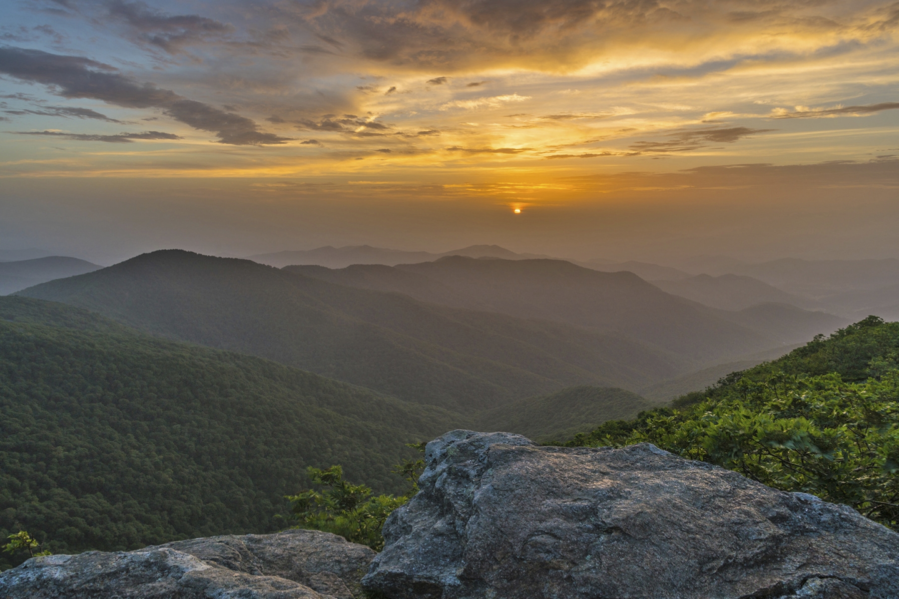
Sunset from Craggy Gardens
Jim Ruff Photo · Public domain (NPS) · NPS
Looking down from the Blue Ridge Parkway near Craggy Gardens. Photo taken with a Panasonic Lumix DMC-FZ20 in Yancey County , North Carolina , USA .
Ken Thomas · Public domain · source
Craggy Gardens Sunrise
Will Thomas · CC BY-SA 3.0 · source
Picture taken from Craggy Gardens Trail near the Blue Ridge Parkway in North Carolina
Amart007 · CC BY-SA 4.0 · source
Picture taken from Craggy Gardens Trail near the Blue Ridge Parkway in North Carolina
Amart007 · CC BY-SA 4.0 · source
The Craggy Gardens Visitor Center on the Blue Ridge Parkway, North Carolina, USA
Acroterion · CC BY-SA 4.0 · source

What you’re looking at

Named terrain inside the view from this overlook, nearest first.

  • Lane Pinnacle5,205 ftsouthwest · 2.1 mi
  • Wolfden Knob4,957 ftwest-southwest · 2.6 mi
  • Paynes Knob3,885 ftsouthwest · 3.2 mi
  • Richland Knob4,713 ftwest-southwest · 3.4 mi
  • Richland Mountain4,713 ftwest-southwest · 3.4 mi
  • Rock Knob3,932 ftsouth-southwest · 3.9 mi

Light

DateSunriseSunsetGolden hour
March equinox07:3419:4219:08
June solstice06:1520:4920:12
September equinox07:1819:2818:54
December solstice07:3617:2116:41

Local time (America/New_York). Computed for this exact position.

Where it is

  • Asheville11.4 mi southwest
  • Hendersonville26.6 mi south
  • Greeneville40.4 mi northwest
Loading map…
Private beta · Free to join

Take the scenic way to Craggy Gardens.

Byway plans around your taste, verified places, real weather and opening hours — then opens every leg in Google Maps with one tap.

Private beta · Free to join · No card · Invite when a spot opens

Craggy Gardens · National Park Service

Craggy Gardens is a popular, high elevation destination 20 miles north of Asheville on the Blue Ridge Parkway. At 5,500 feet, the gorgeous and expansive views are some of the Parkway’s finest. Part of the Great Craggy Mountains, strong winds, fog, and harsh winters have shaped the area, producing stunted, twisted trees and wildlife that is uniquely adapted to this different environment. The name Craggy comes from jagged rock outcroppings or “crags” found here and the shrubs and grasses of the summit balds give the area a “garden” feel. And while colorful wildflowers can be seen from April through October, the highlight comes in June when the spectacular purple and pink blooms of the Catawba rhododendron are at their peak. A visitor center, picnic area, and hiking trails provide plenty to do for a short stop or an all day visit. Craggy Gardens can be a very busy location, especially in the fall when the leaves turn color. Check the conditions of the area before you visit.

Read it at National Park Service →

How high is Craggy Gardens?

Craggy Gardens sits at about 5,216 feet (1,590 m).

What can you see from Craggy Gardens?

From Craggy Gardens: Lane Pinnacle (SW, 2.1 mi); Wolfden Knob (WSW, 2.6 mi); Paynes Knob (SW, 3.2 mi); Richland Knob (WSW, 3.4 mi).

What is the nearest town to Craggy Gardens?

Asheville, 11 miles SW of Craggy Gardens.

What is the next lookout after Craggy Gardens?

Craggy Dome Scenic Overlook is the next surfaced lookout along the same route after Craggy Gardens.

Drive to Craggy Gardens with Byway

Byway plans the scenic way there — real places along Blue Ridge Parkway, real weather, zero hallucinations — and hands the turns to the navigation you already use.

Byways with this lookout

Day trips start here

Locals make it Verified.

Craggy Gardens — confirmed, rated, and photographed by people who actually pulled over. A local confirmation is what upgrades a lookout from Discovered to Verified. Zero hallucinations.

Confirmed by locals

No local confirmations yet. Stood here? Yours is the one that upgrades this lookout to Verified.

Ratings

No ratings yet. Stood at this lookout? Be the first to rate it.

No written reviews yet.

Field notes

No field notes yet. Know the gate hours or the best pull-in? Leave the note you wish you'd had.

Photos

No photos yet.

Sign in to confirm this lookout, rate it, add photos, and leave field notes.

More lookouts on Blue Ridge Parkway

Named places near this lookout