Skip to content

Forest Canyon Overlook

VerifiedOpenStreetMap + National Park Service
Looking south-west from Forest Canyon Overlook. Terrain and imagery at true elevation.

Forest Canyon Overlook sits at 11,619 feet on Trail Ridge Road/Beaver Meadow Road, facing 210 degrees toward terrain that drops 1,179 feet within 600 meters. A paved asphalt trail leads to the viewpoint over Forest Canyon and its tributary canyons, Hayden Gorge and Gorge Lakes, where a glacier once carved the valley into its present U-shape. Peaks visible from the overlook include Terra Tomah Mountain to the southwest at 2.3 miles (12,703 ft), Stones Peak to the south at 2.9 miles (12,891 ft), Hayden Spire to the south-southwest at 3.4 miles (12,418 ft), Sprague Mountain to the south-southwest at 3.6 miles (12,695 ft), Mount Eleanor to the southwest at 3.7 miles (12,351 ft), and Mount Ida to the west-southwest at 3.8 miles (12,866 ft). Marguerite Falls is visible to the south-southeast at 4.4 miles (9,524 ft). Estes Park lies 10.1 miles east, Grand Lake 11.5 miles south-southwest, and Granby 24.5 miles south-southwest. Visitors are asked to stay on the paved trail to protect alpine tundra plants, which can take decades to recover from trampling. The approach road closes seasonally, from October 14 through May 31.

Access
On the byway
Elevation
11,619 ft
View
Southwest · 210°
Relief
1,179 ft drop
In view
7 named features
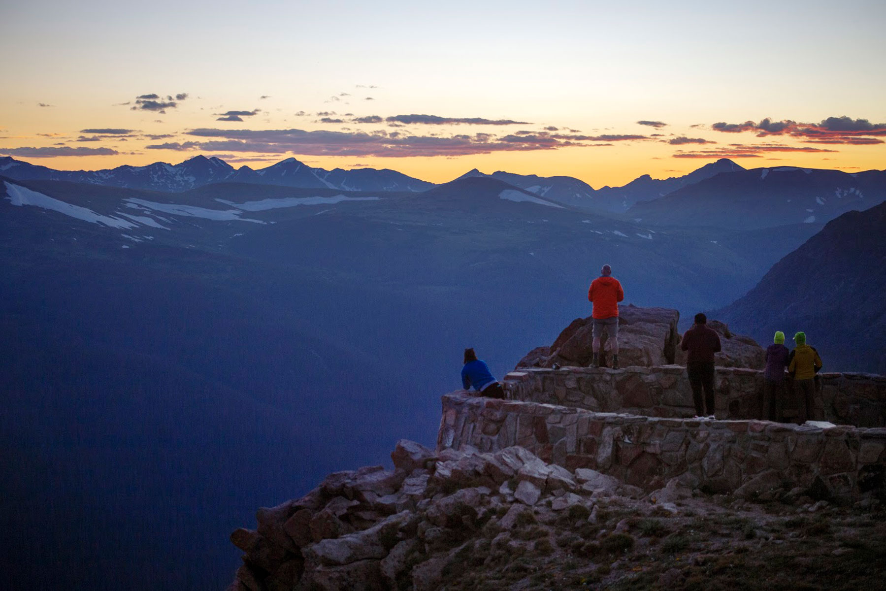
Sunset at Forest Canyon Overlook
NPS Photo · Public domain (NPS) · NPS
Longs Peak from Forest Canyon Overlook, Trail Ridge Road, Rocky Mountain National Park - Photograph by Anne Dirkse, www.annedirkse.com
Anne Dirkse · CC BY-SA 4.0 · source
Forest Canyon Overlook
Thomson M · CC BY 3.0 · source
View of Rocky Mountain National Park in Larimer County, Colorado from Forest Canyon Overlook
Dough4872 · CC BY-SA 4.0 · source
The Forest Canyon Overlook in Rocky Mountains National Park , United States.
Larry D. Moore · CC BY 4.0 · source
Stay on Trail sign, Forest Canyon Overlook, Trail Ridge Road, Rocky Mountain National Park - Photograph by Anne Dirkse, www.annedirkse.com
Anne Dirkse · CC BY-SA 4.0 · source

What you’re looking at

Named terrain inside the view from this overlook, nearest first.

  • Terra Tomah Mountain12,703 ftsouthwest · 2.3 mi
  • Stones Peak12,891 ftsouth · 2.9 mi
  • Hayden Spire12,418 ftsouth-southwest · 3.4 mi
  • Sprague Mountain12,695 ftsouth-southwest · 3.6 mi
  • Mount Eleanor12,351 ftsouthwest · 3.7 mi
  • Mount Ida12,866 ftwest-southwest · 3.8 mi
  • Marguerite Falls9,524 ftsouth-southeast · 4.4 mi

Light

DateSunriseSunsetGolden hour
March equinox07:0719:1518:39
June solstice05:3420:3719:56
September equinox06:5119:0218:26
December solstice07:2316:4015:57

Local time (America/Denver). Computed for this exact position.

Where it is

  • Estes Park10.1 mi east
  • Grand Lake11.5 mi south-southwest
  • Granby24.5 mi south-southwest

The approach closes seasonally. Source: OpenStreetMap (access:conditional=no @ Oct 14th - May 31st). Check the road authority before travelling.

Loading map…
Private beta · Free to join

Take the scenic way to Forest Canyon Overlook.

Byway plans around your taste, verified places, real weather and opening hours — then opens every leg in Google Maps with one tap.

Private beta · Free to join · No card · Invite when a spot opens

Forest Canyon Overlook · National Park Service

Get a panoramic view at 11,716 feet!

Take a five minute walk down the paved asphalt trail to see Forest Canyon and its tributary canyons, Hayden Gorge and Gorge Lakes. Here the erosive force of glacial ice is unmistakable. A 1,500 feet thick glacier shaped a V-shaped stream valley below. With grinding force, the ice scoured the valley into the distinctive U-shaped valley of today.

Please stay on the paved asphalt trail to protect fragile alpine tundra plants. Studies have shown it can take decades for alpine plants and soil to recover after human trampling. Thank you for staying on the path and enjoying the flowers by not picking them, so future visitors can enjoy them as well.

Note: Trail Ridge Road closes mid-October to Memorial Day. Extreme weather can change the status of Trail Ridge Road at any time—be ready to adjust your travel plans if needed, and always check the weather before you start your drive.

Altitude Warning: Altitude sickness affects many visitors every year. Symptoms include headache, nausea, fatigue, dizziness, vomiting, and even unconsciousness. Altitude can also aggravate pre-existing conditions like heart and lung disease. Take your time, drink water, eat, and rest. The only cure for altitude sickness is to go down to a lower altitude.

Read it at National Park Service

How high is Forest Canyon Overlook?

Forest Canyon Overlook sits at about 11,619 feet (3,541 m).

What can you see from Forest Canyon Overlook?

From Forest Canyon Overlook: Terra Tomah Mountain (SW, 2.3 mi); Stones Peak (S, 2.9 mi); Hayden Spire (SSW, 3.4 mi); Sprague Mountain (SSW, 3.6 mi).

Is the road to Forest Canyon Overlook open year-round?

No. The approach to Forest Canyon Overlook closes seasonally. The source records: access:conditional=no @ Oct 14th - May 31st. Check the managing agency before setting out.

What is the nearest town to Forest Canyon Overlook?

Estes Park, 10 miles E of Forest Canyon Overlook.

Drive to Forest Canyon Overlook with Byway

Byway plans the scenic way there — real places along Trail Ridge Road/Beaver Meadow Road, real weather, zero hallucinations — and hands the turns to the navigation you already use.

Byways with this lookout

Day trips start here

Locals make it Verified.

Forest Canyon Overlook — confirmed, rated, and photographed by people who actually pulled over. A local confirmation is what upgrades a lookout from Discovered to Verified. Zero hallucinations.

Confirmed by locals

No local confirmations yet. Stood here? Yours is the one that upgrades this lookout to Verified.

Ratings

No ratings yet. Stood at this lookout? Be the first to rate it.

No written reviews yet.

Field notes

No field notes yet. Know the gate hours or the best pull-in? Leave the note you wish you'd had.

Photos

No photos yet.

Sign in to confirm this lookout, rate it, add photos, and leave field notes.

More lookouts on Trail Ridge Road/Beaver Meadow Road

Named places near this lookout