Skip to content

French Broad Overlook

National Park Service
Looking north from French Broad Overlook. Terrain and imagery at true elevation.

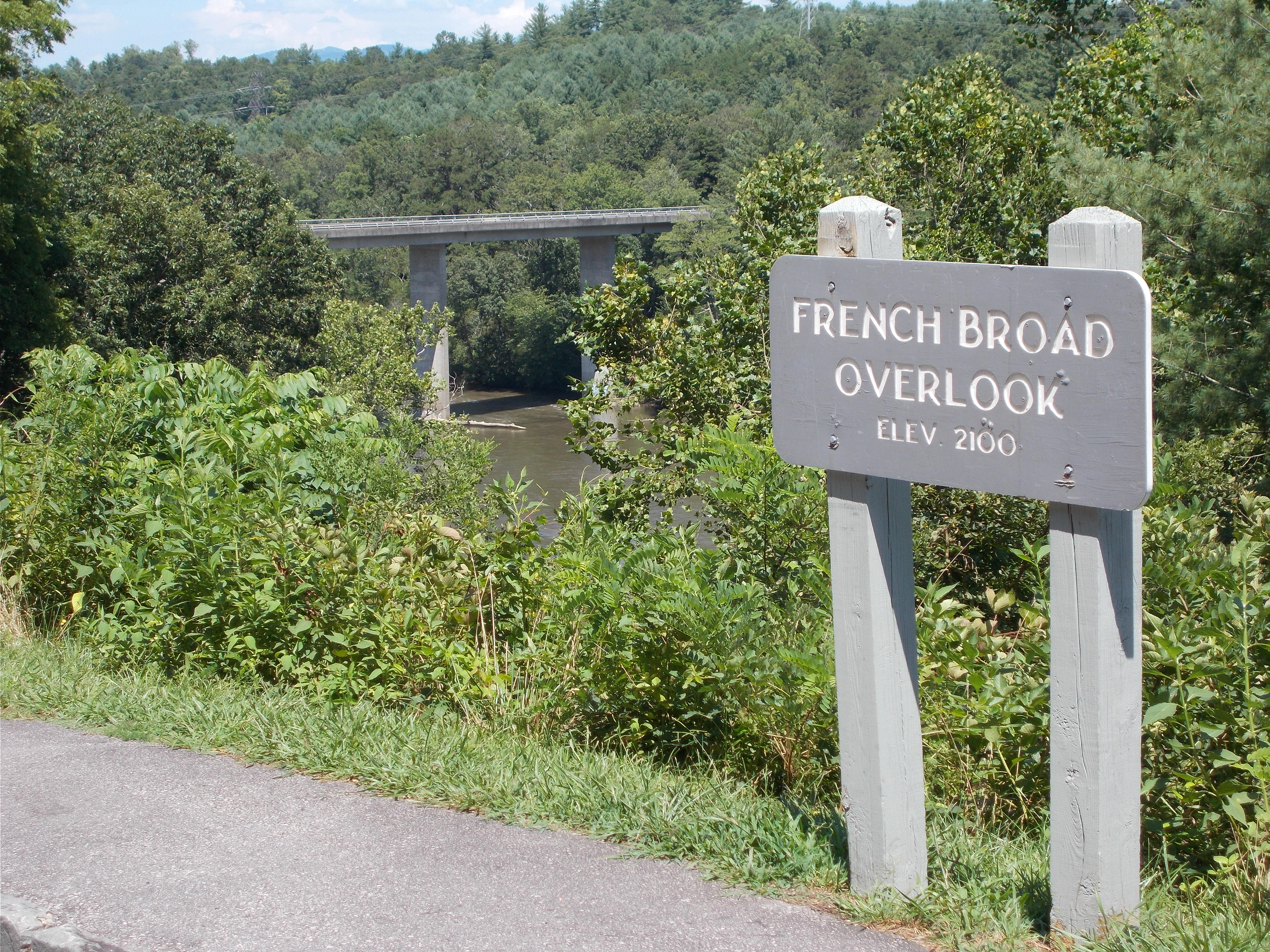
French Broad Overlook sits at 2,097 feet on the Blue Ridge Parkway at Milepost 393.8, on the east side of the road near the North Carolina Arboretum and NC 191. It faces north, with the terrain dropping 89 feet within 600 meters, and looks out over the French Broad River. The river below is named for early European settlers' distinction between two wide rivers in the area, with this one flowing into French territory in Tennessee; the Cherokee called it Agiqua, or "Long Man." An interpretive sign at the overlook covers area history from the 1800s. The parking area is large, making it a convenient stop for those picking up the Mountains-to-Sea Trail's Shut-In Trail section from the nearby Parkway on-ramp, or for bicyclists heading south toward Mount Pisgah. Asheville lies 7.2 miles to the north-northeast, Hendersonville 14.4 miles south-southeast, and Boiling Springs 46.5 miles southeast. Sleepy Gap Parking is the previous lookout along the byway, with French Broad River Overlook next. Visitors should check conditions before arriving.

Access
On the byway
Elevation
2,097 ft
View
North · 0°
Relief
89 ft drop
French Broad River view from the overlook
NPS Photo / Gail Fox · Public domain (NPS) · NPS
The Blue Ridge Quilt Garden is a parterre exhibit at the North Carolina Arboretum Inspired by patterns developed by southern Appalachian quilters . Digital photo taken with a Panasonic Lumix DMC-FZ50 in Buncombe County, NC, USA .
Ken Thomas · Public domain · source
View of Earth taken during ISS Expedition 43.
Earth Science and Remote Sensing Unit , Lyndon B. Johnson Space Center · Public domain · source
View of Earth taken during ISS Expedition 43.
Earth Science and Remote Sensing Unit , Lyndon B. Johnson Space Center · Public domain · source
The Baker Exhibit Center at the North Carolina Arboretum . Photo taken with a Panasonic Lumix DMC-FZ50 in Buncombe County, NC, USA .
Ken Thomas · Public domain · source
The lower entrance to the Bonsai Garden at the North Carolina Arboretum . Photo taken with a Panasonic Lumix DMC-FZ50 in Buncombe County, NC, USA .
Ken Thomas · Public domain · source

Light

DateSunriseSunsetGolden hour
March equinox07:3519:4219:09
June solstice06:1620:5020:12
September equinox07:1919:2918:55
December solstice07:3717:2216:42

Local time (America/New_York). Computed for this exact position.

Where it is

  • Asheville7.2 mi north-northeast
  • Hendersonville14.4 mi south-southeast
  • Boiling Springs46.5 mi southeast
Loading map…
Private beta · Free to join

Take the scenic way to French Broad Overlook.

Byway plans around your taste, verified places, real weather and opening hours — then opens every leg in Google Maps with one tap.

Private beta · Free to join · No card · Invite when a spot opens

French Broad Overlook · National Park Service

The French Broad Overlook's mildly risque-sounding name comes from the river that flows below it—the French Broad River. This ancient river is believed to be the third oldest in the world, around 250 million years old. It is one of the few rivers that flows north. The Cherokee called it Agiqua or "Long Man”, an apt name as the entire watershed contains over 4,000 miles of rivers and streams. Its modern name came from early European settlers. Of the two broad (wide) rivers in this area, this one flowed into French territory in Tennessee. Hence the French Broad River was named! This overlook is on the south side of Asheville, close to the North Carolina Arboretum and NC 191. It is located on the east side of the Blue Ridge Parkway (Milepost 393.8) and provides views of the French Broad River. An interpretive sign provides an overview of area’s history in the 1800’s. This large parking area is perfect if you are thinking about hiking the section of the Mountains-to-Sea Trail called the Shut-In Trail. You can pick up the trail on the nearby Parkway on-ramp. The French Broad Overlook is also a great spot for bicyclists heading south towards Mount Pisgah to start their ride. Whether you spend a few minutes or a few hours, the French Broad Overlook provides an interesting glimpse into the rich history of this area. Check the conditions of the area before you visit.

Read it at National Park Service

How high is French Broad Overlook?

French Broad Overlook sits at about 2,097 feet (639 m).

What is the nearest town to French Broad Overlook?

Asheville, 7.2 miles NNE of French Broad Overlook.

What is the next lookout after French Broad Overlook?

French Broad River Overlook is the next surfaced lookout along the same route after French Broad Overlook.

Drive to French Broad Overlook with Byway

Byway plans the scenic way there — real places along Blue Ridge Parkway, real weather, zero hallucinations — and hands the turns to the navigation you already use.

Byways with this lookout

Day trips start here

Locals make it Verified.

French Broad Overlook — confirmed, rated, and photographed by people who actually pulled over. A local confirmation is what upgrades a lookout from Discovered to Verified. Zero hallucinations.

Confirmed by locals

No local confirmations yet. Stood here? Yours is the one that upgrades this lookout to Verified.

Ratings

No ratings yet. Stood at this lookout? Be the first to rate it.

No written reviews yet.

Field notes

No field notes yet. Know the gate hours or the best pull-in? Leave the note you wish you'd had.

Photos

No photos yet.

Sign in to confirm this lookout, rate it, add photos, and leave field notes.

More lookouts on Blue Ridge Parkway

Named places near this lookout