Harvey's Knob Overlook
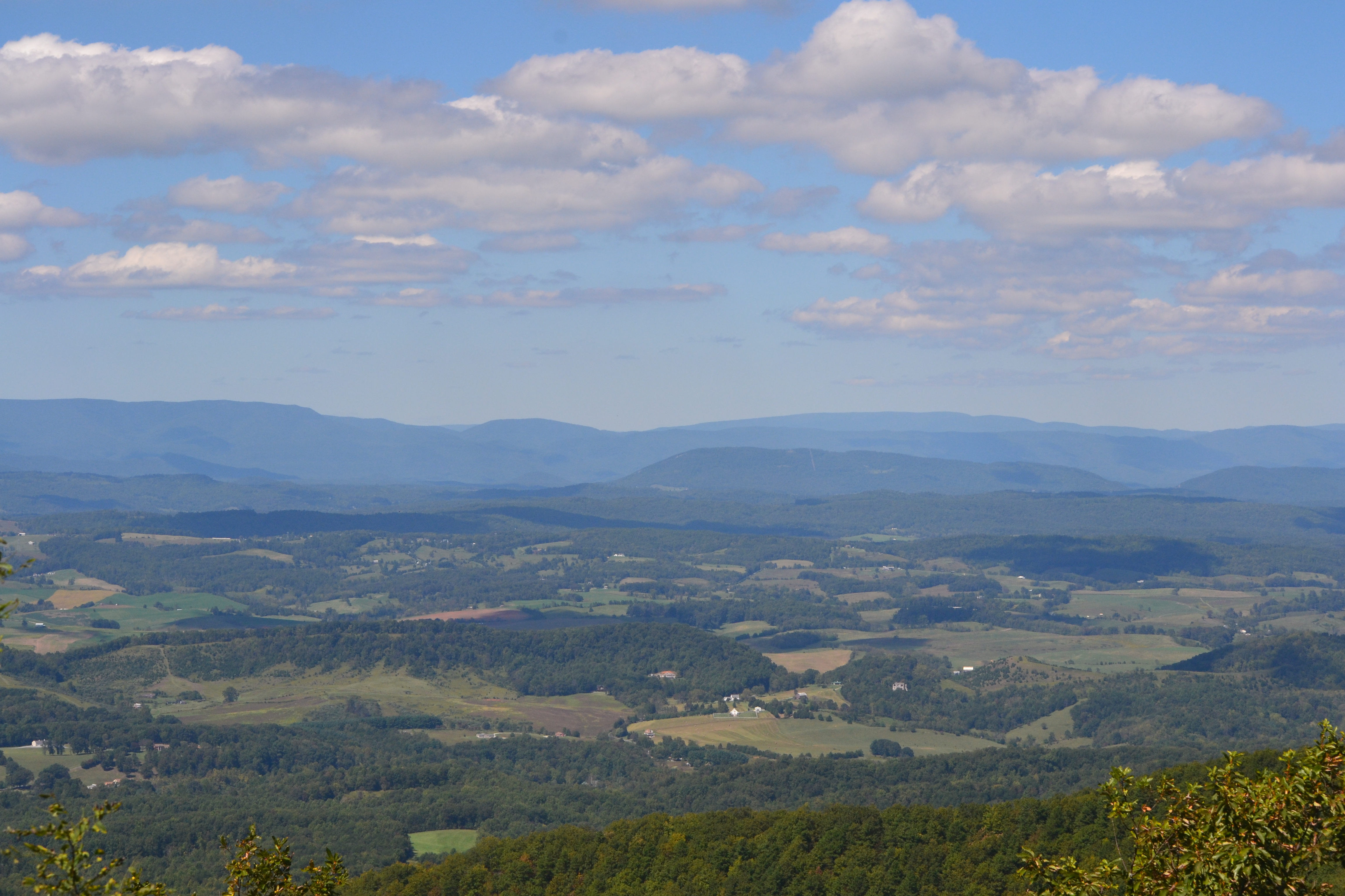
Harvey's Knob Overlook sits at 2,530 feet along the Blue Ridge Parkway, facing south with land dropping 820 feet within 600 meters of the edge. The view opens across a series of peaks and valley features: Blue Knob rises to the southwest at 3.1 miles, with Taylors Mountain southeast at 5.0 miles, and Wildcat Knob, Foster Knob, Wiggington Knob, and Porter Mountain arrayed to the south and south-southwest between 5.2 and 6.5 miles out. Lower ground features are visible as well, including Montvale Wayside and Montvale Park to the south, and Blue Ridge Park to the southwest at 8.7 miles. On the June solstice, sunrise comes at 05:59 and sunset at 20:44, while the December solstice brings a shorter span from 07:30 to 17:05. Roanoke lies 16.9 miles to the southwest, Cave Spring 21.5 miles southwest, and Lynchburg 32.1 miles east. Sharp Top Overlook precedes this stop along the route, with Harveys Knob Overlook following next.
What you’re looking at
Named terrain inside the view from this overlook, nearest first.
- Blue Knob2,644 ftsouthwest · 3.1 mi
- Montvale Wayside994 ftsouth · 4.0 mi
- Taylors Mountain2,549 ftsoutheast · 5.0 mi
- Wildcat Knob2,285 ftsouth-southwest · 5.2 mi
- Montvale Park963 ftsouth · 5.3 mi
- Foster Knob2,562 ftsouth-southwest · 5.6 mi
- Wiggington Knob2,451 ftsouth · 6.5 mi
- Porter Mountain2,451 ftsouth · 6.5 mi
- Blue Ridge Park1,202 ftsouthwest · 8.7 mi
Light
| Date | Sunrise | Sunset | Golden hour |
|---|---|---|---|
| March equinox | 07:23 | 19:31 | 18:57 |
| June solstice | 05:59 | 20:44 | 20:05 |
| September equinox | 07:07 | 19:18 | 18:43 |
| December solstice | 07:30 | 17:05 | 16:24 |
Local time (America/New_York). Computed for this exact position.
Where it is
- Roanoke16.9 mi southwest
- Cave Spring21.5 mi southwest
- Lynchburg32.1 mi east
Take the scenic way to Harvey's Knob Overlook.
Byway plans around your taste, verified places, real weather and opening hours — then opens every leg in Google Maps with one tap.
How high is Harvey's Knob Overlook?
Harvey's Knob Overlook sits at about 2,530 feet (771 m).
What can you see from Harvey's Knob Overlook?
From Harvey's Knob Overlook: Blue Knob (SW, 3.1 mi); Montvale Wayside (S, 4.0 mi); Taylors Mountain (SE, 5.0 mi); Wildcat Knob (SSW, 5.2 mi).
What is the nearest town to Harvey's Knob Overlook?
Roanoke, 17 miles SW of Harvey's Knob Overlook.
What is the next lookout after Harvey's Knob Overlook?
Harveys Knob Overlook is the next surfaced lookout along the same route after Harvey's Knob Overlook.
Drive to Harvey's Knob Overlook with Byway
Byway plans the scenic way there — real places along Blue Ridge Parkway, real weather, zero hallucinations — and hands the turns to the navigation you already use.
Byways with this lookout
Day trips start here
- Roanoke · 17 mi
Locals make it Verified.
Harvey's Knob Overlook — confirmed, rated, and photographed by people who actually pulled over. A local confirmation is what upgrades a lookout from Discovered to Verified. Zero hallucinations.
Confirmed by locals
No local confirmations yet. Stood here? Yours is the one that upgrades this lookout to Verified.
Ratings
No ratings yet. Stood at this lookout? Be the first to rate it.
No written reviews yet.
Field notes
No field notes yet. Know the gate hours or the best pull-in? Leave the note you wish you'd had.
Photos
No photos yet.
Sign in to confirm this lookout, rate it, add photos, and leave field notes.
More lookouts on Blue Ridge Parkway
Named places near this lookout
- Harveys Knob Peak · 0.21 mi
- Blue Knob Peak · 3.1 mi
- Montvale Wayside Park · 4.04 mi
- Campbells Mountain Peak · 4.22 mi
- Virginia Rest Area Mile 158 South (I-81) Rest area · 4.98 mi
- Peaks of Otter Recreation Area Park · 6.83 mi
- Falling Water Cascades Waterfall · 8.26 mi
- Claytor Nature Center Nature reserve · 11 mi