Skip to content

Homestead Overlook

VerifiedOpenStreetMap + National Park Service
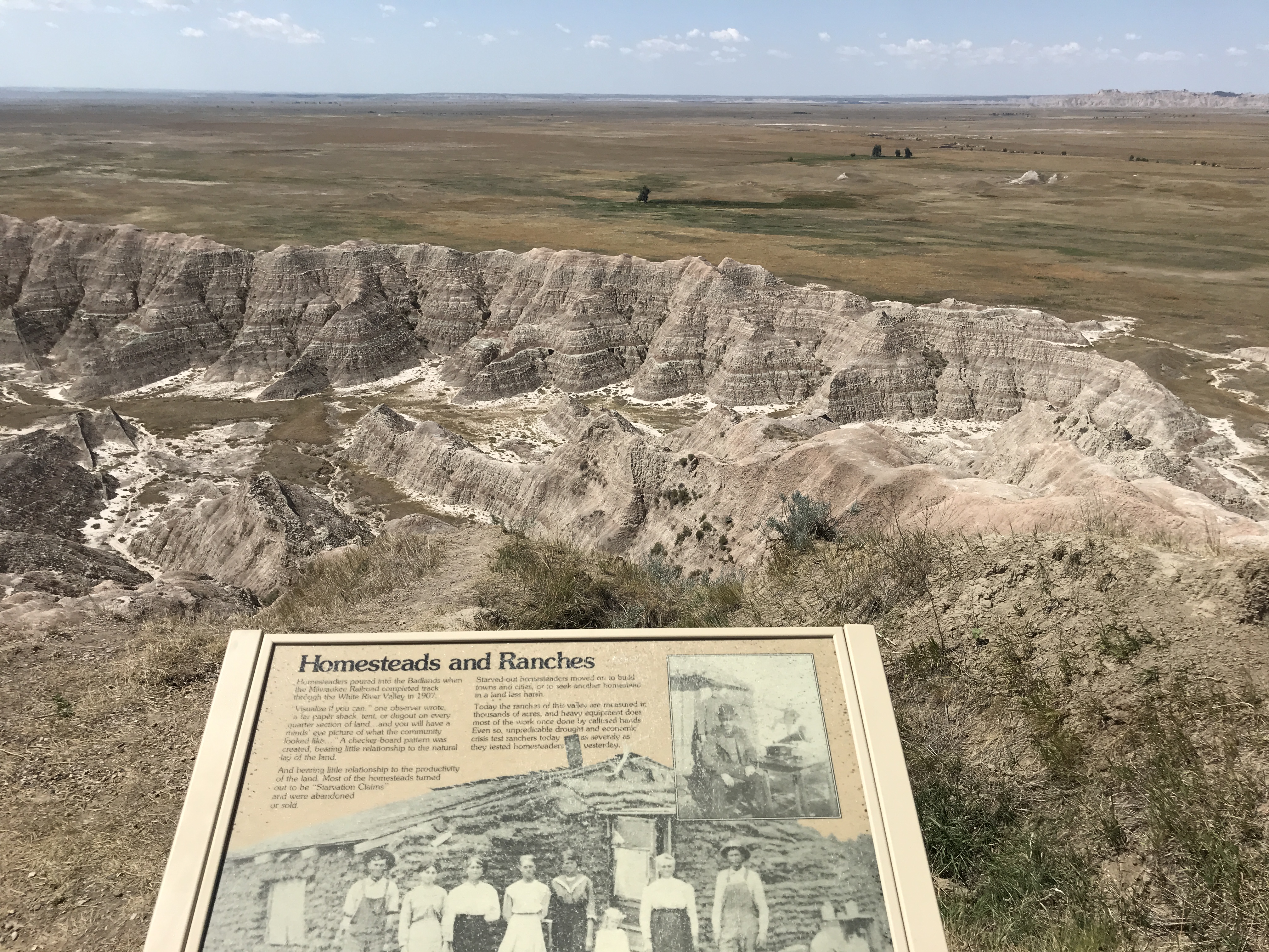
Looking south from Homestead Overlook. Terrain and imagery at true elevation.

Homestead Overlook sits at 2,874 feet along the Badlands Loop Scenic Byway, facing south across terrain that drops 259 feet within 600 meters of the viewpoint. Three peaks are visible to the south: Hurley Butte at 6.9 miles (2,594 ft), Kelier Butte at 8.4 miles (2,538 ft), and Bouquet Table at 11.4 miles (2,700 ft) to the south-southwest. Wall lies 12.2 miles to the north-northwest, with Philip 29.5 miles east-northeast and Kadoka 33.2 miles east. The overlook's name references the Homesteading Acts, US laws promoting westward expansion by granting public land to citizens; the first, signed by President Abraham Lincoln in 1862, allowed settlers to claim 160 acres by living on and improving it for five years and filing for a deed within seven. This land, offered as free to settlers, was largely taken from Native Americans who previously inhabited the Great Plains, through legislation such as the Dawes Act. Conata Basin Overlook precedes this stop on the byway, and Burns Basin Overlook follows it.

Access
On the byway
Elevation
2,874 ft
View
South · 180°
Relief
259 ft drop
In view
3 named features
Homesteading in the Badlands was difficult due to the harsh environment.
NPS Photo / Serena Rosales · Public domain (NPS) · NPS
The White River Badlands of South Dakota consist of a scenic landscape of differentially weathered and eroded, nonmarine sedimentary rocks of Tertiary age. The most visually-striking areas have been set aside as an American national park (Badlands). The simplified stratigraphic succession in Badland
James St. John · CC BY 2.0 · source
The White River Badlands of South Dakota consist of a scenic landscape of differentially weathered and eroded, nonmarine sedimentary rocks of Tertiary age. The most visually-striking areas have been set aside as an American national park (Badlands). The simplified stratigraphic succession in Badland
James St. John · CC BY 2.0 · source
Badlands National Park
Domenico Convertini · CC BY-SA 2.0 · source
Badlands National Park
Domenico Convertini · CC BY-SA 2.0 · source
Badlands National Park
Domenico Convertini · CC BY-SA 2.0 · source

What you’re looking at

Named terrain inside the view from this overlook, nearest first.

  • Hurley Butte2,594 ftsouth · 6.9 mi
  • Kelier Butte2,538 ftsouth · 8.4 mi
  • Bouquet Table2,700 ftsouth-southwest · 11.4 mi

Light

DateSunriseSunsetGolden hour
March equinox06:5319:0118:23
June solstice05:0720:3519:51
September equinox06:3718:4818:10
December solstice07:2016:1515:27

Local time (America/Denver). Computed for this exact position.

Where it is

  • Wall12.2 mi north-northwest
  • Philip29.5 mi east-northeast
  • Kadoka33.2 mi east
Loading map…
Private beta · Free to join

Take the scenic way to Homestead Overlook.

Byway plans around your taste, verified places, real weather and opening hours — then opens every leg in Google Maps with one tap.

Private beta · Free to join · No card · Invite when a spot opens

Homestead Overlook · National Park Service

The Homesteading Acts were laws issued by the US government to promote Westward expansion by giving away free land. In 1862, President Abraham Lincoln signed the first Homesteading Act into law. Under this initial law, a US citizen could claim a 160-acre plot of public land in the West by filing an application, living on and improving the land for a minimum of five years, and filing for a deed within seven years. While the Homesteading Acts offered free land to settlers, this “free” land came at a great cost to Native Americans. Much of the land offered as homesteading plots was seized from the Native Americans who previously inhabited the Great Plains through legislation like the Dawes Act.

Read it at National Park Service

How high is Homestead Overlook?

Homestead Overlook sits at about 2,874 feet (876 m).

What can you see from Homestead Overlook?

From Homestead Overlook: Hurley Butte (S, 6.9 mi); Kelier Butte (S, 8.4 mi); Bouquet Table (SSW, 11 mi).

What is the nearest town to Homestead Overlook?

Wall, 12 miles NNW of Homestead Overlook.

What is the next lookout after Homestead Overlook?

Burns Basin Overlook is the next surfaced lookout along the same route after Homestead Overlook.

Drive to Homestead Overlook with Byway

Byway plans the scenic way there — real places along Badlands Loop Scenic Byway, real weather, zero hallucinations — and hands the turns to the navigation you already use.

Byways with this lookout

Day trips start here

Locals make it Verified.

Homestead Overlook — confirmed, rated, and photographed by people who actually pulled over. A local confirmation is what upgrades a lookout from Discovered to Verified. Zero hallucinations.

Confirmed by locals

No local confirmations yet. Stood here? Yours is the one that upgrades this lookout to Verified.

Ratings

No ratings yet. Stood at this lookout? Be the first to rate it.

No written reviews yet.

Field notes

No field notes yet. Know the gate hours or the best pull-in? Leave the note you wish you'd had.

Photos

No photos yet.

Sign in to confirm this lookout, rate it, add photos, and leave field notes.

More lookouts on Badlands Loop Scenic Byway

Named places near this lookout