Skip to content

Horseshoe Park

National Park Service
Horseshoe Park — direction of view not recorded. Terrain at true elevation.

Horseshoe Park sits at 8,536 feet along Trail Ridge Road/Beaver Meadow Road, a low meadow with small lakes and a terrain that drops 27 feet within 600 meters. Horseshoe Falls lies north-northwest at 0.8 miles, while Hazels Cone rises east-northeast at 0.9 miles. Many Parks Curve, the previous lookout, is visible south-southwest at 1.0 mile, with Deer Mountain Buttress farther east-southeast and MacGregor Mountain to the east-northeast at 2.8 miles. Oogie Boogie Buttress sits east at 3.2 miles. Several pullouts serve the area: the West Horseshoe Park Pullout offers limited parking for meadow access, the Upper Horseshoe Meadow Pullout gives aerial views of the meadow and the Mummy Mountain Range with chances to spot bighorn sheep, moose, and elk, and the Sheep Lakes pullout allows visitors to watch wildlife near the water. Meadow closures are typically in effect from May through October to protect wildlife, and visitors are asked to view animals from the pavement rather than entering closed areas. Fort Collins lies 31.6 miles east-northeast, Boulder 32.6 miles southeast, and Thornton 50.0 miles southeast.

Access
On the byway
Elevation
8,536 ft
Relief
27 ft drop
In view
6 named features
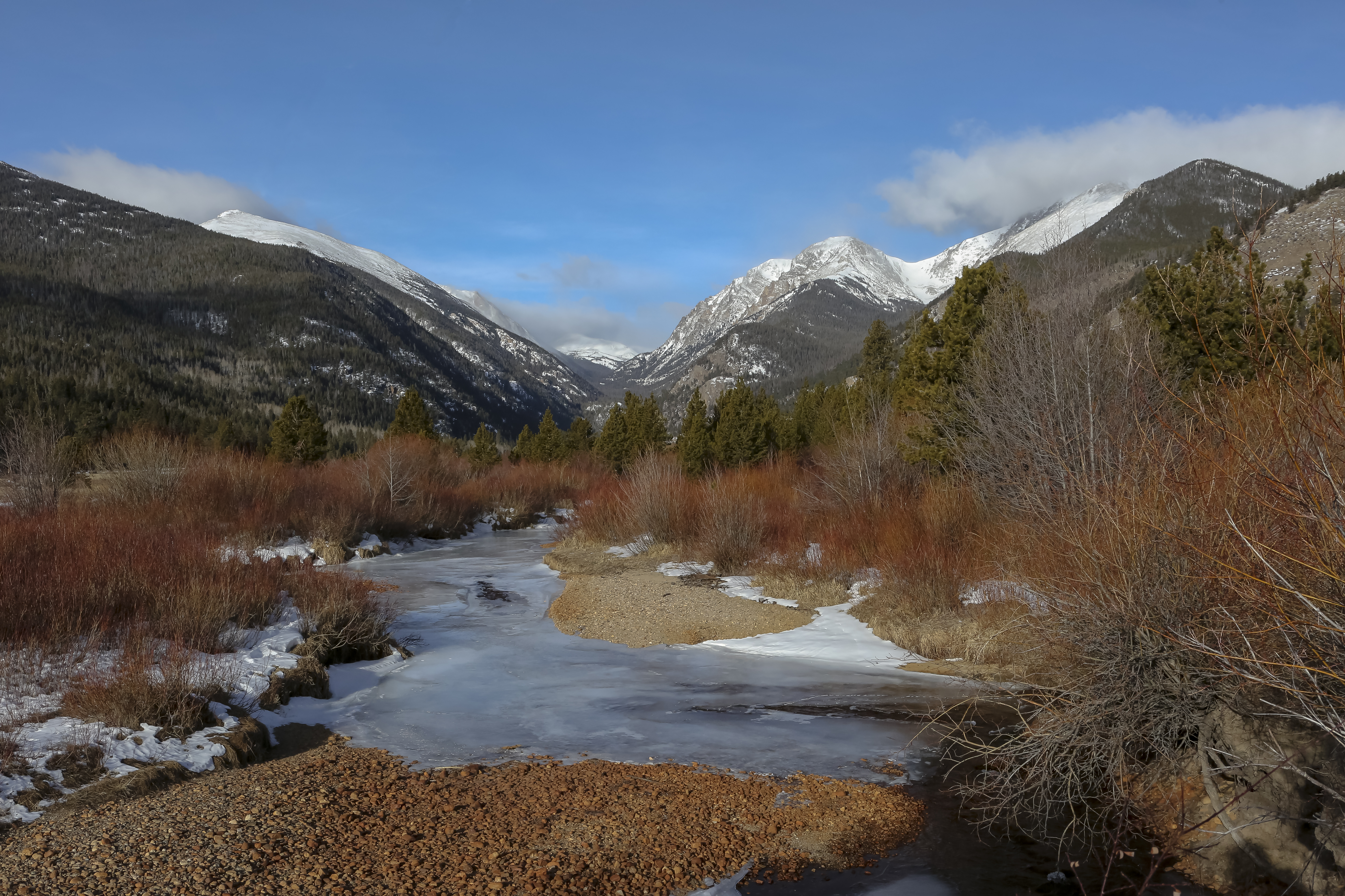
Winter at Horseshoe Park
NPS Photo / Kim Grossman · Public domain (NPS) · NPS
Cyanocitta stelleri macrolopha (Baird, 1854) - Steller's Jay at Horseshoe Park Overlook, northeastern Rocky Mountains National Park, northern Colorado, USA.
James St. John · CC BY 2.0 · source
Cyanocitta stelleri macrolopha (Baird, 1854) - Steller's Jay at Horseshoe Park Overlook, northeastern Rocky Mountains National Park, northern Colorado, USA.
James St. John · CC BY 2.0 · source
Sunrise over West Horseshoe Park, Rocky Mountain National Park, Colorado. Pushed the treatment here as an impression of the warm sun on a cool morning over the cold granite of the valley wall. For slidersunday.
Christian Collins · CC BY-SA 2.0 · source
Rocky Mountain Sheep grazing near Sheep Lakes (Horseshoe Park) in June. The sheep come down from the high country, cross the road and graze for up to an hour or more before returning to the high mountains. In these sink holes, they seek mineral salts needed to sustain life, grow coats, horns and pro
Rocky Mountain National Park · Public domain · source
2010月10月17日、アメリカ合衆国コロラド州ロッキーマウンテン国立公園の黄葉。 ピークは少し過ぎてましたが、とても綺麗でした。 10/17/2010, autumn leaves in Rocky Mountain National Park. It was a little late for taking pictures of autumn leaves, but they were breathtakingly beautiful!
Yuya Sekiguchi · CC BY 2.0 · source

What you’re looking at

Named terrain around this overlook, nearest first. No view direction is recorded, so every bearing is listed.

  • Horseshoe Falls8,819 ftnorth-northwest · 0.8 mi
  • Hazels Cone9,082 fteast-northeast · 0.9 mi
  • Many Parks Curve9,687 ftsouth-southwest · 1.0 mi
  • Deer Mountain Buttress9,814 fteast-southeast · 2.2 mi
  • MacGregor Mountain10,480 fteast-northeast · 2.8 mi
  • Oogie Boogie Buttress8,834 fteast · 3.2 mi

Light

DateSunriseSunsetGolden hour
March equinox07:0719:1518:39
June solstice05:3320:3719:56
September equinox06:5119:0118:25
December solstice07:2316:4015:56

Local time (America/Denver). Computed for this exact position.

Where it is

  • Fort Collins31.6 mi east-northeast
  • Boulder32.6 mi southeast
  • Thornton50.0 mi southeast
Loading map…
Private beta · Free to join

Take the scenic way to Horseshoe Park.

Byway plans around your taste, verified places, real weather and opening hours — then opens every leg in Google Maps with one tap.

Private beta · Free to join · No card · Invite when a spot opens

Horseshoe Park · National Park Service

Horseshoe Park is a low-land meadow with small lakes, great views of the Mummy Mountain Range, and top-notch wildlife viewing opportunities.

West Horseshoe Park Pullout: This pullout contains limited parking spaces that can be used to access the surrounding horseshoe park meadow. Please be aware and follow meadow closures that are often in place May-October.

Upper Horseshoe Meadow Pullout:Use this pullout to see aerial views of Horseshoe park meadows and the Mummy Mountain Range. Bighorn Sheep, Moose, and Elk in the meadow below can be spotted from this location.

Sheep Lakes pullout:Use this pullout to check if Bighorn Sheep, Moose, or Elk are taking a dip in the water or to enjoy a beautiful sunset.

Please check and respect meadow closures that are typically in effect May-October. Most meadow closures indicate visitors can watch wildlife from the pavement, but may not enter the meadows in order to help protect Rocky’s native wildlife species.

Help keep wildlife wild. Never approach or feed wildlife. Animals that learn people are a source of food can become aggressive or stop hunting or foraging on their own. Keep your distance - it's the law! You could be hurt or issued a fine.

Read it at National Park Service →

WikipediaCC BY-SA

Horseshoe Park is a flat at 8,524 feet (2,598 m) in elevation in Larimer County, Colorado. It is within the Rocky Mountain National Park, which lies between Estes Park to the east and Grand Lake, Colorado on the west. Horseshoe Park is home to bighorn sheep, elk and other wildlife, and it is a wetland sanctuary for a wide variety of birds. Recreational activities include picnicking, hiking, cross-country skiing and snowshoeing. Roaring River, Lawn Lake and Crystal Lake are located here.

Read it at Wikipedia →

How high is Horseshoe Park?

Horseshoe Park sits at about 8,536 feet (2,602 m).

What can you see from Horseshoe Park?

From Horseshoe Park: Horseshoe Falls (NNW, 0.8 mi); Hazels Cone (ENE, 0.9 mi); Many Parks Curve (SSW, 1.0 mi); Deer Mountain Buttress (ESE, 2.2 mi).

What is the nearest town to Horseshoe Park?

Fort Collins, 32 miles ENE of Horseshoe Park.

Drive to Horseshoe Park with Byway

Byway plans the scenic way there — real places along Trail Ridge Road/Beaver Meadow Road, real weather, zero hallucinations — and hands the turns to the navigation you already use.

Byways with this lookout

Day trips start here

Locals make it Verified.

Horseshoe Park — confirmed, rated, and photographed by people who actually pulled over. A local confirmation is what upgrades a lookout from Discovered to Verified. Zero hallucinations.

Confirmed by locals

No local confirmations yet. Stood here? Yours is the one that upgrades this lookout to Verified.

Ratings

No ratings yet. Stood at this lookout? Be the first to rate it.

No written reviews yet.

Field notes

No field notes yet. Know the gate hours or the best pull-in? Leave the note you wish you'd had.

Photos

No photos yet.

Sign in to confirm this lookout, rate it, add photos, and leave field notes.

More lookouts on Trail Ridge Road/Beaver Meadow Road

Named places near this lookout