Skip to content

Medicine Bow Curve

National Park Service
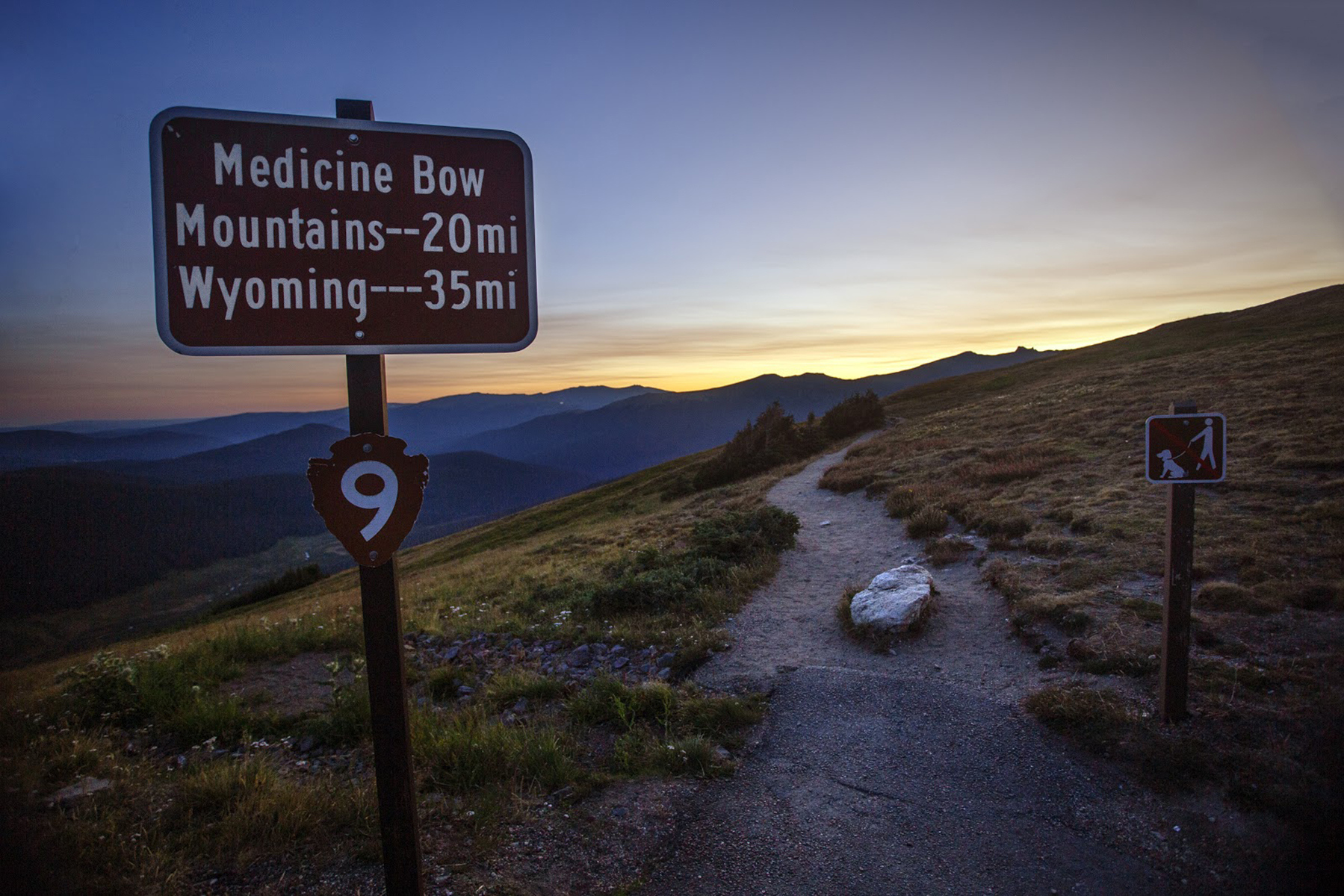
Looking north-west from Medicine Bow Curve. Terrain and imagery at true elevation.

Medicine Bow Curve sits at 11,617 feet on Trail Ridge Road/Beaver Meadow Road, facing 330° across terrain that drops 741 feet within 600 meters of the overlook. The Cache la Poudre river flows through the valley beneath the lookout, and two tree lines are visible from this point: an upper line marking the boundary between sub-alpine forest and alpine tundra, and a lower line near the valley bottom where ground conditions are too wet for trees. Looking west-northwest, Mount Neota (11,717 ft), Thunder Mountain (12,018 ft), Lulu Mountain (12,218 ft), and Static Peak (12,571 ft) are visible, along with Nokhu Crags (12,452 ft) at 7.7 miles. Iron Mountain (12,247 ft) lies to the northwest at 6.6 miles. Rocky Mountain Elk, Ptarmigan, and Marmot are commonly seen in the area; visitors are advised to keep their distance and not approach or feed wildlife. Fort Collins is 36.9 miles east-northeast, Boulder is 39.3 miles southeast, and Longmont is 39.4 miles east-southeast. Trail Ridge Road status can change quickly due to weather, and visitors should check conditions before driving. Given the elevation, visitors should watch for symptoms of altitude sickness, including headache, nausea, and dizziness.

Access
On the byway
Elevation
11,617 ft
View
Northwest · 330°
Relief
741 ft drop
In view
6 named features
Sunrise at Medicine Bow Curve
NPS Photo / Kim Grossman · Public domain (NPS) · NPS
(1 in a multiple picture set) Medicine Bow Curve, just below Alpine Visitor Center on Trail Ridge Road, is actually a series of curves forming switchbacks. This is the view down into the valley below.
inkknife_2000 (7.5 million views +) · CC BY-SA 2.0 · source
(1 in a multiple picture set) In these two sets of pictures, I have mentioned driving on Trail Ridge Road. The next few pictures will give you an idea of how that road climbs up from Grand Lake.
inkknife_2000 (7.5 million views +) · CC BY-SA 2.0 · source
(1 in a multiple picture set) Trail Ridge Road climbs and climbs until at this point, it is taking you beyond the timberline and up to the Alpine Visitor Center.
inkknife_2000 (7.5 million views +) · CC BY-SA 2.0 · source
Specimen Mountain, viewed from the East, from Medicine Bow Curve on Trail Ridge Road
GregMcCollum · CC BY-SA 4.0 · source
(1 in a multiple picture set) We have stopped after coming up from the right, and will soon be headed around a very tight curve (out of the picture to the left) and will then continue upward on the road above where you see cars coming down from the crest of the highway above.
inkknife_2000 (7.5 million views +) · CC BY-SA 2.0 · source

What you’re looking at

Named terrain inside the view from this overlook, nearest first.

  • Mount Neota11,717 ftwest-northwest · 5.4 mi
  • Thunder Mountain12,018 ftwest-northwest · 5.9 mi
  • Lulu Mountain12,218 ftwest-northwest · 6.1 mi
  • Iron Mountain12,247 ftnorthwest · 6.6 mi
  • Static Peak12,571 ftwest-northwest · 7.5 mi
  • Nokhu Crags12,452 ftwest-northwest · 7.7 mi

Light

DateSunriseSunsetGolden hour
March equinox07:0719:1518:39
June solstice05:3420:3719:56
September equinox06:5119:0218:26
December solstice07:2416:4015:57

Local time (America/Denver). Computed for this exact position.

Where it is

  • Fort Collins36.9 mi east-northeast
  • Boulder39.3 mi southeast
  • Longmont39.4 mi east-southeast
Loading map…
Private beta · Free to join

Take the scenic way to Medicine Bow Curve.

Byway plans around your taste, verified places, real weather and opening hours — then opens every leg in Google Maps with one tap.

Private beta · Free to join · No card · Invite when a spot opens

Medicine Bow Curve · National Park Service

Medicine Bow Curve provides a great location to view the northernmost areas of Rocky Mountain National Park.

Looking to the horizon, visitors will see the Medicine Bow Mountains and the state of Wyoming. The Cache la Poudre river can clearly be seen flowing through the valley beneath the lookout area. From this viewing area, visitors can see two tree lines. The uppermost tree line separates the sub-alpine ecosystem from the Alpine Tundra ecosystem. The lower tree line, seen near the bottom of the valley, highlights the valley floor which is too wet for trees to grow. It is also common to see Rocky Mountain Elk and small alpine animals like Ptarmigan and Marmot in this area. But please keep your distance and help keep wildlife wild. Never approach or feed wildlife. Animals that learn people are a source of food can become aggressive or stop hunting or foraging on their own.

Note: Extreme weather can change the status of Trail Ridge Road at any time—be ready to adjust your travel plans if needed, and always check the weather before you start your drive.

Altitude Warning: Altitude sickness affects many visitors every year. Symptoms include headache, nausea, fatigue, dizziness, vomiting, and even unconsciousness. Altitude can also aggravate pre-existing conditions like heart and lung disease. Take your time, drink water, eat, and rest. The only cure for altitude sickness is to go down to a lower altitude.

Read it at National Park Service

How high is Medicine Bow Curve?

Medicine Bow Curve sits at about 11,617 feet (3,541 m).

What can you see from Medicine Bow Curve?

From Medicine Bow Curve: Mount Neota (WNW, 5.4 mi); Thunder Mountain (WNW, 5.9 mi); Lulu Mountain (WNW, 6.1 mi); Iron Mountain (NW, 6.6 mi).

What is the nearest town to Medicine Bow Curve?

Fort Collins, 37 miles ENE of Medicine Bow Curve.

What is the next lookout after Medicine Bow Curve?

Gore Range Overlook is the next surfaced lookout along the same route after Medicine Bow Curve.

Drive to Medicine Bow Curve with Byway

Byway plans the scenic way there — real places along Trail Ridge Road/Beaver Meadow Road, real weather, zero hallucinations — and hands the turns to the navigation you already use.

Byways with this lookout

Day trips start here

Locals make it Verified.

Medicine Bow Curve — confirmed, rated, and photographed by people who actually pulled over. A local confirmation is what upgrades a lookout from Discovered to Verified. Zero hallucinations.

Confirmed by locals

No local confirmations yet. Stood here? Yours is the one that upgrades this lookout to Verified.

Ratings

No ratings yet. Stood at this lookout? Be the first to rate it.

No written reviews yet.

Field notes

No field notes yet. Know the gate hours or the best pull-in? Leave the note you wish you'd had.

Photos

No photos yet.

Sign in to confirm this lookout, rate it, add photos, and leave field notes.

More lookouts on Trail Ridge Road/Beaver Meadow Road

Named places near this lookout