Skip to content

Newfound Gap Overlook

VerifiedOpenStreetMap + National Park Service
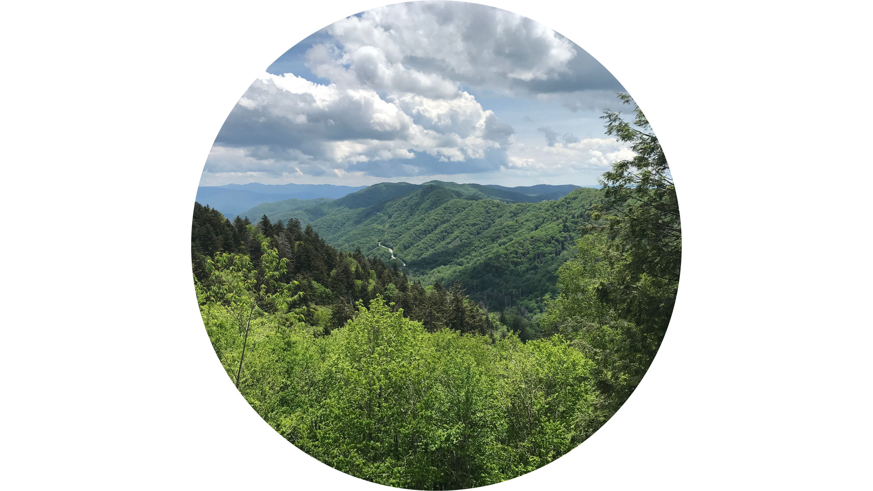
Looking south from Newfound Gap Overlook. Terrain and imagery at true elevation.

Newfound Gap Overlook sits on Newfound Gap Road Byway at 5,061 feet, facing south, with terrain dropping 725 feet within 600 meters. The view spans southeast through southwest, taking in Deep Creek Valley Overlook #1 and #2 and Charles A Webb Overlook, along with peaks including Turkey Flyup, Nettle Creek Bald, Fork Ridge, Round Top Knob, Mount Love, Mt. Buckley, and Mount Collins, plus Kuwohi and Kuwohi Tower to the southwest at 5.3 miles. Mount Collins, situated along the Appalachian Trail between Kuwohi and Newfound Gap, has a summit covered by southern Appalachian spruce-fir forest, with a backcountry shelter and trail junction on its northeastern slope.

Sevierville lies 19.4 miles north-northwest, Maryville 32.2 miles west-northwest, and Knoxville 36.8 miles northwest. The overlook is accessed via US 441, positioned between Ben Morton Overlook and Carlos Campbell Overlook, with parking and seasonal restr

Access
On the byway
Elevation
5,061 ft
View
South · 180°
Relief
725 ft drop
In view
12 named features
Temperatures at Newfound Gap are considerably cooler than in the lowlands, even in summer.
NPS Photo · Public domain (NPS) · NPS
Great Smoky Mountains National Park straddles the border of Tennessee and North Carolina in the United States, and was established in 1934, and formally dedicated by president Franklin Delano Roosevelt at Newfound Gap in 1940. The park was designated as an International Biosphere Reserve in 1976, a
w_lemay · CC BY-SA 2.0 · source
Great Smoky Mountains National Park straddles the border of Tennessee and North Carolina in the United States, and was established in 1934, and formally dedicated by president Franklin Delano Roosevelt at Newfound Gap in 1940. The park was designated as an International Biosphere Reserve in 1976, a
w_lemay · CC BY-SA 2.0 · source
Great Smoky Mountains National Park straddles the border of Tennessee and North Carolina in the United States, and was established in 1934, and formally dedicated by president Franklin Delano Roosevelt at Newfound Gap in 1940. The park was designated as an International Biosphere Reserve in 1976, a
w_lemay · CC BY-SA 2.0 · source
Great Smoky Mountains National Park straddles the border of Tennessee and North Carolina in the United States, and was established in 1934, and formally dedicated by president Franklin Delano Roosevelt at Newfound Gap in 1940. The park was designated as an International Biosphere Reserve in 1976, a
w_lemay · CC BY-SA 2.0 · source
Great Smoky Mountains National Park straddles the border of Tennessee and North Carolina in the United States, and was established in 1934, and formally dedicated by president Franklin Delano Roosevelt at Newfound Gap in 1940. The park was designated as an International Biosphere Reserve in 1976, a
w_lemay · CC BY-SA 2.0 · source

What you’re looking at

Named terrain inside the view from this overlook, nearest first.

  • Deep Creek Valley Overlook #14,884 ftsouth-southeast · 0.9 mi
  • Deep Creek Valley Overlook #24,814 ftsouth-southeast · 1.2 mi
  • Charles A Webb Overlook4,853 ftsoutheast · 1.9 mi
  • Mount Collins6,186 ftwest-southwest · 3.2 mi
  • Turkey Flyup5,107 ftsoutheast · 3.2 mi
  • Nettle Creek Bald5,137 ftsoutheast · 3.8 mi
  • Fork Ridge3,800 ftsouth · 4.3 mi
  • Round Top Knob5,161 ftsouth-southwest · 4.7 mi
  • Mount Love6,406 ftsouthwest · 4.9 mi
  • Kuwohi Tower6,643 ftsouthwest · 5.3 mi
  • Kuwohi6,643 ftsouthwest · 5.3 mi
  • Mt. Buckley6,565 ftsouthwest · 5.7 mi

Light

DateSunriseSunsetGolden hour
March equinox07:3819:4619:12
June solstice06:1920:5320:15
September equinox07:2219:3218:59
December solstice07:4017:2516:45

Local time (America/New_York). Computed for this exact position.

Where it is

  • Sevierville19.4 mi north-northwest
  • Maryville32.2 mi west-northwest
  • Knoxville36.8 mi northwest
Loading map…
Private beta · Free to join

Take the scenic way to Newfound Gap Overlook.

Byway plans around your taste, verified places, real weather and opening hours — then opens every leg in Google Maps with one tap.

Private beta · Free to join · No card · Invite when a spot opens

Newfound Gap Overlook · National Park Service

Overview In southern Appalachian vernacular, a gap is a low point in a mountain ridge. New Englanders call such places “notches,” while westerners refer to them as mountain “passes.” At an elevation of 5,046 feet (1,538 m), Newfound Gap is the lowest drivable gap through Great Smoky Mountains National Park. Temperatures at the gap are considerably cooler than in the lowlands, and precipitation falling as rain in Gatlinburg or Cherokee may be snow at Newfound Gap. Pack layers even in summer.

How to Get There Check current conditions before heading to Newfound Gap Overlook. Drive on Newfound Gap Road (US 441) from either Cherokee, North Carolina, or Gatlinburg, Tennessee. Parking and seasonal restrooms available at the overlook.

Read it at National Park Service

Mount Collins · WikipediaCC BY-SA

Mount Collins is a mountain in the Great Smoky Mountains, located in the Southeastern United States. It has an elevation of 6,188 feet (1,886 m) above sea level. Located along the Appalachian Trail between Kuwohi and Newfound Gap, the mountain is a popular destination for thru-hikers. A backcountry shelter and a major trail junction are located along the mountain's northeastern slope. The mountain's summit is covered by a southern Appalachian spruce–fir forest.

Read it at Wikipedia

How high is Newfound Gap Overlook?

Newfound Gap Overlook sits at about 5,061 feet (1,542 m).

What can you see from Newfound Gap Overlook?

From Newfound Gap Overlook: Deep Creek Valley Overlook #1 (SSE, 0.9 mi); Deep Creek Valley Overlook #2 (SSE, 1.2 mi); Charles A Webb Overlook (SE, 1.9 mi); Mount Collins (WSW, 3.2 mi).

What is the nearest town to Newfound Gap Overlook?

Sevierville, 19 miles NNW of Newfound Gap Overlook.

What is the next lookout after Newfound Gap Overlook?

Carlos Campbell Overlook is the next surfaced lookout along the same route after Newfound Gap Overlook.

Drive to Newfound Gap Overlook with Byway

Byway plans the scenic way there — real places along Newfound Gap Road Byway, real weather, zero hallucinations — and hands the turns to the navigation you already use.

Byways with this lookout

Locals make it Verified.

Newfound Gap Overlook — confirmed, rated, and photographed by people who actually pulled over. A local confirmation is what upgrades a lookout from Discovered to Verified. Zero hallucinations.

Confirmed by locals

No local confirmations yet. Stood here? Yours is the one that upgrades this lookout to Verified.

Ratings

No ratings yet. Stood at this lookout? Be the first to rate it.

No written reviews yet.

Field notes

No field notes yet. Know the gate hours or the best pull-in? Leave the note you wish you'd had.

Photos

No photos yet.

Sign in to confirm this lookout, rate it, add photos, and leave field notes.

More lookouts on Newfound Gap Road Byway

Named places near this lookout