Skip to content

Old Town Overlook

VerifiedOpenStreetMap + National Park Service
Old Town Overlook — direction of view not recorded. Terrain and imagery at true elevation.

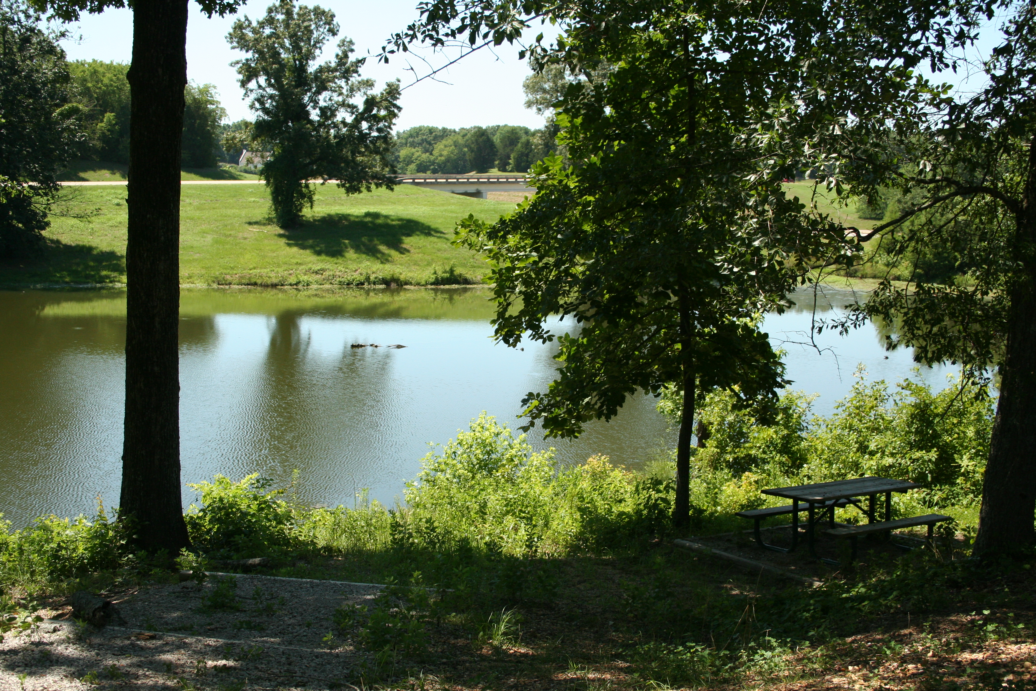
Old Town Overlook sits at 309 feet on the Natchez Trace Parkway, with the land dropping 45 feet within 600 meters of the site. Looking southeast, Veterans Park and the F-105 Thunderchief are both visible about 3.7 miles away, at elevations of 268 and 266 feet respectively. From the north side of the overlook, visitors can see a mix of natural land and cultivated fields, part of the agricultural leases that maintain traditional crops along the Parkway. A pond nearby offers fishing and a chance to watch turtles sunning on its banks. Walking trails lead into the woods and down to Town Creek, and hikers can pick up the Natchez Trace National Scenic Trail here, heading about two miles south to the Chickasaw Village Site or a similar distance north to the Beech Springs Trailhead. The area carries a long human history, beginning with American Indian settlement and the Chickasaw village the English called Old Town. A 1914 DAR marker references the Battle of Ackia nearby, and the bottomland along the creek was the site of fighting during the Civil War's Battle of Tupelo on July 15, 1864. Tupelo lies 3.4 miles to the south-southeast; New Albany and Booneville are farther off to the northwest and north-northeast. The overlook falls between Twentymile Bottom Overlook and Black Belt Overlook along the parkway route.

Access
On the byway
Elevation
309 ft
Relief
45 ft drop
In view
2 named features
Stop and take in all that has happened at Old Town Overlook
NPS Photo · Public domain (NPS) · NPS
View of Earth taken during ISS Expedition 29.
Earth Science and Remote Sensing Unit , Lyndon B. Johnson Space Center · Public domain · source
View of Earth taken during ISS Expedition 29.
Earth Science and Remote Sensing Unit , Lyndon B. Johnson Space Center · Public domain · source
View of Earth taken during ISS Expedition 30.
Earth Science and Remote Sensing Unit , Lyndon B. Johnson Space Center · Public domain · source
Trail crew and volunteers construct wooden path along the Natchez Trace National Scenic Trail Keywords: national trails system; national scenic trail; natchez trace national scenic trail
NPS · Public domain · source
Damage to the Comfort Suites on Mississippi Highway 145 caused by the tornado on 28 April 2014 in Tupelo, Mississippi.
Fredlyfish4 · CC BY-SA 4.0 · source

What you’re looking at

Named terrain around this overlook, nearest first. No view direction is recorded, so every bearing is listed.

  • Veterans Park268 ftsoutheast · 3.7 mi
  • F-105 Thunderchief266 ftsoutheast · 3.7 mi

Light

DateSunriseSunsetGolden hour
March equinox06:5919:0718:34
June solstice05:4420:1119:34
September equinox06:4418:5318:20
December solstice06:5816:5016:11

Local time (America/Chicago). Computed for this exact position.

Where it is

  • Tupelo3.4 mi south-southeast
  • New Albany20.8 mi northwest
  • Booneville25.9 mi north-northeast
Loading map…
Private beta · Free to join

Take the scenic way to Old Town Overlook.

Byway plans around your taste, verified places, real weather and opening hours — then opens every leg in Google Maps with one tap.

Private beta · Free to join · No card · Invite when a spot opens

Old Town Overlook, Milepost 263.9 · National Park Service

Old Town Overlook presents a medley of possibilities to enjoy. Will it be history, nature, agriculture, recreation? You can experience them all at this overlook that combines everything the Natchez Trace Parkway is about.  Folks interested in nature and recreation can fish in the pond, watch turtles pile up and warm their shells in the sun, or imagine back more than 11,000 years ago and picture mastodons ambling to the creek. Walkers can stretch their legs on a short jaunt into the woods or down to Town Creek. Hikers can access the Natchez Trace National Scenic Trail and walk a little more than 2 miles south to the Chickasaw Village Site, or head northward for little less than two miles to the Beech Springs Trailhead.  Over time, people have used this area in many ways. The human history of Old Town started with American Indians who settled here. The name Old Town was what the English called a large established Chickasaw village.  Old Town was not always a peaceful bottomland. The 1914 DAR marker indicates that the Battle of Ackia took place near here, which is debatable, but we know that during the Civil War's Battle of Tupelo, on July 15, 1864, an intense battle was fought in the bottoms at the creek.  Standing on the north side of the overlook, there are views of both natural and cultivated land protected by the Natchez Trace Parkway. The agricultural land is leased and planted with traditional crops to help conserve the rural beauty of the Parkway.

Read it at National Park Service

How high is Old Town Overlook?

Old Town Overlook sits at about 309 feet (94 m).

What can you see from Old Town Overlook?

From Old Town Overlook: Veterans Park (SE, 3.7 mi); F-105 Thunderchief (SE, 3.7 mi).

What is the nearest town to Old Town Overlook?

Tupelo, 3.4 miles SSE of Old Town Overlook.

What is the next lookout after Old Town Overlook?

Black Belt Overlook is the next surfaced lookout along the same route after Old Town Overlook.

Drive to Old Town Overlook with Byway

Byway plans the scenic way there — real places along Natchez Trace Parkway, real weather, zero hallucinations — and hands the turns to the navigation you already use.

Byways with this lookout

Day trips start here

Locals make it Verified.

Old Town Overlook — confirmed, rated, and photographed by people who actually pulled over. A local confirmation is what upgrades a lookout from Discovered to Verified. Zero hallucinations.

Confirmed by locals

No local confirmations yet. Stood here? Yours is the one that upgrades this lookout to Verified.

Ratings

No ratings yet. Stood at this lookout? Be the first to rate it.

No written reviews yet.

Field notes

No field notes yet. Know the gate hours or the best pull-in? Leave the note you wish you'd had.

Photos

No photos yet.

Sign in to confirm this lookout, rate it, add photos, and leave field notes.

More lookouts on Natchez Trace Parkway

Named places near this lookout