Skip to content

Twentymile Bottom Overlook

National Park Service
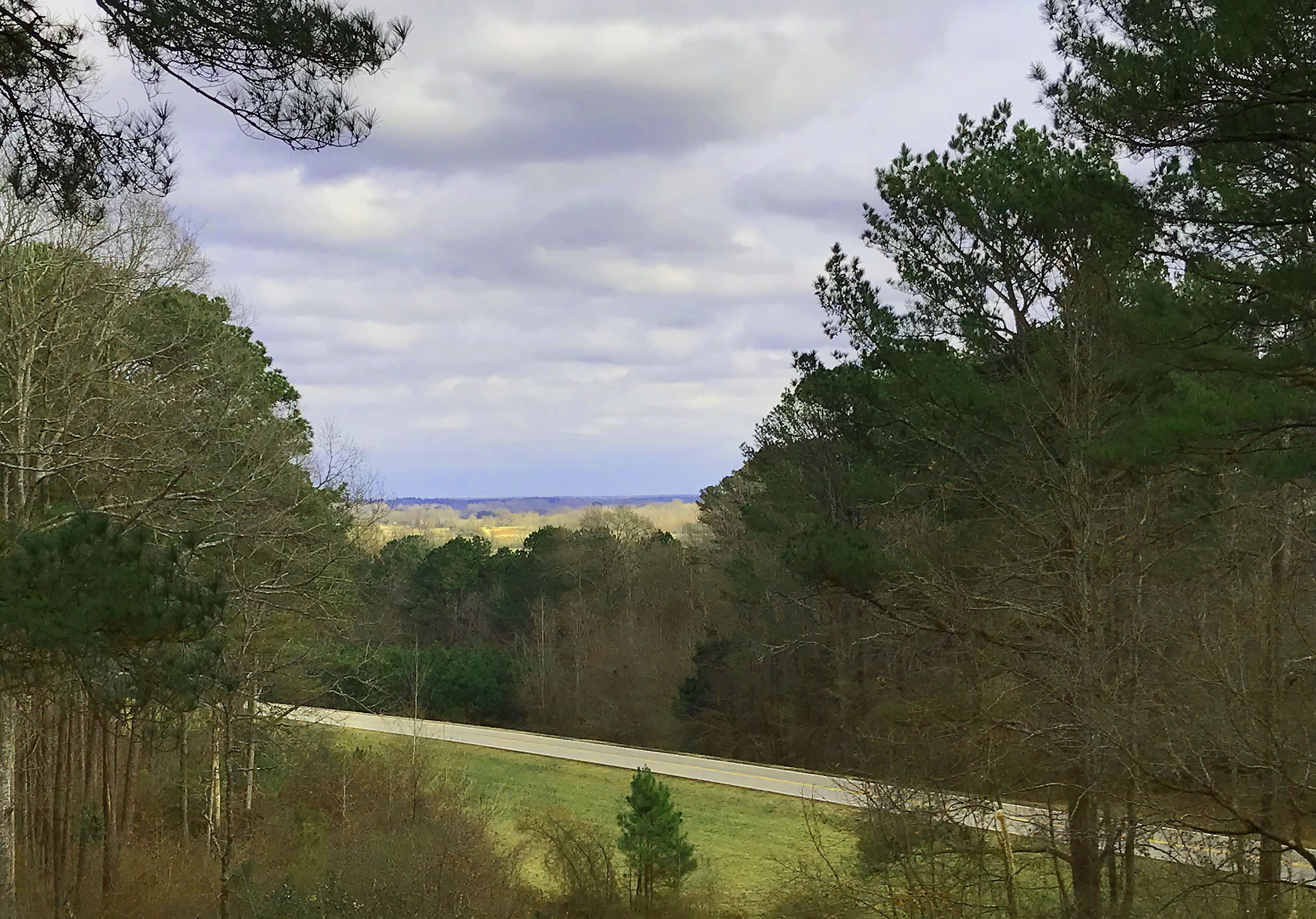
Looking north-east from Twentymile Bottom Overlook. Terrain and imagery at true elevation.

Twentymile Bottom Overlook sits at 402 feet on the Natchez Trace Parkway, facing 60 degrees toward an agricultural bottom area, with the land dropping 111 feet within 600 meters of the pullout. Beaver Lake Recreation Area lies to the east-southeast, 9.3 miles away at 381 feet elevation. The facing is oriented toward sunrise, roughly 30 degrees off square, so early light crosses the bottomland; sunrise runs from about 5:43 in June to 6:59 in March. The overlook sits between Waterfall and Old Town Overlook along the parkway, with Tupelo 14.8 miles southwest, New Albany 26.5 miles west, and Corinth 34.9 miles north. A quotation from Reverend John Johnson, dated 1812, describes swimming his horse five times, bridging one creek, fording others, and wading a swamp in a single day, followed by rain that night. The area now consists largely of cultivated fields where forest and swamp once stood. Average annual rainfall here is about 55 inches, with recorded totals exceeding 80 inches in some years. This is not a circular drive, and large RVs will have difficulty in the parking area.

Access
On the byway
Elevation
402 ft
View
Northeast · 60°
Light
Best at sunrise
Relief
111 ft drop
In view
1 named features
Twentymile Bottom Overlook, a place to imagine
NPS Photo - J Farmer · Public domain (NPS) · NPS

What you’re looking at

Named terrain inside the view from this overlook, nearest first.

  • Beaver Lake Recreation Area381 fteast-southeast · 9.3 mi

Light

This overlook faces sunrise 30° off square to it.

DateSunriseSunsetGolden hour
March equinox06:5919:0618:33
June solstice05:4320:1119:33
September equinox06:4318:5318:19
December solstice06:5816:4916:10

Local time (America/Chicago). Computed for this exact position.

Where it is

  • Tupelo14.8 mi southwest
  • New Albany26.5 mi west
  • Corinth34.9 mi north
Loading map…
Private beta · Free to join

Take the scenic way to Twentymile Bottom Overlook.

Byway plans around your taste, verified places, real weather and opening hours — then opens every leg in Google Maps with one tap.

Private beta · Free to join · No card · Invite when a spot opens

Twentymile Bottom Overlook, Milepost 278.4 · National Park Service

"I have this day swam my horse 5 times, bridged one creek, forded several others, besides the swamp we had to wade through. At night we had a shower of rain." Reverend John Johnson, 1812 This overlook takes in a wide view of a rich agricultural bottom area. Use your imagination to replace some of the fields with forests and swamps. Imagine what it would be like to traverse the area in 1812, on a horse. It sounds like the reverend had a soggy time. Water was always a critical survival factor for early travelers. In the west, it was frequently lack of water. In the southeast, it was sometimes too much water. This area averages about 55 inches of rain per year, but yearly totals of rainforest proportion, over 80 inches, have been recorded. Take a moment and contemplate being exposed to so much water during all seasons of the year, over weeks or months with no indoor shelter. This was the plight of early travelers on the Old Trace.  Please note that this is not a circular drive and large RVs will have trouble negotiating the parking area.

Read it at National Park Service

How high is Twentymile Bottom Overlook?

Twentymile Bottom Overlook sits at about 402 feet (122 m).

What can you see from Twentymile Bottom Overlook?

From Twentymile Bottom Overlook: Beaver Lake Recreation Area (ESE, 9.3 mi).

Is Twentymile Bottom Overlook better at sunrise or sunset?

Sunrise. The land falls away from Twentymile Bottom Overlook toward the sunrise, so at sunset the light is behind you. Exact times shift through the year; the page shows the current window.

What is the nearest town to Twentymile Bottom Overlook?

Tupelo, 15 miles SW of Twentymile Bottom Overlook.

What is the next lookout after Twentymile Bottom Overlook?

Old Town Overlook is the next surfaced lookout along the same route after Twentymile Bottom Overlook.

Drive to Twentymile Bottom Overlook with Byway

Byway plans the scenic way there — real places along Natchez Trace Parkway, real weather, zero hallucinations — and hands the turns to the navigation you already use.

Byways with this lookout

Day trips start here

Locals make it Verified.

Twentymile Bottom Overlook — confirmed, rated, and photographed by people who actually pulled over. A local confirmation is what upgrades a lookout from Discovered to Verified. Zero hallucinations.

Confirmed by locals

No local confirmations yet. Stood here? Yours is the one that upgrades this lookout to Verified.

Ratings

No ratings yet. Stood at this lookout? Be the first to rate it.

No written reviews yet.

Field notes

No field notes yet. Know the gate hours or the best pull-in? Leave the note you wish you'd had.

Photos

No photos yet.

Sign in to confirm this lookout, rate it, add photos, and leave field notes.

More lookouts on Natchez Trace Parkway

Named places near this lookout