Skip to content

Richland Balsam Overlook

National Park Service
Looking south from Richland Balsam Overlook. Terrain and imagery at true elevation.

Richland Balsam Overlook sits along the Blue Ridge Parkway at 6,045 feet, facing south, with terrain dropping 539 feet within 600 meters of the viewpoint. The area is named for the red spruce and Fraser fir trees found here, referred to locally as "he-balsam" and "she-balsam," and the forest resembles a Canadian wilderness type. Since the late 1970s, the balsam woolly adelgid, an invasive pest, has affected the Fraser fir trees in this forest. From the overlook, Cowee Mountains Overlook is visible to the south-southeast at 0.6 miles and 5,995 feet elevation, and Reinhart Knob rises to the southeast at 1.2 miles and 6,103 feet. The overlook is part of the Nantahala National Forest area. Asheville lies 29.6 miles to the east-northeast, Easley is 43.7 miles south-southeast, and Greenville is 48.7 miles southeast. Lone Bald Overlook precedes this stop on the Parkway, and Richland Balsam Overlook - Highest Point on the Parkway follows. Visitors should check current conditions before arriving.

Access
On the byway
Elevation
6,045 ft
View
South · 180°
Relief
539 ft drop
In view
2 named features
Richland Balsam
NPS Photo / Morgan Bissell · Public domain (NPS) · NPS
Richland Balsam Overlook
Thomson200 · CC0 · source
Richland Balsam Overlook in the rain. Rain probably from Hurricane Matthew
Thomson200 · CC0 · source
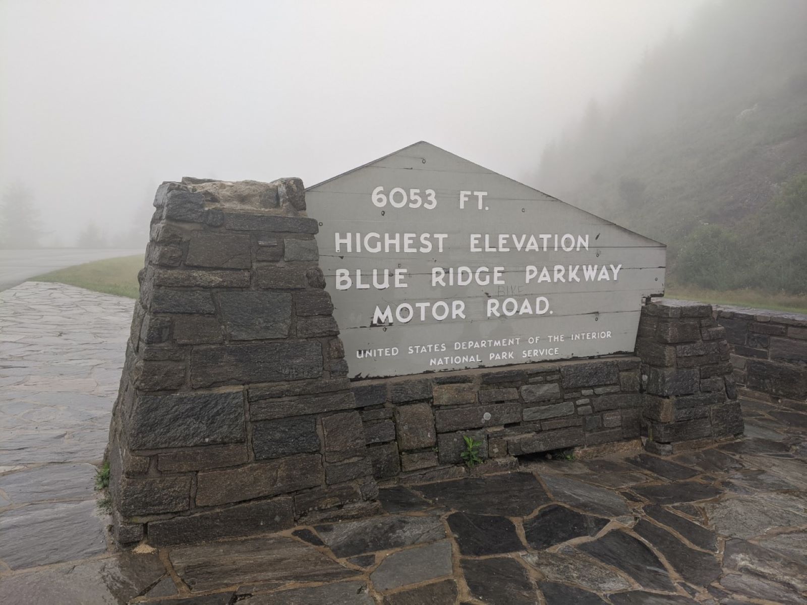
Sign at Richland Balsam Overlook on the Blue Ridge Parkway noting the highest point on the road
Chaneyforkriver · CC0 · source
Abies fraseri , Blue Ridge Parkway, near Cherokee, NC. 35°21'26"N 82°59'09"W, 1815 m altitude.
Gene from Aiken, SC, USA · CC BY 2.0 · source
Richland Balsam viewed from Cowee Mountain Overlook, Oct 2016
Thomson200 · CC0 · source

What you’re looking at

Named terrain inside the view from this overlook, nearest first.

  • Cowee mountains Overlook (MP 430.7)5,995 ftsouth-southeast · 0.6 mi
  • Reinhart Knob6,103 ftsoutheast · 1.2 mi

Light

DateSunriseSunsetGolden hour
March equinox07:3719:4419:10
June solstice06:1820:5120:13
September equinox07:2119:3018:57
December solstice07:3817:2416:45

Local time (America/New_York). Computed for this exact position.

Where it is

  • Asheville29.6 mi east-northeast
  • Easley43.7 mi south-southeast
  • Greenville48.7 mi southeast
Loading map…
Private beta · Free to join

Take the scenic way to Richland Balsam Overlook.

Byway plans around your taste, verified places, real weather and opening hours — then opens every leg in Google Maps with one tap.

Private beta · Free to join · No card · Invite when a spot opens

Richland Balsam Overlook: Highest Point on the Parkway, Milepost 431.4 · National Park Service

Take in the expansive views of the Nantahala National Forest from the highest point on the Parkway at Richland Balsam Overlook. Sitting at 6,053 feet above sea level, Richland Balsam is the highest point along the Blue Ridge Parkway motor road. Named for the red spruce and Fraser fir trees found here, known as the “he-balsam” and “she-balsam” respectively, this area features a forest type that resembles a Canadian wilderness. Since the late 1970s the forest has been affected by the balsam woolly adelgid, an invasive pest that has been killing Fraser fir trees. Check the conditions of the area before you visit.

Read it at National Park Service

How high is Richland Balsam Overlook?

Richland Balsam Overlook sits at about 6,045 feet (1,843 m).

What can you see from Richland Balsam Overlook?

From Richland Balsam Overlook: Cowee mountains Overlook (MP 430.7) (SSE, 0.6 mi); Reinhart Knob (SE, 1.2 mi).

What is the nearest town to Richland Balsam Overlook?

Asheville, 30 miles ENE of Richland Balsam Overlook.

What is the next lookout after Richland Balsam Overlook?

Richland Balsam Overlook - Highest Point on the Parkway is the next surfaced lookout along the same route after Richland Balsam Overlook.

Drive to Richland Balsam Overlook with Byway

Byway plans the scenic way there — real places along Blue Ridge Parkway, real weather, zero hallucinations — and hands the turns to the navigation you already use.

Byways with this lookout

Day trips start here

Locals make it Verified.

Richland Balsam Overlook — confirmed, rated, and photographed by people who actually pulled over. A local confirmation is what upgrades a lookout from Discovered to Verified. Zero hallucinations.

Confirmed by locals

No local confirmations yet. Stood here? Yours is the one that upgrades this lookout to Verified.

Ratings

No ratings yet. Stood at this lookout? Be the first to rate it.

No written reviews yet.

Field notes

No field notes yet. Know the gate hours or the best pull-in? Leave the note you wish you'd had.

Photos

No photos yet.

Sign in to confirm this lookout, rate it, add photos, and leave field notes.

More lookouts on Blue Ridge Parkway

Named places near this lookout