Skip to content

View Black Mountain Overlook

National Park Service
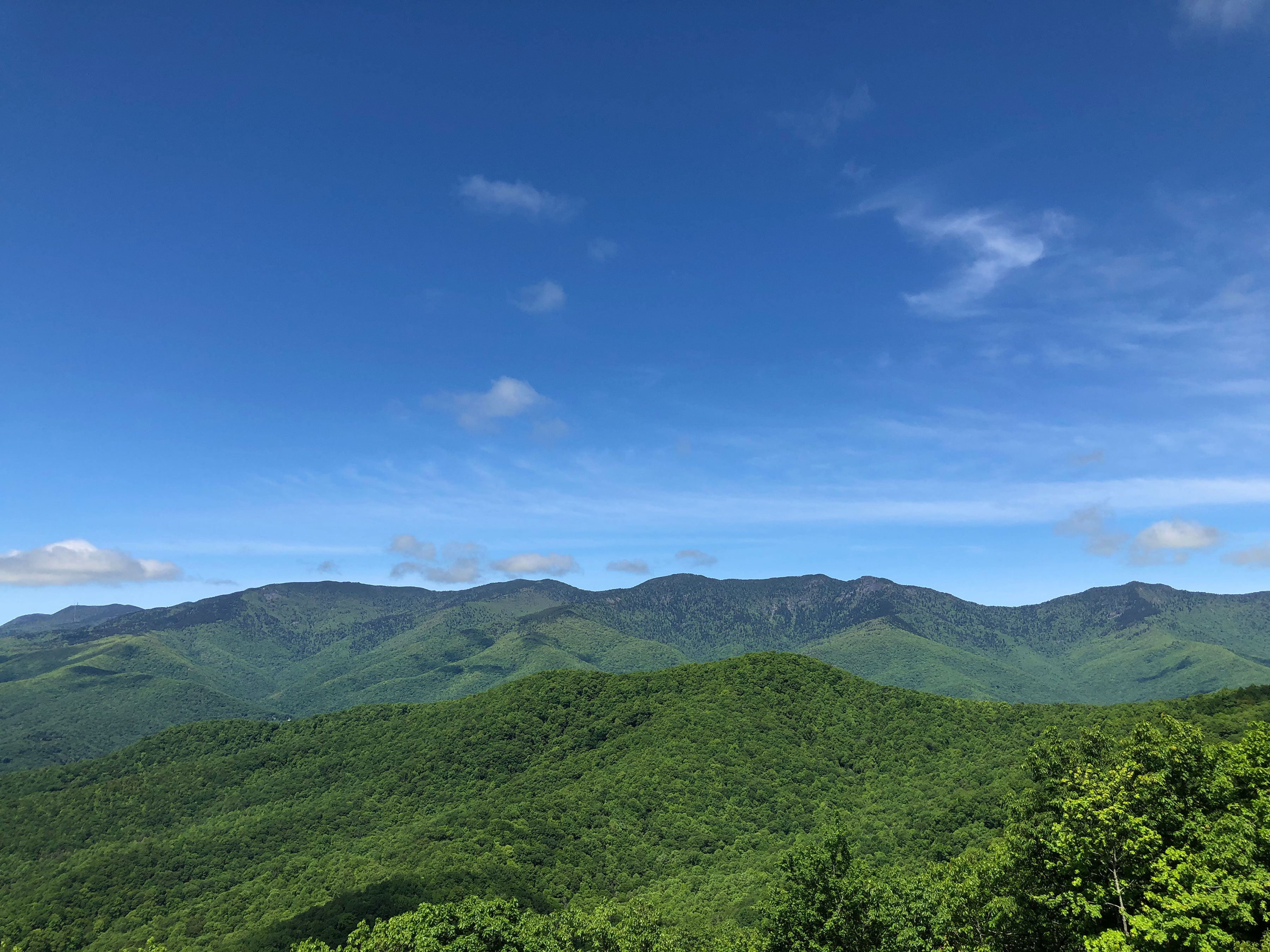
Looking south-west from View Black Mountain Overlook. Terrain and imagery at true elevation.

View Black Mountain Overlook sits at 3,875 feet on the Blue Ridge Parkway, facing 240 degrees with terrain dropping 663 feet within 600 meters of the pull-off. Big Laurel Mountain rises south-southwest at 3.4 miles, with an elevation of 4,141 feet, and Hewat Overlook (MP 347.9) is visible in the same direction at 3.7 miles, 4,293 feet. To the west, three waterfalls appear in the view: Anaconda Falls at 3.9 miles (4,170 feet), Crevice Falls at 4.0 miles (4,333 feet), and Timber Falls at 4.1 miles (4,451 feet). The overlook's facing is angled 30 degrees off directly toward sunset, making evening light a factor here; sunset falls at 19:41 near the March equinox, 20:49 at the June solstice, 19:27 near the September equinox, and 17:19 at the December solstice. Asheville lies 25.2 miles west-southwest, Johnson City is 38.0 miles north-northwest, and Shelby is 49.3 miles southeast. This stop falls along the parkway between Black Mountains Overlook and Three Knob Overlook.

Access
On the byway
Elevation
3,875 ft
View
Southwest · 240°
Light
Best at sunset
Relief
663 ft drop
In view
5 named features
View Black Mountain Overlook
NPS photo · Public domain (NPS) · NPS
A snowstorm breaks over the crest of the Black Mountain range. Photo taken with a Panasonic Lumix DMC-FZ50 in Yancey County, NC, USA . Cropping and post-processing performed with The GIMP .
Ken Thomas · Public domain · source
The Eastern Continental Divide, located along NC 80 and the Blue Ridge Parkway, at Buck Creek Gap.
Washuotaku · CC BY-SA 4.0 · source
From left: Balsam Cone, Cattail Peak and Potato Hill viewed from Black Mountains Overlook
Thomson200 · CC0 · source
Mount Mitchell (left) and Mount Craig (right) viewed from the Black Mountains Overlook
Thomson200 · CC0 · source
Mount Mitchell viewed from the Black Mountains Overlook
Thomson200 · CC0 · source

What you’re looking at

Named terrain inside the view from this overlook, nearest first.

  • Big Laurel Mountain4,141 ftsouth-southwest · 3.4 mi
  • Hewat Overlook (MP 347.9)4,293 ftsouth-southwest · 3.7 mi
  • Anaconda Falls4,170 ftwest · 3.9 mi
  • Crevice Falls4,333 ftwest · 4.0 mi
  • Timber Falls4,451 ftwest · 4.1 mi

Light

This overlook faces sunset 30° off square to it.

DateSunriseSunsetGolden hour
March equinox07:3319:4119:07
June solstice06:1420:4920:11
September equinox07:1719:2718:53
December solstice07:3617:1916:40

Local time (America/New_York). Computed for this exact position.

Where it is

  • Asheville25.2 mi west-southwest
  • Johnson City38.0 mi north-northwest
  • Shelby49.3 mi southeast
Loading map…
Private beta · Free to join

Take the scenic way to View Black Mountain Overlook.

Byway plans around your taste, verified places, real weather and opening hours — then opens every leg in Google Maps with one tap.

Private beta · Free to join · No card · Invite when a spot opens

View Black Mountain Overlook · National Park Service

Black Mountain Overlook provides a view of the entire Black Mountain Range, which is the tallest range east of the Black Hills in South Dakota. Six of the ten highest peaks in the eastern United States are in the Black Mountain range, as well as 18 peaks over 6,300 feet in elevation. The shadows of these mountains, cast long over the valleys below, might be one reason for the name. The dark and dense spruce fir forest cloaking the ridge tops may be another. The Black Mountains are home to Mount Mitchell, the tallest peak east of the Mississippi River (6,684 feet). A side trip Mount Mitchell State Park provides visitors with an opportunity to walk to the top of the mountain. This impressive mountain range rises out of the valley created by the South Toe River as it flows northward. Big Ridge and Seven Mile Ridge dwarf in comparison yet add reference and breadth to the valley below.  With its western facing view, this overlook is an excellent spot for viewing sunsets over the lofty peaks of the Black Mountains. Check the conditions of the area before you visit.

Read it at National Park Service

How high is View Black Mountain Overlook?

View Black Mountain Overlook sits at about 3,875 feet (1,181 m).

What can you see from View Black Mountain Overlook?

From View Black Mountain Overlook: Big Laurel Mountain (SSW, 3.4 mi); Hewat Overlook (MP 347.9) (SSW, 3.7 mi); Anaconda Falls (W, 3.9 mi); Crevice Falls (W, 4.0 mi).

Is View Black Mountain Overlook better at sunrise or sunset?

Sunset. The land falls away from View Black Mountain Overlook toward the sunset, so at sunrise the light is behind you. Exact times shift through the year; the page shows the current window.

What is the nearest town to View Black Mountain Overlook?

Asheville, 25 miles WSW of View Black Mountain Overlook.

What is the next lookout after View Black Mountain Overlook?

Three Knob Overlook is the next surfaced lookout along the same route after View Black Mountain Overlook.

Drive to View Black Mountain Overlook with Byway

Byway plans the scenic way there — real places along Blue Ridge Parkway, real weather, zero hallucinations — and hands the turns to the navigation you already use.

Byways with this lookout

Day trips start here

Locals make it Verified.

View Black Mountain Overlook — confirmed, rated, and photographed by people who actually pulled over. A local confirmation is what upgrades a lookout from Discovered to Verified. Zero hallucinations.

Confirmed by locals

No local confirmations yet. Stood here? Yours is the one that upgrades this lookout to Verified.

Ratings

No ratings yet. Stood at this lookout? Be the first to rate it.

No written reviews yet.

Field notes

No field notes yet. Know the gate hours or the best pull-in? Leave the note you wish you'd had.

Photos

No photos yet.

Sign in to confirm this lookout, rate it, add photos, and leave field notes.

More lookouts on Blue Ridge Parkway

Named places near this lookout