Black Canyon of the Gunnison National Park

Official park boundary · National Park Service
Take the scenic way to Black Canyon of the Gunnison National Park.
Byway plans around your taste, verified places, real weather and opening hours — then opens every leg in Google Maps with one tap.
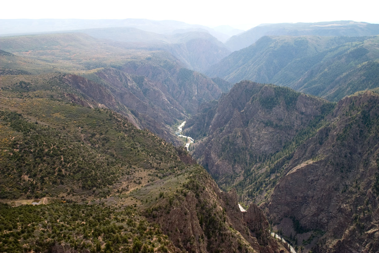
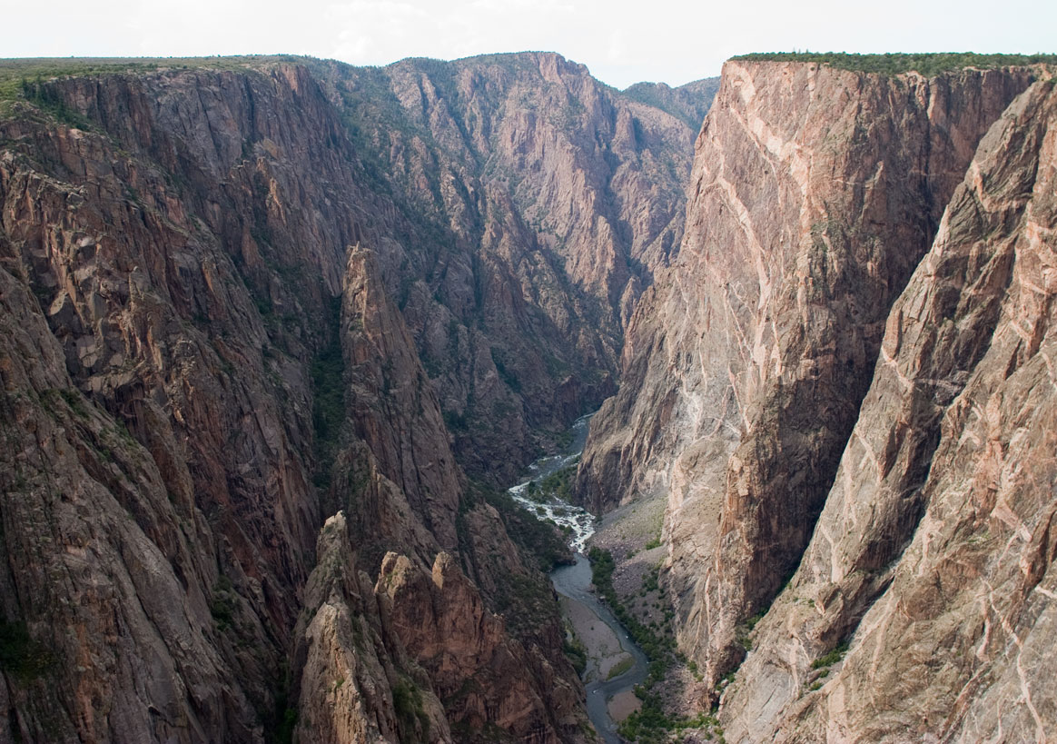
Big enough to be overwhelming, yet still intimate enough to feel the pulse of time. Come see some of the steepest cliffs, oldest rock, and craggiest spires in North America. Forces of nature and the Gunnison River sculpted this canyon over two million years. The result is a vertical wilderness of rock, water, and sky.
Black Canyon of the Gunnison National Park is a national park of the United States located in western Colorado and managed by the National Park Service. The Black Canyon of the Gunnison was established as a national monument on March 2, 1933. It was redesignated a national park on October 21, 1999, and incorporated 4,000 acres owned by the Bureau of Land Management. The Gunnison Gorge National Conservation Area was created at the same time. There are two primary entrances to the park: the south rim entrance is located 15 miles (24 km) east of Montrose, while the north rim entrance is 11 miles (18 km) south of Crawford and is closed in the winter. The park contains 12 miles (19 km) of the 48-mile-long (77 km) Gunnison River. The national park itself contains the deepest and most dramatic section of the canyon, but the canyon continues upstream into Curecanti National Recreation Area and downstream into Gunnison Gorge National Conservation Area. The canyon's name owes itself to the fact that parts of the gorge only receive 33 minutes of sunlight a day, according to Images of America: The Black Canyon of the Gunnison. In the book, author Duane Vandenbusche states, "Several canyons of the American West are longer and some are deeper, but none combines the depth, sheerness, narrowness, darkness, and dread of the Black Canyon."
South Rim: 7 miles north on CO Highway 347 from the intersection with U.S. Highway 50 east of Montrose. Physical/GPS address is: 9800 Highway 347, Montrose, CO 81401 North Rim: 11 miles southwest of Crawford, Colorado. From CO Highway 92, turn west on Black Canyon Road approximately 3 miles south of Crawford. Follow the road signs to the park.
Today's Weather: http://www.weather.com/weather/today/l/NPBLCA:13:US CLIMATE Weather can vary greatly throughout the day. Summer daytime temperatures range between 55 to 90F (13 to 32C), nights 45 to 60F (7 to 16C). Winter daytime temperatures range between 15 to 40F (-9 to 4C), nights 10 to 20F (-12 to -6C). Afternoon thunderstorms are common during the summer. Snow accumulation varies greatly year to year. Layered clothing appropriate for the season is recommended.
Source: National Park Service
7-Day Vehicle Pass. Entrance fees cover all persons in a single, private, non-commercial vehicle.
Valid for 7 days. Admits up to 2 private, non-commercial motorcycles with up to 4 total passengers.
7-Day Individual Pass (pedestrian or bicycle)
Commercial tour fee for vehicle/bus with seating capacity of 1-6 persons. Fee is $25.00 per vehicle plus $7.00 per passenger.
Park facts, fees, and activities confirmed against the National Park Service registry.
National Park Service registryChecked 2026-08-04
- Cross-country Skiing at Black Canyon
In winter, South Rim Drive is closed to vehicles beyond the visitor center at Gunnison Point. As staffing and snow conditions allow, rangers groom the remainder of the road for cross-country skiing (skate and classic) and snowshoeing.
- Snowshoeing at Black Canyon
Although services and access are limited during winter, the park provides recreation opportunities for winter enthusiasts.
- Hike Rim Rock Trail - South Rim
This 1-mile (1.6 km) trail, which meanders along the canyon rim, connects the South Rim Visitor Center to the South Rim Campground.
- Hike Uplands Trail - South Rim
This .9-mile (1.4 km) trail links the Rim Rock Trail (near the campground) to the upper Oak Flat Loop Trail near the South Rim Visitor Center.
- Stargazing at Black Canyon
Black Canyon has exceptional opportunities to view the night skies. Choose overlooks far from the road for optimal stargazing and astrophotography or join one of the park's telescope viewing programs during summer.
- Tour the South Rim Drive
The South Rim Drive is a scenic paved road that follows the canyon rim for 7 miles from Tomichi Point to High Point and features 12 overlooks.
- Hike North Vista Trail - North Rim
Constructed by the Volunteers for Outdoor Colorado, the North Vista Trail offers some of the best scenic views and birding in the park. Difficulty varies from moderate to strenuous based on distance.
- Hike Deadhorse Trail - North Rim
Deadhorse Trail takes hikers into the Black Canyon of the Gunnison Wilderness Area. It offers good views of Deadhorse Gulch and East Portal on the Gunnison River, as well as good birding.
Source: National Park Service
Where is Black Canyon of the Gunnison National Park?
Black Canyon of the Gunnison National Park is in Colorado.
When was Black Canyon of the Gunnison National Park established?
Black Canyon of the Gunnison National Park was established in 1999.
How big is Black Canyon of the Gunnison National Park?
Black Canyon of the Gunnison National Park covers 48 square miles (30,780 acres).
How much does it cost to enter Black Canyon of the Gunnison National Park?
Black Canyon of the Gunnison National Park charges $30 per private vehicle. Other rates apply to motorcycles, cyclists and walk-ins, and some parks add their own reservation or surcharge on top.
Can you camp in Black Canyon of the Gunnison National Park?
Yes. The National Park Service runs 3 campgrounds in Black Canyon of the Gunnison National Park, with 116 campsites between them.
Does Black Canyon of the Gunnison National Park have a visitor center?
Yes. Black Canyon of the Gunnison National Park has 2 visitor centers: North Rim Ranger Station, South Rim Visitor Center.
Day trips start here
Drive Black Canyon of the Gunnison with Byway
Byway plans the scenic day around Black Canyon of the Gunnison — real places, real weather, every stop verified. Zero hallucinations. Google Maps for turns. Byway for soul.