Daisy Farm Campground
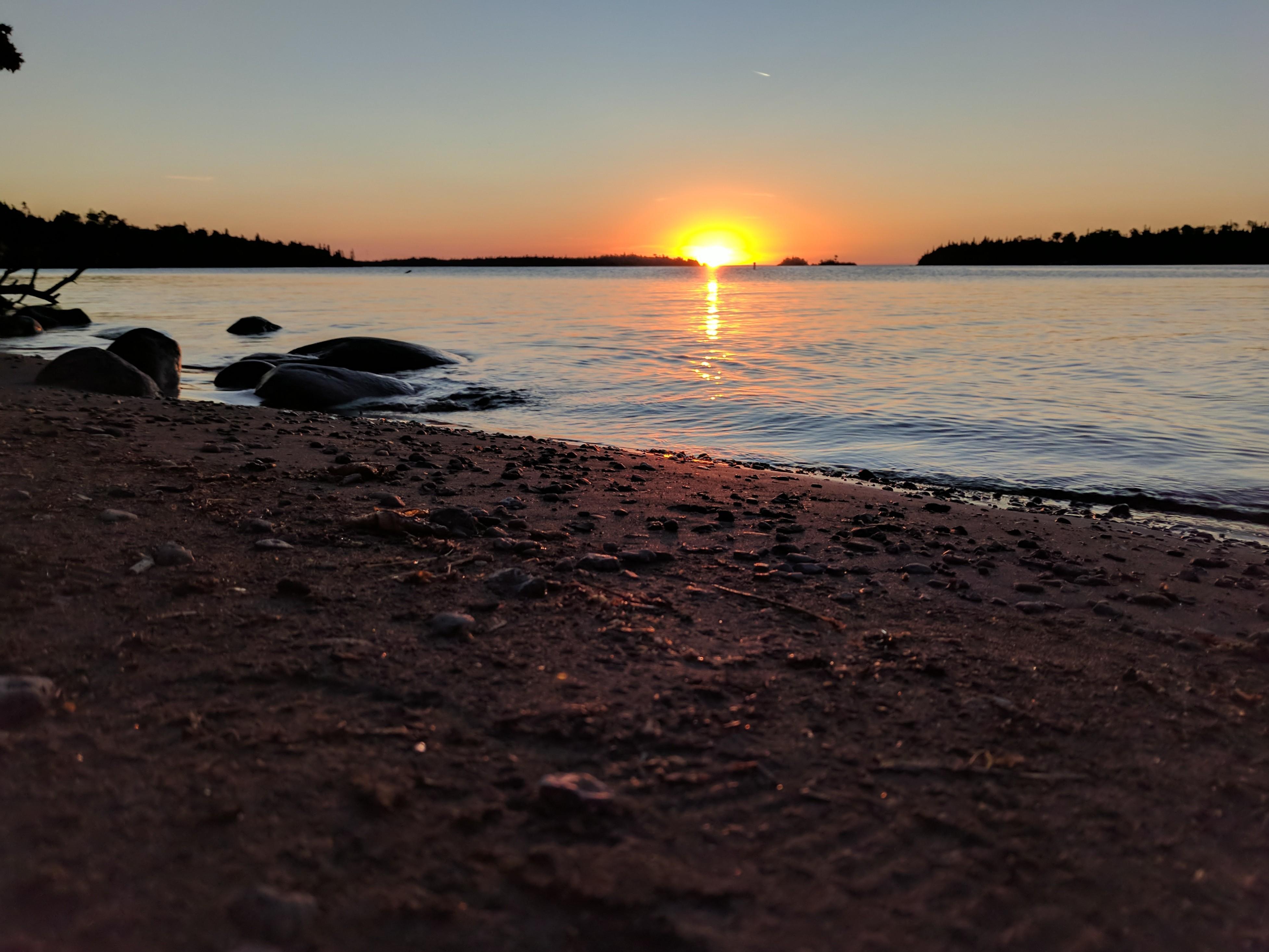
48.0921, -88.5962 · Park boundary: National Park Service
Make Daisy Farm Campground part of the drive.
Byway plans around your taste, verified places, real weather and opening hours — then opens every leg in Google Maps with one tap.
Isle Royale's largest campground is located at Daisy Farm, in Rock Harbor Channel, off of the Rock Harbor Trail, Daisy Farm Trail, and Mount Ojibway Trail. Boats can stay overnight at dock. Ranger Station staffed seasonally. Stay Limit: 3 nights from June 1 – Labor Day annually. Shelters: 16 Depth at dock (normal conditions): 9’. Access: Foot/canoe/kayak/private boat
- Every day
- All Day
The campground is open from April 16 - October 31 (the park operating season) annually, 24 hours a day.
- Park Closed · Nov 1, 2026 – Apr 15, 2027 · Closed
No fee for small-party camping. A free overnight permit is required.
3 Group Sites by advanced reservation only. All parties of 7 or more must submit group permit requests through the park's online request system. The fee is a per permit cost for each party within a group of 7 or more.
Individual tent sites and shelters are first come, first serve. Group tent sites need to be reserved in advance.
- Amphitheater
- Yes - seasonal
- Drinking water
- Water · but not potable
- Food storage lockers
- Yes - year round
- Host on site
- Yes - seasonal
- Toilets
- Vault Toilets - seasonal
- Camp store
- No
- Cell reception
- No
- Dump station
- No
- Firewood for sale
- No
- Ice for sale
- No
- Internet
- No
- Laundry
- No
- Showers
- None
- Trash & recycling
- No
- RVs
- Not allowed
- Trailers
- Not allowed
- Access roads
- No Roads
- Classification
- Limited Development Campground
No wheelchair access.
Uneven, rough terrain throughout campground. Facilities not accessible.
Self-contained stoves only.
Daisy Farm Campground is located in Rock Harbor Channel at the intersection of the Rock Harbor, Daisy Farm, and Mount Ojibway Trails.
Isle Royale National Park is a remote archipelago in the middle of Lake Superior. To make the most of your visit, it is necessary that you plan ahead and prepare. Be aware that many services and items that are available on the mainland are not available at Isle Royale. Due to the unpredictable waters of Lake Superior and its effect on island weather, be prepared for any and all weather conditions.
All park visitors pay an entrance fee. Self-contained stoves only. Dogs, cats, and other pets are not allowed. Quiet hours are from 10:00 p.m. to 6:00 a.m. EDT/ 9:00 p.m. to 5:00 a.m. CDT. Fishing licenses are not required for inland lakes and streams on the island. However, Michigan size, season, and possession limits still apply. Only barbless hooks and artificial lures and flies may be used on inland lakes and streams. A State of Michigan fishing license is required to fish in the waters of Lake Superior.
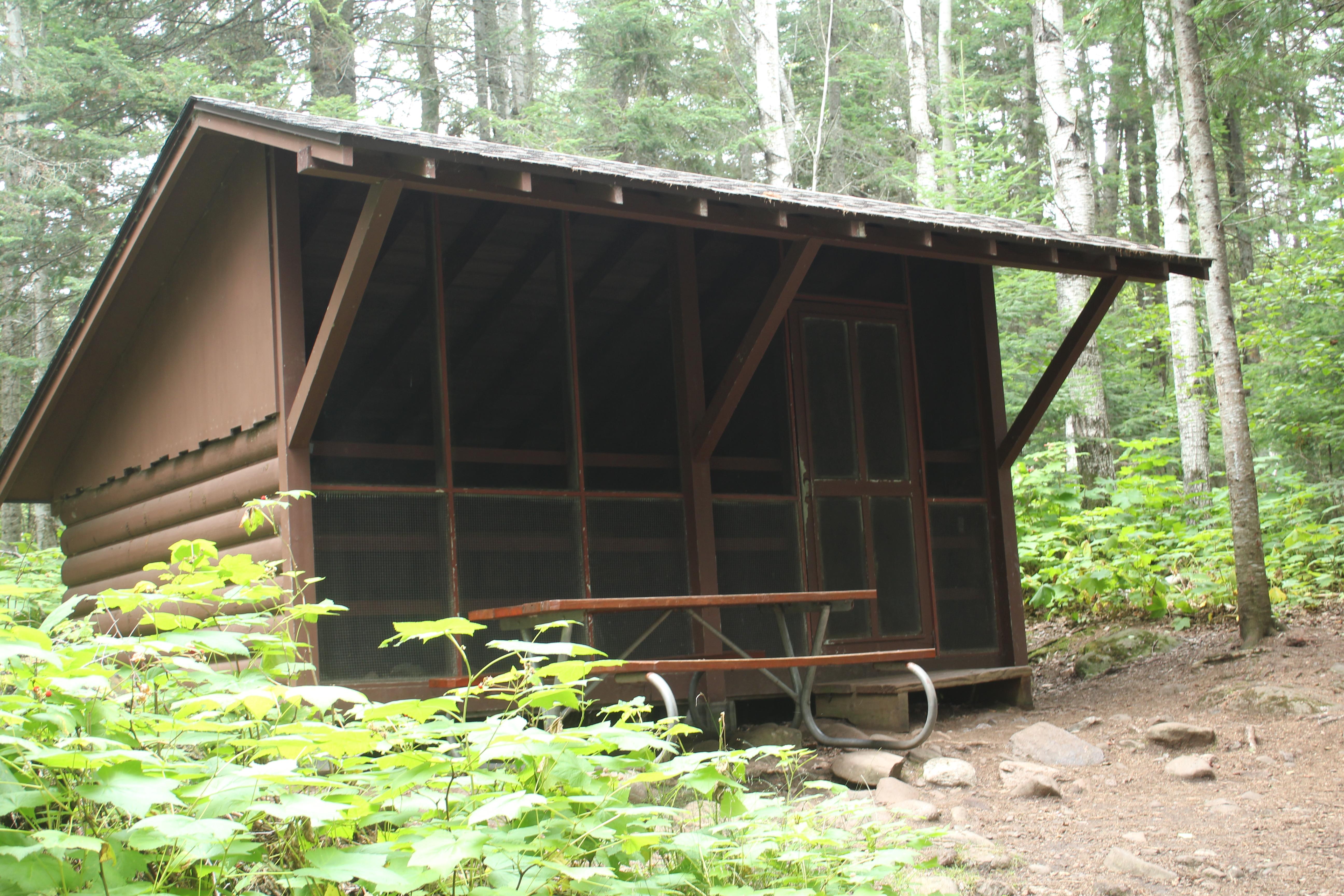
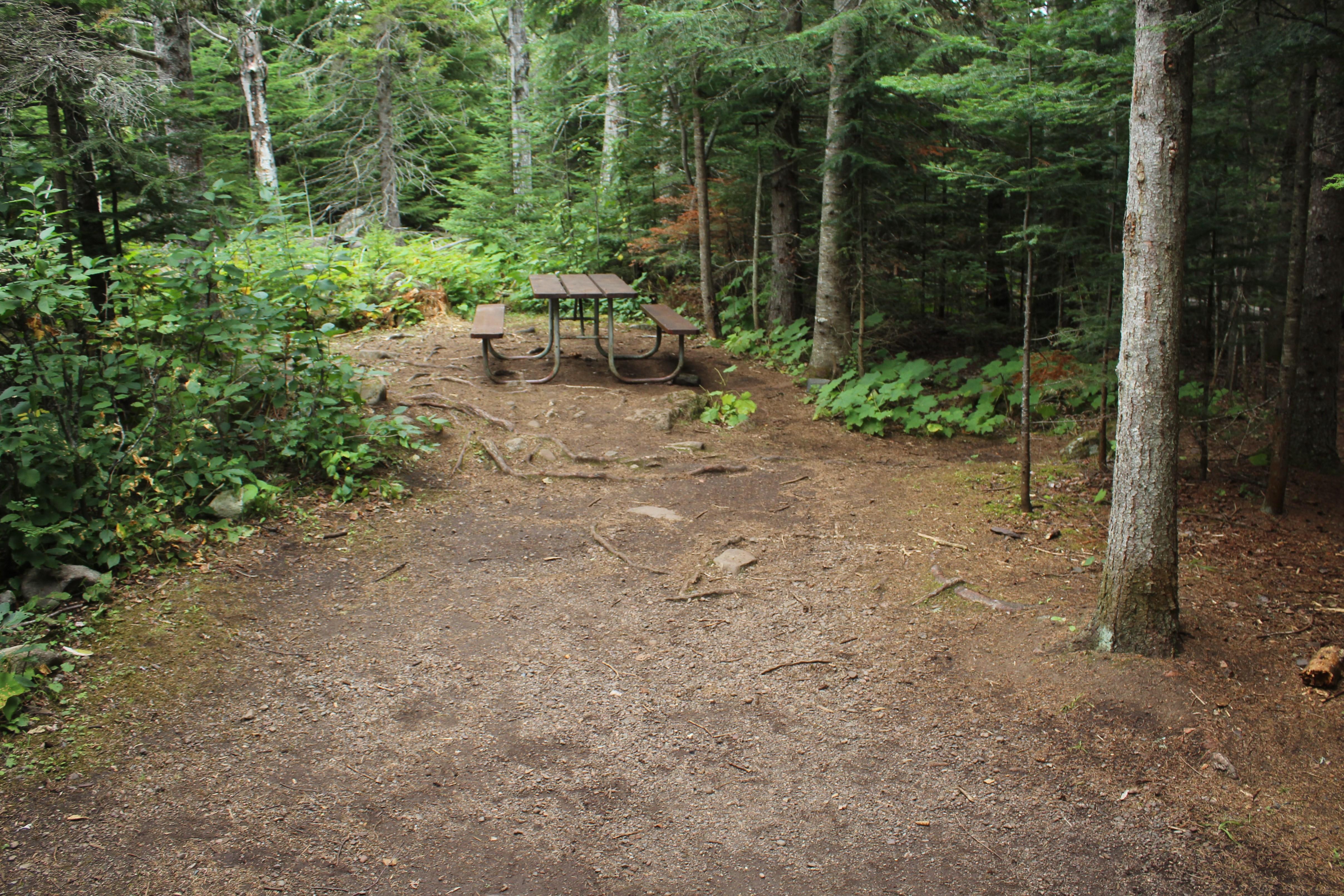
Daisy Farm is located in the Rock Harbor Channel, off of the Rock Harbor Trail, Daisy Farm Trail, and Mount Ojibway Trail. Daisy Farm is Isle Royale’s largest campground with sixteen shelters, six individual tent sites, and three group sites. The stay limit is three nights from June 1 – Labor Day annually. Boats are permitted to stay overnight at the dock. Under normal conditions the depth at the dock is 9’. Canoe/kayak/private boat access. Ranger Station staffed seasonally.
Location, hours, and facility details confirmed against the National Park Service registry.
National Park Service registryChecked 2026-08-04
Can you reserve a campsite at Daisy Farm Campground?
Both. Daisy Farm Campground in Isle Royale National Park has 3 sites that can be reserved in advance and 22 that are first-come, first-served.
How many campsites does Daisy Farm Campground have?
Daisy Farm Campground in Isle Royale National Park has 25 campsites.
What is the maximum RV length at Daisy Farm Campground?
Daisy Farm Campground does not take RVs.
How much does it cost to camp at Daisy Farm Campground?
Daisy Farm Campground in Isle Royale National Park charges between Free and $25 per night, depending on the site type.
Are there showers at Daisy Farm Campground?
No. Daisy Farm Campground in Isle Royale National Park does not list showers.
Is there drinking water at Daisy Farm Campground?
Yes. Daisy Farm Campground in Isle Royale National Park lists drinking water: Water · but not potable.
Is there cell service at Daisy Farm Campground?
No. Daisy Farm Campground in Isle Royale National Park does not list cell reception.
Is there a dump station at Daisy Farm Campground?
No. Daisy Farm Campground in Isle Royale National Park does not list dump station.
Is Daisy Farm Campground wheelchair accessible?
Daisy Farm Campground in Isle Royale National Park: No wheelchair access.
- Beaver Island Campground3 sites
- Belle Isle Campground7 sites
- Birch Island Campground2 sites
- Caribou Island Campground3 sites
- Chippewa Harbor Campground7 sites
- Duncan Bay Campground3 sites
- Duncan Narrows Campground3 sites
- East Chickenbone Campground4 sites
- Feldtmann Lake Campground7 sites
- Grace Island Campground2 sites
- Hatchet Lake Campground8 sites
- Hay Bay Campground1 sites
- Huginnin Cove Campground5 sites
- Intermediate Lake Campground3 sites
- Island Mine Campground6 sites
- Lake Richie Campground6 sites
- Lake Richie Canoe Campground3 sites
- Lake Whittlesey Campground3 sites
- Lane Cove Campground5 sites
- Little Todd Campground4 sites
- Malone Bay Campground7 sites
- McCargoe Cove Campground12 sites
- Merritt Lane Campground2 sites
- Moskey Basin Campground10 sites
- North Desor Campground3 sites
- Pickerel Cove Campground1 sites
- Rock Harbor Campground23 sites
- Siskiwit Bay Campground9 sites
- South Lake Desor Campground10 sites
- Three Mile Campground15 sites
- Todd Harbor Campground9 sites
- Tookers Island Campground2 sites
- Washington Creek Campground19 sites
- West Chickenbone Campground9 sites
- Wood Lake Campground3 sites
Drive to Daisy Farm Campground
Byway plans the scenic way in — real places, real weather, every stop verified. Zero hallucinations. Google Maps for turns. Byway for soul.