Juniper Basin
32.1828, -110.6445 · Park boundary: National Park Service
Make Juniper Basin part of the drive.
Byway plans around your taste, verified places, real weather and opening hours — then opens every leg in Google Maps with one tap.
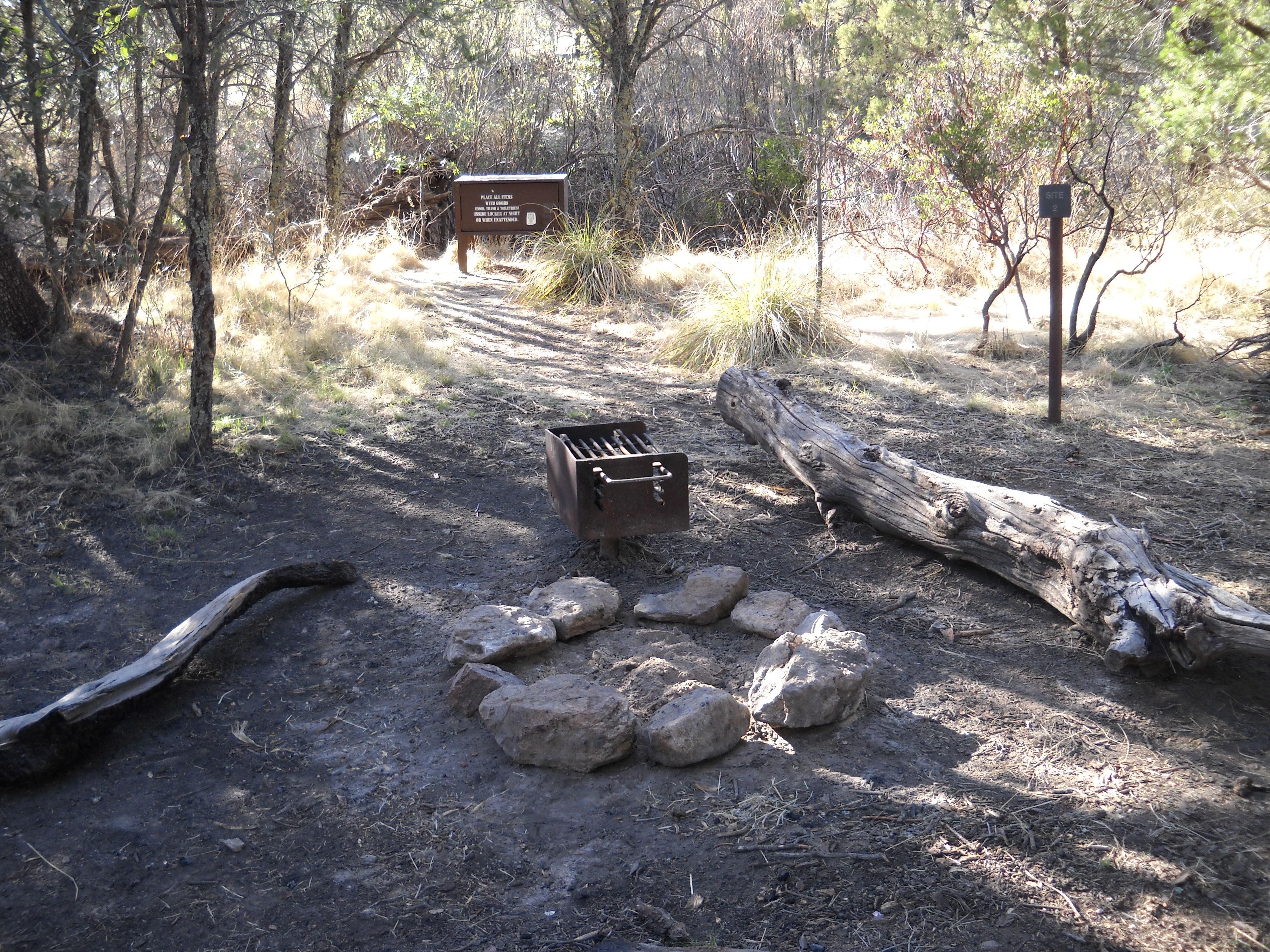
- 6,000 elevation - 3 campsites (6 people max per site) *This campground is hike in only! This campground is a tough day hike up the Tanque Verde Ridge over 6.9 miles and 3000 feet of elevation gain. Exceptional views can be seen throughout the hike, and habitats change quickly from desert scrub to oak savanna and pine / juniper woodlands. Water here is very seasonal, and it is often dry during the summer, spring and fall. When there is water, sources can be found west of site 1.
- Every day
- All Day
This campground is hike in only, and open 24/7. Reservations can be made on reservation.gov
All campsites have the same fee, $8 per campsite with a 50% discount to those with a senior or access pass ($4). Each campsite has a maximum capacity of 6 people per group, for groups larger than 6 an additional campsite must be reserved and paid for.
All campsites have the same fee, $8 per campsite with a 50% discount to those with a senior or access pass ($4). Each campsite has a maximum capacity of 6 people per group, for groups larger than 6 an additional campsite must be reserved and paid for.
All campsites have the same fee, $8 per campsite with a 50% discount to those with a senior or access pass ($4). Each campsite has a maximum capacity of 6 people per group, for groups larger than 6 an additional campsite must be reserved and paid for.
- RVs
- Not allowed
- Trailers
- Not allowed
Location, hours, and facility details confirmed against the National Park Service registry.
National Park Service registryChecked 2026-08-04
What is the maximum RV length at Juniper Basin?
Juniper Basin does not take RVs.
How much does it cost to camp at Juniper Basin?
Juniper Basin in Saguaro National Park charges between $4 and $8 per night, depending on the site type.
Drive to Juniper Basin
Byway plans the scenic way in — real places, real weather, every stop verified. Zero hallucinations. Google Maps for turns. Byway for soul.