Skip to content

Beehive Overlook

National Park Service
Looking south-east from Beehive Overlook. Terrain and imagery at true elevation.

Beehive Overlook sits at 105 feet along the Acadia Scenic Byway, facing 120 degrees toward the east. The land drops 105 feet within 600 meters of the overlook. To the east and east-northeast, the view takes in Ravens Nest at 5.4 miles, Schoodic Point and its viewpoint at 5.9 miles, and Schoodic Head, The Anvil, and Buck Cove Mountain, each between 6.4 and 6.7 miles out. The Beehive itself is a roche moutonnée, a landform shaped by glaciers that covered the area from 35,000 to 16,000 years ago; ice more than a mile thick smoothed one slope while pressure changes on the descent caused rock to be plucked away, forming a steeper face on the other side. The overlook faces toward sunrise, about 30 degrees off due east. Sunrise times here range from 04:49 at the June solstice to 07:06 at the December solstice, with equinox sunrises near 06:20-06:37. Ellsworth lies 19.0 miles to the northwest, with Brewer and Bangor farther on at roughly 43 miles. Schooner Head Overlook Parking Lot Accessibility Information precedes this stop on the byway, and Old Soaker Overlook follows.

Access
0.3 mi detour
Elevation
105 ft
View
Southeast · 120°
Light
Best at sunrise
Relief
105 ft drop
In view
7 named features
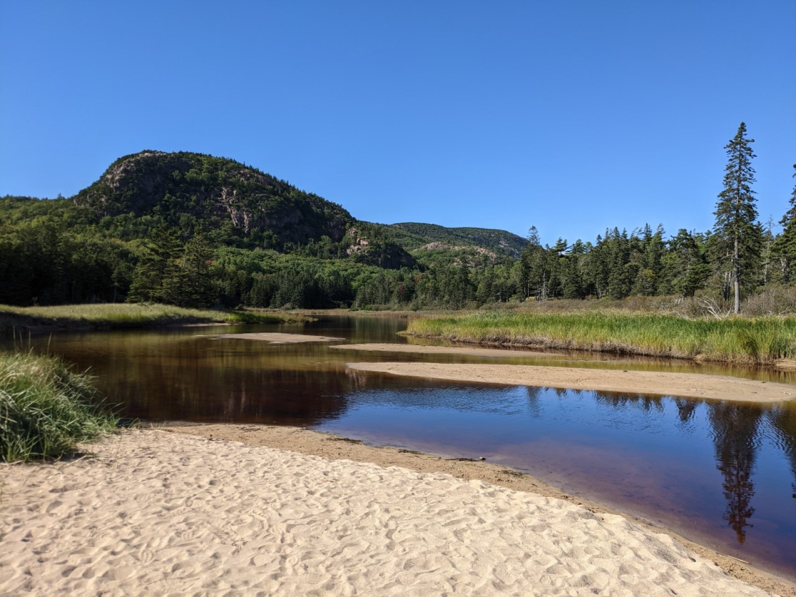
The Beehive's profile gives us hints about its glacial past.
NPS Photo / Alex Ennes · Public domain (NPS) · NPS
The Beehive, Champlain Mountain, and Sand Beach from Great Head in Acadia National Park, Maine
Fredlyfish4 · CC BY-SA 4.0 · source
Acadia National Park
Always Shooting · CC BY 2.0 · source
Sand Beach, Acadia National Park, Maine
matt.a · CC BY 3.0 · source
PLAYA EN EL ACADIA NATIONAL PARK
Manuel Velazquez · CC BY 3.0 · source
Sand Beach, Acadia National Park
Thomson M · CC BY 3.0 · source

What you’re looking at

Named terrain inside the view from this overlook, nearest first.

  • Ravens Nest77 fteast-northeast · 5.4 mi
  • Schoodic Point46 fteast · 5.9 mi
  • Viewpoint Schoodic Point62 fteast · 5.9 mi
  • Schoodic Head435 fteast-northeast · 6.4 mi
  • Overlook437 fteast-northeast · 6.4 mi
  • The Anvil183 fteast · 6.7 mi
  • Buck Cove Mountain219 fteast-northeast · 6.7 mi

Light

This overlook faces sunrise 30° off square to it.

DateSunriseSunsetGolden hour
March equinox06:3718:4518:07
June solstice04:4920:2119:37
September equinox06:2018:3217:54
December solstice07:0615:5715:09

Local time (America/New_York). Computed for this exact position.

Where it is

  • Ellsworth19.0 mi northwest
  • Brewer43.2 mi northwest
  • Bangor43.8 mi northwest
Loading map…
Private beta · Free to join

Take the scenic way to Beehive Overlook.

Byway plans around your taste, verified places, real weather and opening hours — then opens every leg in Google Maps with one tap.

Private beta · Free to join · No card · Invite when a spot opens

Beehive Overlook · National Park Service

The Beehive and many of Acadia’s other mountains are examples of a geologic feature called a “roche mountonée.” Roches mountonée always have this distinct shape: a gradual slope leading up to a steep drop-off. This shape was created by glaciers, which covered Acadia from 35,000 to 16,000 years ago. As they made their way over mountains like the Beehive, glaciers had to fight against gravity as the mountain pushed them up toward the sky. This created a lot of pressure on the surface of the mountain. Not only were the glaciers working against the force of gravity, but the glaciers here were over a mile thick! That ice adds up to a lot of weight. The pressure from the combined weight of the ice and the gravity pulling it downwards meant that the glacier smoothed the surface of the mountains it traveled over, much like sandpaper. When we look at the Beehive and see the gentle slope leading up to its summit, we are looking at the path that the glaciers created as they passed over the mountain. But if glaciers have smoothed one side to a gentle slope, why does the other side look so steep? After the glacier reached the summit, there was a large release in the pressure that we previously talked about. Now, gravity was helping to pull that heavy ice back down the mountain. As the ice moved back down the mountain, changes in pressure meant that some of the ice at the base of the glacier melted – and that water seeped into cracks of the mountain’s surface. Eventually, that water would refreeze, breaking chunks of rock loose from the mountain as it expanded into ice. The glacier continued “plucking” rocks from the surface, making a steeper slope each time. This process happened over and over again as the glacier continued sliding over the mountain; eventually, it created the famously steep path up the Beehive that Acadia visitors know today.

Read it at National Park Service

How high is Beehive Overlook?

Beehive Overlook sits at about 105 feet (32 m).

What can you see from Beehive Overlook?

From Beehive Overlook: Ravens Nest (ENE, 5.4 mi); Schoodic Point (E, 5.9 mi); Viewpoint Schoodic Point (E, 5.9 mi); Schoodic Head (ENE, 6.4 mi).

Is Beehive Overlook better at sunrise or sunset?

Sunrise. The land falls away from Beehive Overlook toward the sunrise, so at sunset the light is behind you. Exact times shift through the year; the page shows the current window.

What is the nearest town to Beehive Overlook?

Ellsworth, 19 miles NW of Beehive Overlook.

What is the next lookout after Beehive Overlook?

Old Soaker Overlook is the next surfaced lookout along the same route after Beehive Overlook.

Drive to Beehive Overlook with Byway

Byway plans the scenic way there — real places along Acadia Scenic Byway, real weather, zero hallucinations — and hands the turns to the navigation you already use.

Byways with this lookout

Day trips start here

Locals make it Verified.

Beehive Overlook — confirmed, rated, and photographed by people who actually pulled over. A local confirmation is what upgrades a lookout from Discovered to Verified. Zero hallucinations.

Confirmed by locals

No local confirmations yet. Stood here? Yours is the one that upgrades this lookout to Verified.

Ratings

No ratings yet. Stood at this lookout? Be the first to rate it.

No written reviews yet.

Field notes

No field notes yet. Know the gate hours or the best pull-in? Leave the note you wish you'd had.

Photos

No photos yet.

Sign in to confirm this lookout, rate it, add photos, and leave field notes.

More lookouts on Acadia Scenic Byway

Named places near this lookout