Skip to content

Bull Creek Valley Overlook

VerifiedOpenStreetMap + National Park Service
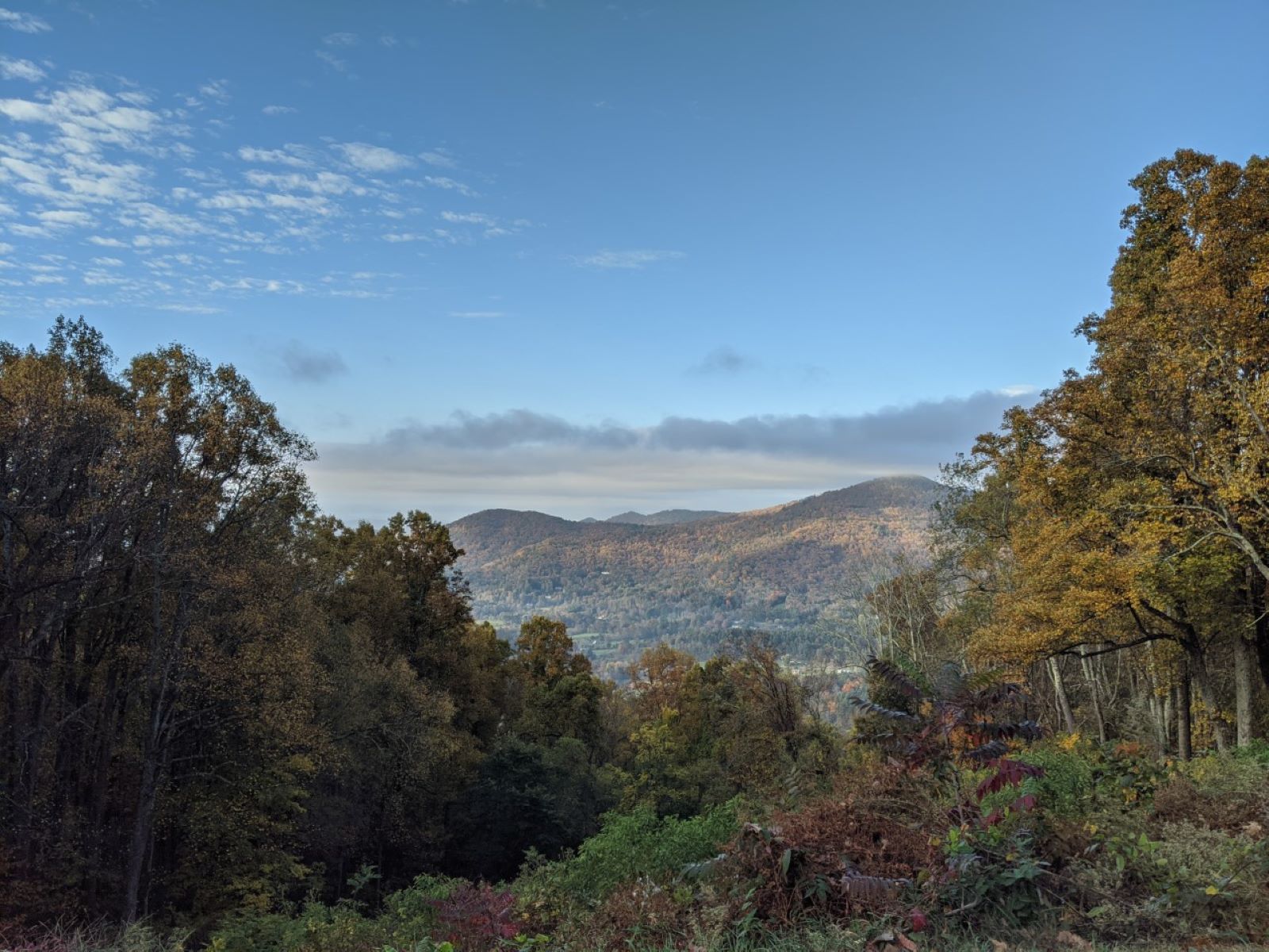
Looking south-west from Bull Creek Valley Overlook. Terrain and imagery at true elevation.

Bull Creek Valley Overlook sits at 3,483 feet on the Blue Ridge Parkway, facing 210 degrees, with the land dropping 702 feet within 600 meters of the pullout. Swan Mountain rises to the south at 0.6 miles and 3,363 feet, Tanbark Ridge Overlook lies to the west at 1.6 miles and 3,308 feet, and Peach Knob is visible west-southwest at 2.4 miles and 3,412 feet. A sign at the overlook recognizes the 1799 extirpation of the region's last bison, hunted by early settler Joseph Rice in Bull Creek Valley below. A picnic table is available for those who want to stop for a meal. Asheville is 6.8 miles to the southwest, Hendersonville is 23.3 miles to the south, and Greeneville is 40.8 miles to the north-northwest. Tanbark Ridge Overlook is the previous stop along the byway, and Lane Pinnacle Overlook is next. Daylight hours vary by season, with sunrise at 6:15 and sunset at 20:50 around the June solstice, and sunrise at 7:36 and sunset at 17:21 around the December solstice. Visitors are advised to check current conditions before arriving.

Access
On the byway
Elevation
3,483 ft
View
Southwest · 210°
Relief
702 ft drop
In view
3 named features
View from Bull Creek Valley Overlook
NPS Photo / Morgan Bissell · Public domain (NPS) · NPS
Puccinia recondita
Evan M. Raskin · CC BY 4.0 · source
Puccinia recondita
Evan M. Raskin · CC BY 4.0 · source
Puccinia recondita
Evan M. Raskin · CC BY 4.0 · source
Puccinia recondita
Evan M. Raskin · CC BY 4.0 · source
Picture of Bull Gap sign, along the Blue Ridge Parkway.
Washuotaku · CC BY-SA 4.0 · source

What you’re looking at

Named terrain inside the view from this overlook, nearest first.

  • Swan Mountain3,363 ftsouth · 0.6 mi
  • Tanbark Ridge Overlook (MP 376.7)3,308 ftwest · 1.6 mi
  • Peach Knob3,412 ftwest-southwest · 2.4 mi

Light

DateSunriseSunsetGolden hour
March equinox07:3419:4219:08
June solstice06:1520:5020:12
September equinox07:1819:2818:55
December solstice07:3617:2116:41

Local time (America/New_York). Computed for this exact position.

Where it is

  • Asheville6.8 mi southwest
  • Hendersonville23.3 mi south
  • Greeneville40.8 mi north-northwest
Loading map…
Private beta · Free to join

Take the scenic way to Bull Creek Valley Overlook.

Byway plans around your taste, verified places, real weather and opening hours — then opens every leg in Google Maps with one tap.

Private beta · Free to join · No card · Invite when a spot opens

Bull Creek Valley Overlook · National Park Service

Located 10 miles north of Asheville on the way to Craggy Gardens, Bull Creek Valley Overlook is one of close to 300 overlooks found along the Blue Ridge Parkway. Located at 3,483 feet above sea level, it offers a scenic view into Bull Creek Valley. It was in this valley in 1799 that Joseph Rice, an early settler of the region, hunted the last remaining bison in the region. A sign at the overlook recognizes this extirpation of the native species. This overlook also hosts a picnic table if you would like to enjoy a meal with a view. Check the conditions of the area before you visit.

Read it at National Park Service

How high is Bull Creek Valley Overlook?

Bull Creek Valley Overlook sits at about 3,483 feet (1,062 m).

What can you see from Bull Creek Valley Overlook?

From Bull Creek Valley Overlook: Swan Mountain (S, 0.6 mi); Tanbark Ridge Overlook (MP 376.7) (W, 1.6 mi); Peach Knob (WSW, 2.4 mi).

What is the nearest town to Bull Creek Valley Overlook?

Asheville, 6.8 miles SW of Bull Creek Valley Overlook.

What is the next lookout after Bull Creek Valley Overlook?

Lane Pinnacle Overlook is the next surfaced lookout along the same route after Bull Creek Valley Overlook.

Drive to Bull Creek Valley Overlook with Byway

Byway plans the scenic way there — real places along Blue Ridge Parkway, real weather, zero hallucinations — and hands the turns to the navigation you already use.

Byways with this lookout

Day trips start here

Locals make it Verified.

Bull Creek Valley Overlook — confirmed, rated, and photographed by people who actually pulled over. A local confirmation is what upgrades a lookout from Discovered to Verified. Zero hallucinations.

Confirmed by locals

No local confirmations yet. Stood here? Yours is the one that upgrades this lookout to Verified.

Ratings

No ratings yet. Stood at this lookout? Be the first to rate it.

No written reviews yet.

Field notes

No field notes yet. Know the gate hours or the best pull-in? Leave the note you wish you'd had.

Photos

No photos yet.

Sign in to confirm this lookout, rate it, add photos, and leave field notes.

More lookouts on Blue Ridge Parkway

Named places near this lookout