Skip to content

Haw Creek Valley

VerifiedOpenStreetMap + National Park Service
Looking south-west from Haw Creek Valley. Terrain and imagery at true elevation.

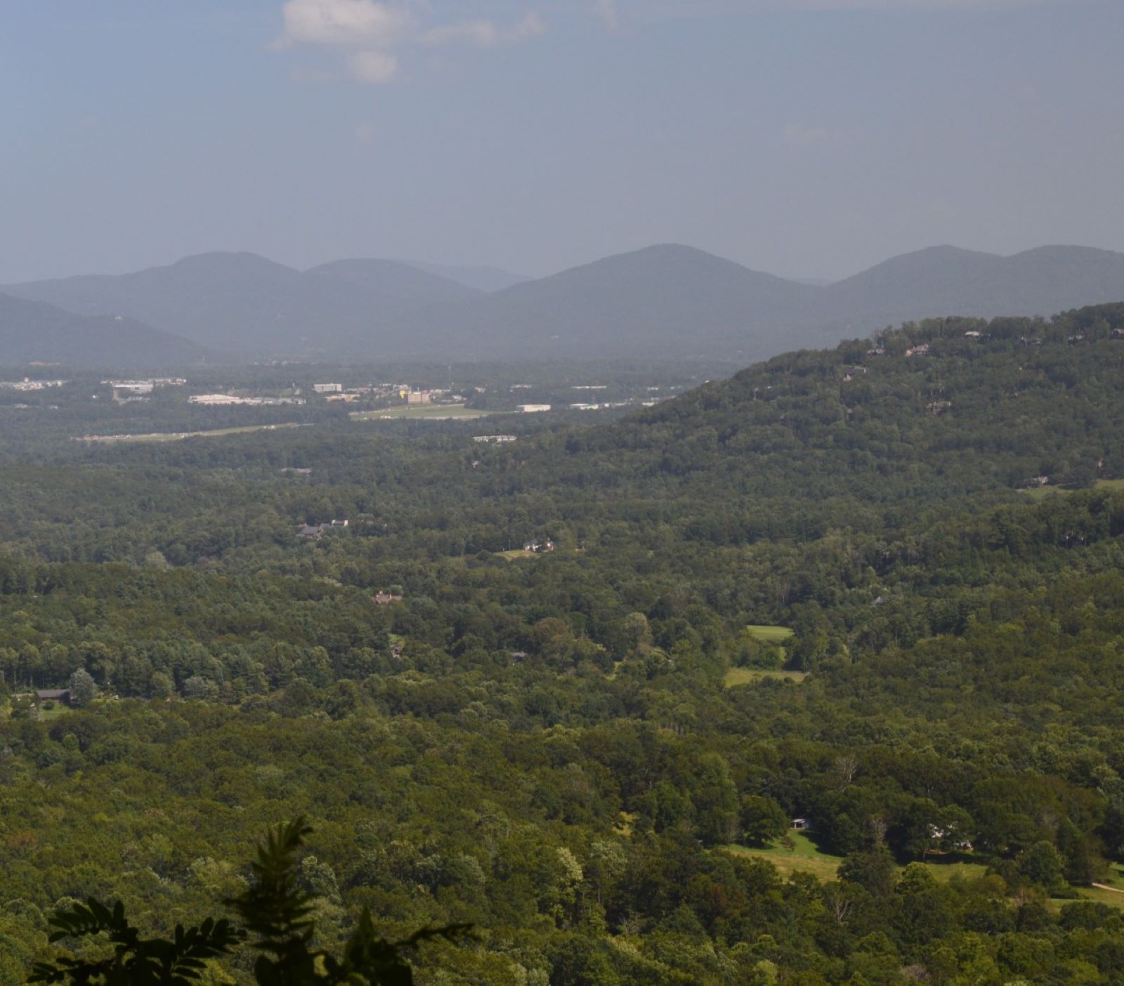
Haw Creek Valley overlook sits at 2,720 feet on the Blue Ridge Parkway, facing 240 degrees, a direction that looks toward sunset. The land drops 447 feet within 600 meters of the overlook, giving depth to the view across Haw Creek Valley. Masters Park lies southwest at 0.5 mile and 2,346 feet, Cisco Mountain rises west-southwest at 1.5 miles to 3,097 feet, and Haw Creek Park is visible south-southwest at 2.0 miles, elevation 2,166 feet. Asheville is 3.6 miles west-southwest, with Hendersonville 20.7 miles south and Waynesville 29.3 miles west-southwest. Sunset falls at 19:42 near the March equinox, 20:50 at the June solstice, 19:28 at the September equinox, and 17:21 at the December solstice. French Broad River Overlook precedes this stop on the byway, with Tanbark Ridge Overlook next.

Access
On the byway
Elevation
2,720 ft
View
Southwest · 240°
Light
Best at sunset
Relief
447 ft drop
In view
3 named features
View from Haw Creek Valley Overlook
NPS Photo / Laura White · Public domain (NPS) · NPS
North Carolina Highway 694 is a connector route between downtown Asheville and the Blue Ridge Parkway.
Mark Clifton · CC BY-SA 3.0 · source
View of Earth taken during ISS Expedition 48.
Earth Science and Remote Sensing Unit , Lyndon B. Johnson Space Center · Public domain · source
This is an image of a place or building that is listed on the National Register of Historic Places in the United States of America . Its reference number is 86002881 ( Wikidata ).
Karen Hoffman · CC BY-SA 3.0 · source
This is an image of a place or building that is listed on the National Register of Historic Places in the United States of America . Its reference number is 86002881 ( Wikidata ).
Karen Hoffman · CC BY-SA 3.0 · source
This is an image of a place or building that is listed on the National Register of Historic Places in the United States of America . Its reference number is 86002881 ( Wikidata ).
Karen Hoffman · CC BY-SA 3.0 · source

What you’re looking at

Named terrain inside the view from this overlook, nearest first.

  • Masters Park2,346 ftsouthwest · 0.5 mi
  • Cisco Mountain3,097 ftwest-southwest · 1.5 mi
  • Haw Creek Park2,166 ftsouth-southwest · 2.0 mi

Light

This overlook faces sunset 30° off square to it.

DateSunriseSunsetGolden hour
March equinox07:3519:4219:08
June solstice06:1520:5020:12
September equinox07:1919:2818:55
December solstice07:3717:2116:42

Local time (America/New_York). Computed for this exact position.

Where it is

  • Asheville3.6 mi west-southwest
  • Hendersonville20.7 mi south
  • Waynesville29.3 mi west-southwest
Loading map…
Private beta · Free to join

Take the scenic way to Haw Creek Valley.

Byway plans around your taste, verified places, real weather and opening hours — then opens every leg in Google Maps with one tap.

Private beta · Free to join · No card · Invite when a spot opens

Haw Creek Valley Overlook · National Park Service

This overlook is a short drive north from Asheville, but feels miles away. The valley view is of the Haw Creek Valley community and major Asheville buildings. There is a wide span of mountains across this overlook’s viewscape. The major visible peaks are Ducker Mountain, Chestnut Top, Ball Mountain, Double Head, Little Bald Mountain, Mount Pisgah, Scott Mountain, and Piney Mountain.  

The vegetation has been cut at the overlook, making for good visibility. This overlook trimming practice is good wildlife management for birds and a variety of mammals. It provides habitat variety from shrubs and small trees to the large, mature trees seen at the tree line. Common birds like blue jay, northern cardinal, Carolina chickadee, tufted titmouse, American crow, eastern towhee, American robin, mourning dove, brown thrasher, Carolina wren, red-tailed hawk, red-shouldered hawk, turkey vulture, chimney swift, and swallows will be seen and heard in the trees and skies at this overlook. Black bears, white-tailed deer, Virginia opossum, raccoon, southern flying squirrel, and gray squirrel will use this area as well. Check the conditions of the area before you visit.

Read it at National Park Service

How high is Haw Creek Valley?

Haw Creek Valley sits at about 2,720 feet (829 m).

What can you see from Haw Creek Valley?

From Haw Creek Valley: Masters Park (SW, 0.5 mi); Cisco Mountain (WSW, 1.5 mi); Haw Creek Park (SSW, 2.0 mi).

Is Haw Creek Valley better at sunrise or sunset?

Sunset. The land falls away from Haw Creek Valley toward the sunset, so at sunrise the light is behind you. Exact times shift through the year; the page shows the current window.

What is the nearest town to Haw Creek Valley?

Asheville, 3.6 miles WSW of Haw Creek Valley.

What is the next lookout after Haw Creek Valley?

Tanbark Ridge Overlook is the next surfaced lookout along the same route after Haw Creek Valley.

Drive to Haw Creek Valley with Byway

Byway plans the scenic way there — real places along Blue Ridge Parkway, real weather, zero hallucinations — and hands the turns to the navigation you already use.

Byways with this lookout

Day trips start here

Locals make it Verified.

Haw Creek Valley — confirmed, rated, and photographed by people who actually pulled over. A local confirmation is what upgrades a lookout from Discovered to Verified. Zero hallucinations.

Confirmed by locals

No local confirmations yet. Stood here? Yours is the one that upgrades this lookout to Verified.

Ratings

No ratings yet. Stood at this lookout? Be the first to rate it.

No written reviews yet.

Field notes

No field notes yet. Know the gate hours or the best pull-in? Leave the note you wish you'd had.

Photos

No photos yet.

Sign in to confirm this lookout, rate it, add photos, and leave field notes.

More lookouts on Blue Ridge Parkway

Named places near this lookout