Skip to content

Doyel Valley Overlook

National Park Service
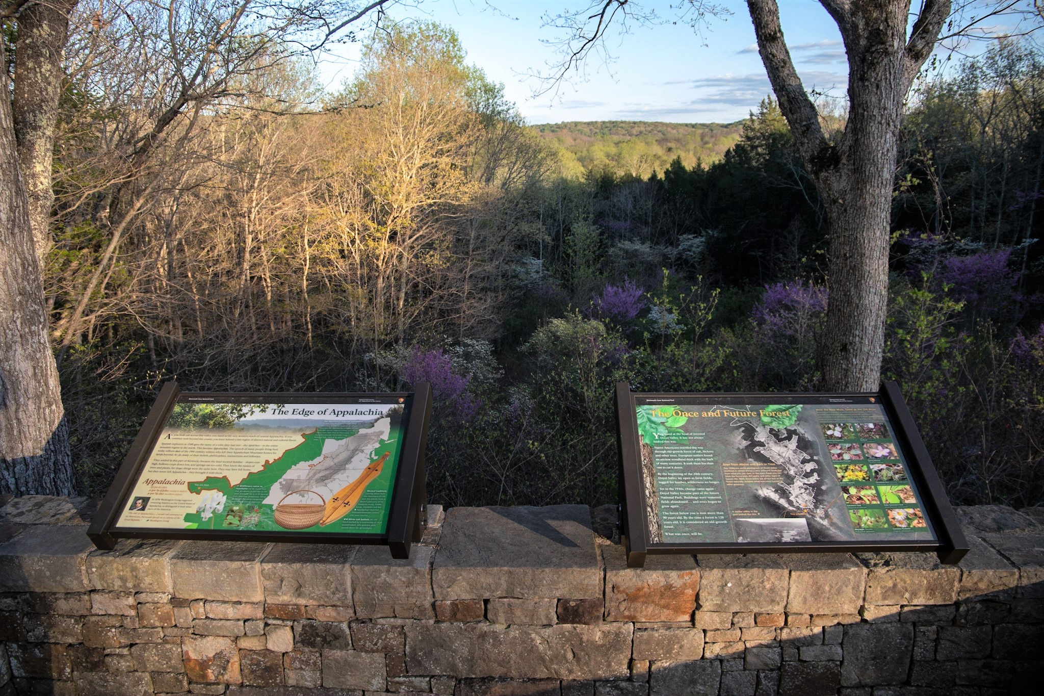
Looking west from Doyel Valley Overlook. Terrain and imagery at true elevation.

Doyel Valley Overlook sits at 721 feet along Duncan Hines Scenic Road, facing west (270°), directly toward the setting sun. The terrain drops 83 feet within 600 meters of the pull-off, opening a view across rolling hills and valleys. Crumps Knob, at 837 feet, is visible to the west-northwest at a distance of 6.8 miles. Because the overlook faces due west, sunsets are visible straight ahead across the seasons, from 20:09 at the June solstice to 16:31 at the December solstice. The area is named for the Doyel family, who lived here before the creation of Mammoth Cave National Park in 1941; the family also owned nearby Sand Cave, site of the January 1925 Tragedy at Sand Cave. Glasgow lies 15.3 miles to the southeast, Bowling Green 22.6 miles to the southwest, and Elizabethtown 38.8 miles to the north-northeast. This overlook is a pull-off along the main entrance road to the visitor center, positioned between the Sunset Point lookout and Furlong Cemetery on the byway.

Access
On the byway
Elevation
721 ft
View
West · 270°
Light
Best at sunset
Relief
83 ft drop
In view
1 named features
Learn about the historic communities of Mammoth Cave at the Doyel Valley Overlook.
NPS Photo/ Kait Evensen · Public domain (NPS) · NPS
Green River Ferry Road
LittleT889 · CC BY-SA 4.0 · source
Muddy flashbulbs from film cameras shaped like squares, long rectangles, and bulbs are laid out on a piece of white plastic. Flash bulbs of all shapes and sizes were recovered from the bottom of Crystal Lake. The flash bulbs were likely dropped from the tour route as cave visitors tried to capture t
NPS Photo · Public domain · source
A pair of black cat eye shaped eyeglasses covered in mud. Some unlucky visitor lost a pair of cat eye prescription glasses into the depths of Crystal Lake. Keywords: Crystal Lake; Mammoth Cave; Cave Clean Up; Habitat Restoration; Resource Management and Science; Volunteer
NPS Photo · Public domain · source
A mud covered blue green box that reads Edgeworth Extra High Grade Ready-Rubbed Tobacco. An Edgeworth Extra High Grade Ready-Rubbed Tobacco Tin from the bottom of Crystal Lake. Keywords: Crystal Lake; Mammoth Cave; Cave Clean Up; Habitat Restoration; Resource Management and Science; Volunteer
NPS Photo · Public domain · source
A pile of several hundred mall green and white tinted coins sit on a wire mesh screen. Hundreds of coins were collected from Crystal Lake during a cleanup project. Keywords: Crystal Lake; Mammoth Cave; Cave Clean Up; Habitat Restoration; Resource Management and Science; Volunteer
NPS Photo · Public domain · source

What you’re looking at

Named terrain inside the view from this overlook, nearest first.

  • Crumps Knob837 ftwest-northwest · 6.8 mi

Light

This overlook faces sunset 0° off square to it.

DateSunriseSunsetGolden hour
March equinox06:4918:5618:22
June solstice05:2520:0919:30
September equinox06:3318:4318:09
December solstice06:5516:3115:51

Local time (America/Chicago). Computed for this exact position.

Where it is

  • Glasgow15.3 mi southeast
  • Bowling Green22.6 mi west-southwest
  • Elizabethtown38.8 mi north-northeast
Loading map…
Private beta · Free to join

Take the scenic way to Doyel Valley Overlook.

Byway plans around your taste, verified places, real weather and opening hours — then opens every leg in Google Maps with one tap.

Private beta · Free to join · No card · Invite when a spot opens

Doyel Valley Overlook · National Park Service

The Doyel Valley Overlook is a pull-off area along the most commonly used entrance road leading to the visitor center. This scenic overlook provides a rare view of the park landscape's rolling hills and valleys. The namesake of the area, the Doyel family, called this area home prior to the creation of Mammoth Cave National Park in 1941. The Doyels would have also owned nearby Sand Cave, where, in January 1925, a local caver became stuck, an event known at the Tragedy at Sand Cave. Learn more about the historic communities and the history of appalachian homesteading and culture, the wildflowers and forest ecosystem within the park, or just get a different view of the park at this overlook.

Read it at National Park Service

How high is Doyel Valley Overlook?

Doyel Valley Overlook sits at about 721 feet (220 m).

What can you see from Doyel Valley Overlook?

From Doyel Valley Overlook: Crumps Knob (WNW, 6.8 mi).

Is Doyel Valley Overlook better at sunrise or sunset?

Sunset. The land falls away from Doyel Valley Overlook toward the sunset, so at sunrise the light is behind you. Exact times shift through the year; the page shows the current window.

What is the nearest town to Doyel Valley Overlook?

Glasgow, 15 miles SE of Doyel Valley Overlook.

What is the next lookout after Doyel Valley Overlook?

Furlong Cemetery is the next surfaced lookout along the same route after Doyel Valley Overlook.

Drive to Doyel Valley Overlook with Byway

Byway plans the scenic way there — real places along Duncan Hines Scenic Road, real weather, zero hallucinations — and hands the turns to the navigation you already use.

Byways with this lookout

Day trips start here

Locals make it Verified.

Doyel Valley Overlook — confirmed, rated, and photographed by people who actually pulled over. A local confirmation is what upgrades a lookout from Discovered to Verified. Zero hallucinations.

Confirmed by locals

No local confirmations yet. Stood here? Yours is the one that upgrades this lookout to Verified.

Ratings

No ratings yet. Stood at this lookout? Be the first to rate it.

No written reviews yet.

Field notes

No field notes yet. Know the gate hours or the best pull-in? Leave the note you wish you'd had.

Photos

No photos yet.

Sign in to confirm this lookout, rate it, add photos, and leave field notes.

More lookouts on Duncan Hines Scenic Road

Named places near this lookout