Skip to content

Sunset Point

OpenStreetMap
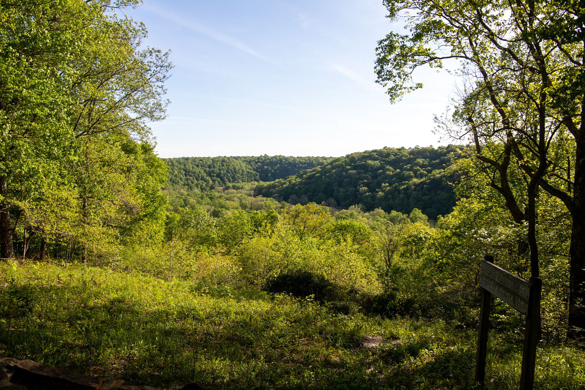
Looking south-west from Sunset Point. Terrain and imagery at true elevation.

Sunset Point sits at 697 ft along the Duncan Hines Scenic Road, facing 210 degrees, with the land dropping 242 ft within 600 m of the overlook. The view takes in the setting sun over the forested hills of the park, along with the deep river valley of the Green River, which cuts the park into two parts. The overlook is about halfway along the Heritage Trail, a wheelchair-accessible half-mile hiking trail near the visitor center; additional information panels are located along the trail, as well as the Old Guide's Cemetery.

Glasgow is 17.0 miles to the southeast, Bowling Green is 22.9 miles to the southwest, and Elizabethtown is 37.6 miles north-northeast. Sunrise and sunset times vary by season: on the March equinox, sunrise is at 06:49 and sunset at 18:57; on the June solstice, sunrise is at 05:25 and sunset at 20:09; on the September equinox, sunrise is at 06:33 and sunset at 18:43; and on the December solstice, sunrise is at 06:55 and sunset at 16:31. Dixon Cave precedes this stop, and Doyel Valley Overlook follows it along the route.

Access
0.6 mi detour
Elevation
697 ft
View
Southwest · 210°
Relief
242 ft drop
The rolling hills are a product of the Green River and its drainage basin.
NPS Photo/ Kait Evensen · Public domain (NPS) · NPS
The largest known cave system in the world, the Mammoth-Flint Ridge Cave System, as of 2022, has 426 miles of documented passages, and sits beneath the ground in Mammoth Cave National Park, established in 1941, and was listed as a UNESCO World Heritage Site in 1981, the only designation in the state
w_lemay · CC BY-SA 2.0 · source
The largest known cave system in the world, the Mammoth-Flint Ridge Cave System, as of 2022, has 426 miles of documented passages, and sits beneath the ground in Mammoth Cave National Park, established in 1941, and was listed as a UNESCO World Heritage Site in 1981, the only designation in the state
w_lemay · CC BY-SA 2.0 · source
The largest known cave system in the world, the Mammoth-Flint Ridge Cave System, as of 2022, has 426 miles of documented passages, and sits beneath the ground in Mammoth Cave National Park, established in 1941, and was listed as a UNESCO World Heritage Site in 1981, the only designation in the state
w_lemay · CC BY-SA 2.0 · source
The largest known cave system in the world, the Mammoth-Flint Ridge Cave System, as of 2022, has 426 miles of documented passages, and sits beneath the ground in Mammoth Cave National Park, established in 1941, and was listed as a UNESCO World Heritage Site in 1981, the only designation in the state
w_lemay · CC BY-SA 2.0 · source
The largest known cave system in the world, the Mammoth-Flint Ridge Cave System, as of 2022, has 426 miles of documented passages, and sits beneath the ground in Mammoth Cave National Park, established in 1941, and was listed as a UNESCO World Heritage Site in 1981, the only designation in the state
w_lemay · CC BY-SA 2.0 · source

Light

DateSunriseSunsetGolden hour
March equinox06:4918:5718:22
June solstice05:2520:0919:30
September equinox06:3318:4318:09
December solstice06:5516:3115:51

Local time (America/Chicago). Computed for this exact position.

Where it is

  • Glasgow17.0 mi southeast
  • Bowling Green22.9 mi southwest
  • Elizabethtown37.6 mi north-northeast
Loading map…
Private beta · Free to join

Take the scenic way to Sunset Point.

Byway plans around your taste, verified places, real weather and opening hours — then opens every leg in Google Maps with one tap.

Private beta · Free to join · No card · Invite when a spot opens

Sunset Point · National Park Service

As you may have guessed, this overlook is ideal for taking in the setting sun over the forested hills of the park. This scenic view also showcases the deep river valley of the Green River that cuts the park into two parts. Sunset Point is about half-way along the Heritage Trail, a wheelchair accessible .5 mile hiking trail near the visitor center. More information panels can be found along the Heritage Trail, as well as the Old Guide's Cemetery.

Read it at National Park Service

How high is Sunset Point?

Sunset Point sits at about 697 feet (212 m).

What is the nearest town to Sunset Point?

Glasgow, 17 miles SE of Sunset Point.

What is the next lookout after Sunset Point?

Doyel Valley Overlook is the next surfaced lookout along the same route after Sunset Point.

Drive to Sunset Point with Byway

Byway plans the scenic way there — real places along Duncan Hines Scenic Road, real weather, zero hallucinations — and hands the turns to the navigation you already use.

Byways with this lookout

Day trips start here

Locals make it Verified.

Sunset Point — confirmed, rated, and photographed by people who actually pulled over. A local confirmation is what upgrades a lookout from Discovered to Verified. Zero hallucinations.

Confirmed by locals

No local confirmations yet. Stood here? Yours is the one that upgrades this lookout to Verified.

Ratings

No ratings yet. Stood at this lookout? Be the first to rate it.

No written reviews yet.

Field notes

No field notes yet. Know the gate hours or the best pull-in? Leave the note you wish you'd had.

Photos

No photos yet.

Sign in to confirm this lookout, rate it, add photos, and leave field notes.

More lookouts on Duncan Hines Scenic Road

Named places near this lookout