Skip to content

Farview Curve Overlook

VerifiedOpenStreetMap + National Park Service
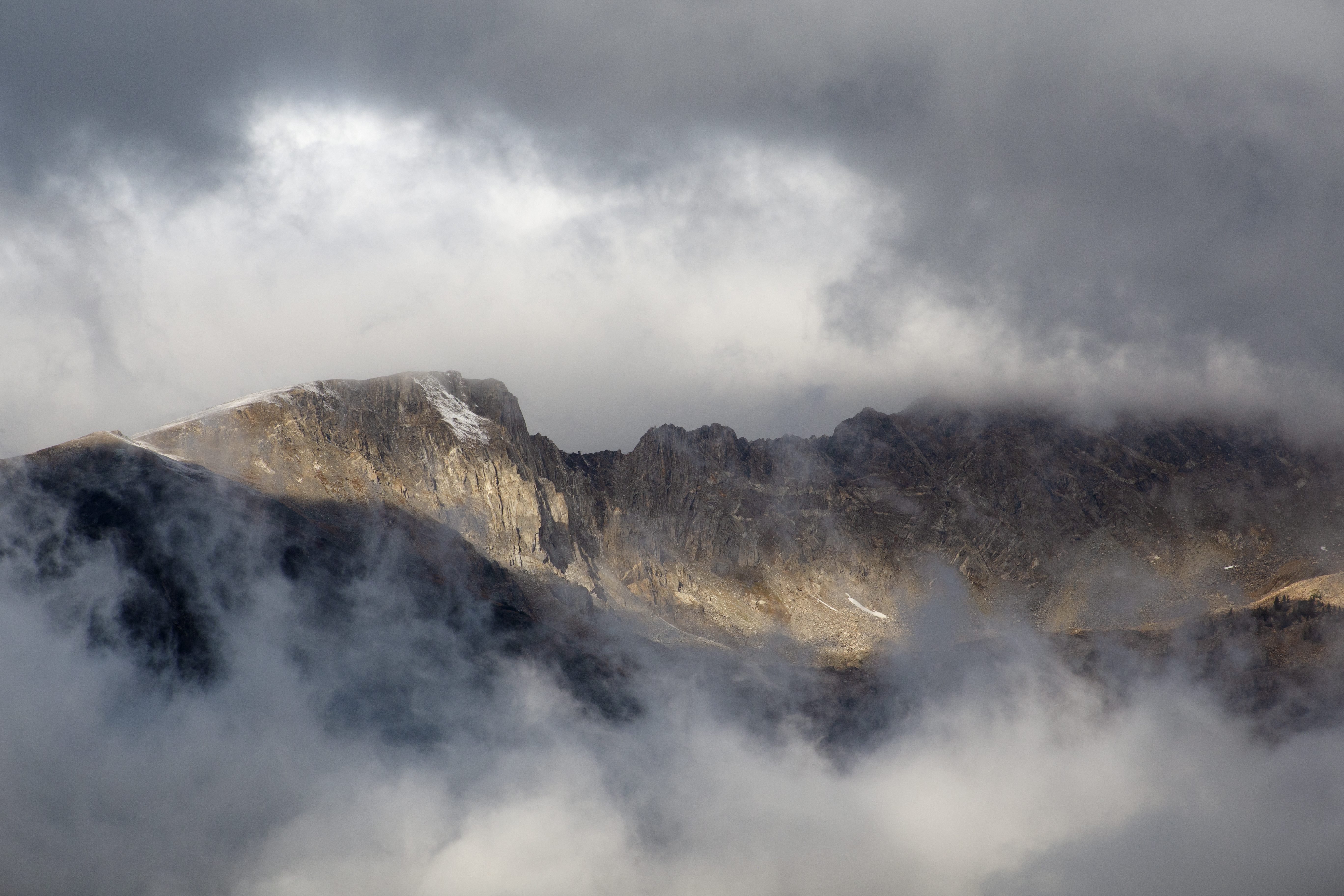
Looking south-west from Farview Curve Overlook. Terrain and imagery at true elevation.

Farview Curve Overlook sits at 10,104 feet on Trail Ridge Road/Beaver Meadow Road, facing 240 degrees toward a terrain drop of 910 feet within 600 meters. Beaver Creek lies southwest at 1.1 miles, 9,005 feet in elevation. Beyond it, a line of peaks fills the western horizon: Green Knoll to the west-southwest, Mount Cumulus and Howard Mountain to the west-northwest, Mount Nimbus and Mount Stratus to the west, Mineral Point to the southwest, and Bowen Mountain further west-southwest at 5.8 miles. Elevations among these peaks range from 11,486 feet at Mineral Point to 12,797 feet at Howard Mountain. The facing direction points roughly toward sunset, about 30 degrees off square, with sunset times ranging from 16:41 at the December solstice to 20:38 at the June solstice. Estes Park is 16.5 miles east; Boulder and Louisville lie farther southeast. The road closes from this point west to the Colorado River Trailhead from mid-October to Memorial Day, and conditions can change quickly with weather. Visitors should be aware that the elevation here can contribute to altitude sickness, with symptoms including headache, nausea, and fatigue; slowing down and staying hydrated are advised.

Access
On the byway
Elevation
10,104 ft
View
Southwest · 240°
Light
Best at sunset
Relief
910 ft drop
In view
8 named features
View from Farview Curve
NPS Photo / Kim Grossman · Public domain (NPS) · NPS
Kawuneeche Valley, Rocky Mountains, Colorado River, USA
Dariusz Kowalczyk · CC BY-SA 3.0 · source
Panorama shot from the road throguh Rocky Mountain National Park- it goes above treeline, above 12,000 ft elevation
cogdogblog · CC BY 2.0 · source
That is the name of this range of peaks in the Rocky Mountains, can you spot the volcanic land form?
cogdogblog · CC BY 2.0 · source
Rocky Mountain National Park
cogdogblog · CC BY 2.0 · source
(1 in a multiple picture album) Driving up Trail Ridge Road from Grand Lake, CO, you come to Fairview Curve. And fair the view really is! Down in the valley the newly birthed Colorado River starts its trek across the Southwest towards its terminus at the Mexico/California border.
inkknife_2000 (7.5 million views +) · CC BY-SA 2.0 · source

What you’re looking at

Named terrain inside the view from this overlook, nearest first.

  • Beaver Creek9,005 ftsouthwest · 1.1 mi
  • Green Knoll12,264 ftwest-southwest · 3.4 mi
  • Mount Cumulus12,717 ftwest-northwest · 3.6 mi
  • Mount Nimbus12,636 ftwest · 3.6 mi
  • Mount Stratus12,496 ftwest · 3.7 mi
  • Howard Mountain12,797 ftwest-northwest · 3.9 mi
  • Mineral Point11,486 ftsouthwest · 4.5 mi
  • Bowen Mountain12,537 ftwest-southwest · 5.8 mi

Light

This overlook faces sunset 30° off square to it.

DateSunriseSunsetGolden hour
March equinox07:0819:1618:40
June solstice05:3420:3819:57
September equinox06:5219:0218:26
December solstice07:2416:4115:57

Local time (America/Denver). Computed for this exact position.

Where it is

  • Estes Park16.5 mi east
  • Boulder39.9 mi southeast
  • Louisville47.2 mi southeast
Loading map…
Private beta · Free to join

Take the scenic way to Farview Curve Overlook.

Byway plans around your taste, verified places, real weather and opening hours — then opens every leg in Google Maps with one tap.

Private beta · Free to join · No card · Invite when a spot opens

Farview Curve Overlook · National Park Service

Enjoy sweeping views of the Kawnueeche Valley and the Never Summer Range from this spectacular overlook.

For thousands of years, Native American communities lived seasonally in the Kawnueeche Valley. The Colorado River provided valuable resources that sustained communities through the summer months. In the late 1800’s, settlers from the United States of America began to farm the valley as homesteads.

Along the far side of the valley, visitors can view the impressive Never Summer Range. This row of mountains is the only volcanic mountain range in Rocky Mountain National Park. In the late 1800’s, prospectors looking for precious metals mined the valley below Farview Curve. The mines never produced riches, but today, the Never Summers provide another valuable resource: water. Look for a horizontal stripe running across the middle of the mountain range. Known as the Grand Ditch, this canal collects and carries water to Long Draw Reservoir. Even today, the ditch provides water to farmers and communities living east of Colorado's Front Range.

Note: Trail Ridge Road closes from here west to Colorado River Trailhead mid-October to Memorial Day. Extreme weather can change the status of Trail Ridge Road at any time—be ready to adjust your travel plans if needed, and always check the weather before you start your drive.

Altitude Warning: Altitude sickness affects many visitors every year. Symptoms include headache, nausea, fatigue, dizziness, vomiting, and even unconsciousness. Altitude can also aggravate pre-existing conditions like heart and lung disease. Take your time, drink water, eat, and rest. The only cure for altitude sickness is to go down to a lower altitude.

Help keep wildlife wild. Never approach or feed wildlife. Animals that learn people are a source of food can become aggressive or stop hunting or foraging on their own. Keep your distance - it's the law! You could be hurt or issued a fine.

Read it at National Park Service

How high is Farview Curve Overlook?

Farview Curve Overlook sits at about 10,104 feet (3,080 m).

What can you see from Farview Curve Overlook?

From Farview Curve Overlook: Beaver Creek (SW, 1.1 mi); Green Knoll (WSW, 3.4 mi); Mount Cumulus (WNW, 3.6 mi); Mount Nimbus (W, 3.6 mi).

Is Farview Curve Overlook better at sunrise or sunset?

Sunset. The land falls away from Farview Curve Overlook toward the sunset, so at sunrise the light is behind you. Exact times shift through the year; the page shows the current window.

What is the nearest town to Farview Curve Overlook?

Estes Park, 17 miles E of Farview Curve Overlook.

What is the next lookout after Farview Curve Overlook?

2 miles above sea level is the next surfaced lookout along the same route after Farview Curve Overlook.

Drive to Farview Curve Overlook with Byway

Byway plans the scenic way there — real places along Trail Ridge Road/Beaver Meadow Road, real weather, zero hallucinations — and hands the turns to the navigation you already use.

Byways with this lookout

Day trips start here

Locals make it Verified.

Farview Curve Overlook — confirmed, rated, and photographed by people who actually pulled over. A local confirmation is what upgrades a lookout from Discovered to Verified. Zero hallucinations.

Confirmed by locals

No local confirmations yet. Stood here? Yours is the one that upgrades this lookout to Verified.

Ratings

No ratings yet. Stood at this lookout? Be the first to rate it.

No written reviews yet.

Field notes

No field notes yet. Know the gate hours or the best pull-in? Leave the note you wish you'd had.

Photos

No photos yet.

Sign in to confirm this lookout, rate it, add photos, and leave field notes.

More lookouts on Trail Ridge Road/Beaver Meadow Road

Named places near this lookout