Skip to content

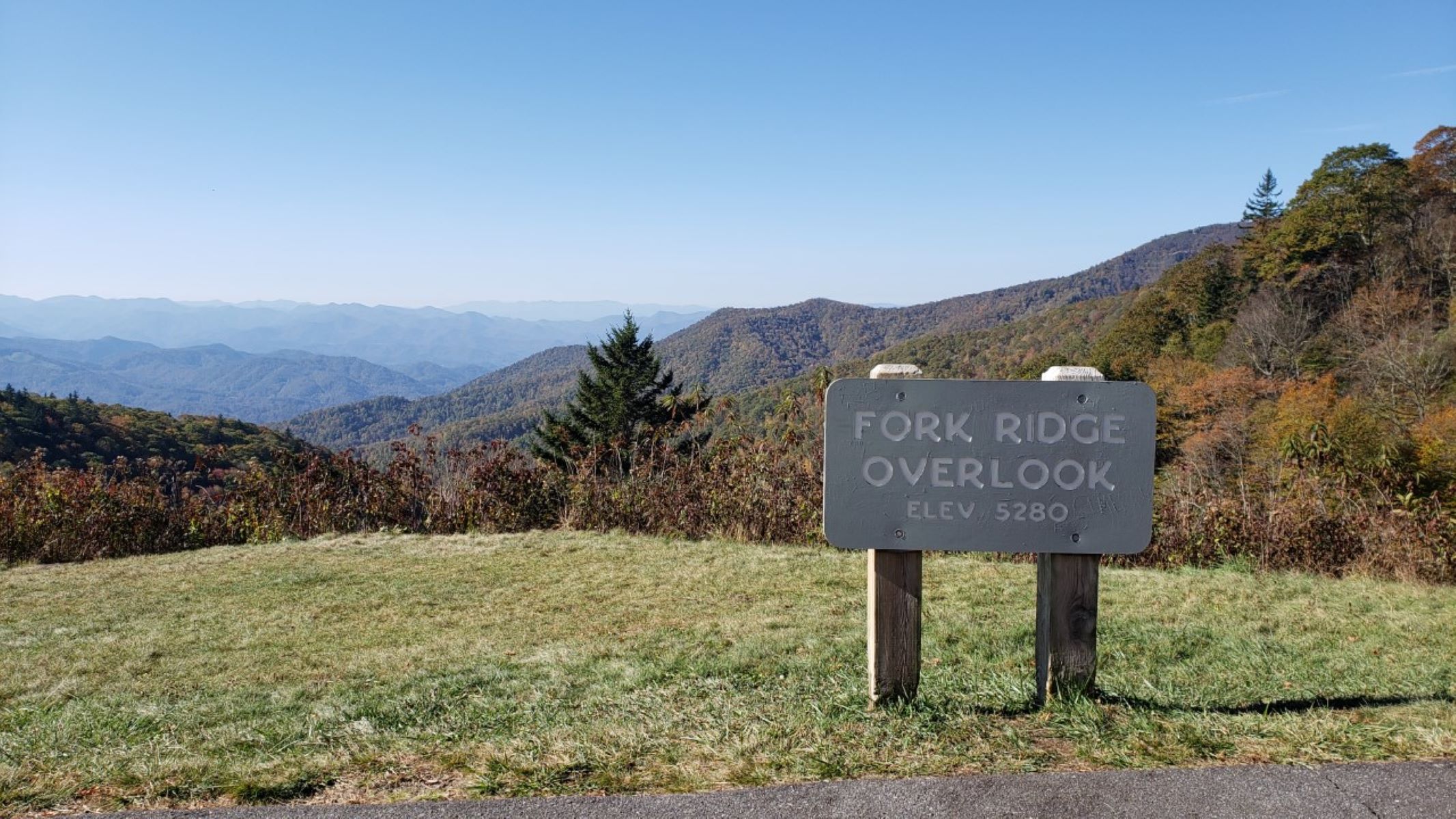
Fork Ridge Overlook

VerifiedOpenStreetMap + National Park Service
Looking south-west from Fork Ridge Overlook. Terrain and imagery at true elevation.

Fork Ridge Overlook sits at 5,280 feet on the Blue Ridge Parkway, facing 210 degrees, with the land dropping 495 feet within 600 meters of the pullout. From this point, Yellow Face is visible to the west-southwest at 2.0 miles, reaching 6,029 feet, and Joe Mountain lies south-southwest at 3.4 miles, at 3,474 feet. Asheville is 33.2 miles east-northeast, Sevierville is 37.8 miles northwest, and Hendersonville is 38.2 miles east-southeast. The Mountains-to-Sea Trail can be accessed across the Parkway from this overlook. Yellow Face Overlook is the previous stop along the route, with Scott Creek Overlook next. Adjacent land, 81 acres visible from this overlook, was purchased and protected by the Conservation Trust for North Carolina with help from private landowners and philanthropists, after the area was identified as being at risk of development due to its proximity to a housing subdivision. This protected acreage extends across the Plott Balsam Range toward Waterrock Knob. Visitors should check current conditions before traveling to this section of the Parkway.

Access
On the byway
Elevation
5,280 ft
View
Southwest · 210°
Relief
495 ft drop
In view
2 named features
View from Fork Ridge Overlook
NPS Photo / Alexa Saxton Bush · Public domain (NPS) · NPS
WaterRock Knob Smoky Mts. NP Maggie Valley
pseabolt · CC BY 3.0 · source
Waterrock Knob Blue Ridge Parkway
Pete Seabolt · CC BY 3.0 · source
Blue Ridge Parkway
hakkun · CC BY-SA 3.0 · source
500px provided description: Untitled [#HDR ,#Fall ,#Sunrise ,#Autumn ,#Landscapes ,#Mountains ,#Road ,#North Carolina ,#Haywood County ,#Blue Ridge Parkway ,#HDR Photography ,#Waynesville ,#Great Smoky Mountains ,#Curve ,#Western North Carolina ,#Aaron Morgan Photography]
Aaron Morgan · CC BY-SA 3.0 · source
500px provided description: Untitled [#HDR ,#Fall ,#Sunrise ,#Autumn ,#Landscapes ,#Mountains ,#Road ,#North Carolina ,#Haywood County ,#Blue Ridge Parkway ,#HDR Photography ,#Waynesville ,#Great Smoky Mountains ,#Curve ,#Western North Carolina ,#Aaron Morgan Photography]
Aaron Morgan · CC BY-SA 3.0 · source

What you’re looking at

Named terrain inside the view from this overlook, nearest first.

  • Yellow Face6,029 ftwest-southwest · 2.0 mi
  • Joe Mountain3,474 ftsouth-southwest · 3.4 mi

Light

DateSunriseSunsetGolden hour
March equinox07:3719:4419:11
June solstice06:1820:5220:14
September equinox07:2119:3118:57
December solstice07:3917:2416:45

Local time (America/New_York). Computed for this exact position.

Where it is

  • Asheville33.2 mi east-northeast
  • Sevierville37.8 mi northwest
  • Hendersonville38.2 mi east-southeast
Loading map…
Private beta · Free to join

Take the scenic way to Fork Ridge Overlook.

Byway plans around your taste, verified places, real weather and opening hours — then opens every leg in Google Maps with one tap.

Private beta · Free to join · No card · Invite when a spot opens

Fork Ridge Overlook · National Park Service

Perhaps you’ve wondered how the Parkway manages its scenic vistas and overlooks—or, perhaps you’ve never wondered at all, and have simply assumed that the land has always been under protection. Unfortunately, that’s not the case. While much of the southern end of the Parkway is adjacent to Pisgah and Nantahala National Forests, the National Park Service also relies on a patchwork of partnerships, private citizens, and nonprofit groups to make the views possible. With its long-range views towards the distant mountain ranges and valley below, Fork Ridge Overlook is a great example of what we can achieve when we work together. This area is close to a housing subdivision and was at risk of development. Thankfully, the Conservation Trust for North Carolina, with the help of private landowners and philanthropists, was able to purchase and protect 81 acres adjacent to the Parkway that can be seen from this overlook.  Without the purchase, “the land might have become a blight of development amid the forested views from the Parkway,” according to Executive Director Reid Wilson. Now it is part of a growing stretch of protected land that extends across the Plott Balsam Range toward Waterrock Knob. So, the next time you’re traveling along the Parkway, take a moment to appreciate the views and the people who help protect them. The Mountains-to-Sea Trail can be accessed across the Parkway from this overlook. Check the conditions of the area before you visit.

Read it at National Park Service

How high is Fork Ridge Overlook?

Fork Ridge Overlook sits at about 5,280 feet (1,609 m).

What can you see from Fork Ridge Overlook?

From Fork Ridge Overlook: Yellow Face (WSW, 2.0 mi); Joe Mountain (SSW, 3.4 mi).

What is the nearest town to Fork Ridge Overlook?

Asheville, 33 miles ENE of Fork Ridge Overlook.

What is the next lookout after Fork Ridge Overlook?

Scott Creek Overlook is the next surfaced lookout along the same route after Fork Ridge Overlook.

Drive to Fork Ridge Overlook with Byway

Byway plans the scenic way there — real places along Blue Ridge Parkway, real weather, zero hallucinations — and hands the turns to the navigation you already use.

Byways with this lookout

Locals make it Verified.

Fork Ridge Overlook — confirmed, rated, and photographed by people who actually pulled over. A local confirmation is what upgrades a lookout from Discovered to Verified. Zero hallucinations.

Confirmed by locals

No local confirmations yet. Stood here? Yours is the one that upgrades this lookout to Verified.

Ratings

No ratings yet. Stood at this lookout? Be the first to rate it.

No written reviews yet.

Field notes

No field notes yet. Know the gate hours or the best pull-in? Leave the note you wish you'd had.

Photos

No photos yet.

Sign in to confirm this lookout, rate it, add photos, and leave field notes.

More lookouts on Blue Ridge Parkway

Named places near this lookout