Skip to content

Waterrock Knob Viewpoint and Trail

National Park Service
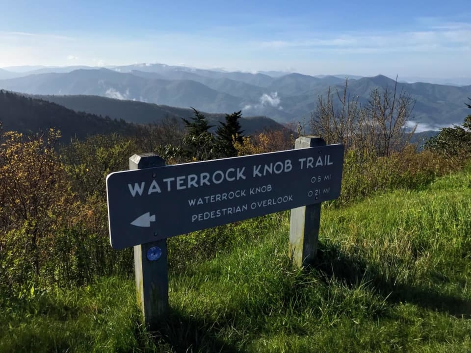
Looking south-east from Waterrock Knob Viewpoint and Trail. Terrain and imagery at true elevation.

Waterrock Knob Viewpoint sits at 5,816 feet on the Blue Ridge Parkway, facing 120 degrees toward the southeast. The terrain drops 718 feet within 600 meters of the overlook, giving an open line of sight across the surrounding ridgelines. Three named viewpoints are visible from here: Yellow Face Overlook to the east at 0.5 miles (5,734 ft), Scott Creek Overlook to the east-southeast at 1.5 miles (5,158 ft), and Wesner Bald Overlook to the southeast at 1.7 miles (4,990 ft). The facing direction is oriented toward sunrise, offset 30 degrees from due east; sunrise times across the year range from about 06:18 at the June solstice to 07:39 at the December solstice. Waynesville lies 8.8 miles to the east-northeast, Asheville is 34.4 miles east-northeast, and Sevierville is 36.9 miles to the northwest. Browning Knob Overlook precedes this stop along the byway, with Yellow Face Overlook next. The location connects to a trail system leading toward the summit area, part of the broader Waterrock Knob site along the Parkway.

Access
On the byway
Elevation
5,816 ft
View
Southeast · 120°
Light
Best at sunrise
Relief
718 ft drop
In view
3 named features
Take in the views and take a (short) hike!
Lori Marois · Public domain (NPS) · NPS
WaterRock Knob Smoky Mts. NP Maggie Valley
pseabolt · CC BY 3.0 · source
Waterrock Knob Blue Ridge Parkway
Pete Seabolt · CC BY 3.0 · source
Blue Ridge Parkway
hakkun · CC BY-SA 3.0 · source
view from trail
Dsdugan · CC0 · source
blue ridge parkway
Dsdugan · CC0 · source

What you’re looking at

Named terrain inside the view from this overlook, nearest first.

  • Yellow Face Overlook (MP 450.2)5,734 fteast · 0.5 mi
  • Scott Creek Overlook (MP 448.5)5,158 fteast-southeast · 1.5 mi
  • Wesner Bald Overlook (MP 448.1)4,990 ftsoutheast · 1.7 mi

Light

This overlook faces sunrise 30° off square to it.

DateSunriseSunsetGolden hour
March equinox07:3719:4519:11
June solstice06:1820:5220:14
September equinox07:2119:3118:57
December solstice07:3917:2416:45

Local time (America/New_York). Computed for this exact position.

Where it is

  • Waynesville8.8 mi east-northeast
  • Asheville34.4 mi east-northeast
  • Sevierville36.9 mi northwest
Loading map…
Private beta · Free to join

Take the scenic way to Waterrock Knob Viewpoint and Trail.

Byway plans around your taste, verified places, real weather and opening hours — then opens every leg in Google Maps with one tap.

Private beta · Free to join · No card · Invite when a spot opens

Waterrock Knob Viewpoint and Trail · National Park Service

Waterrock Knob is truly a hidden gem on the Blue Ridge Parkway. Located just 18 miles from the southern end of the Parkway and farther away from larger cities, it has a more remote and quiet feel to it. Perfect for escaping the crowds you sometimes find at other park locations! Waterrock Knob has the highest elevation on the Parkway. The visitor center is located at 5,820 feet and the summit itself is 6,273 feet. A large open parking area can provide fantastic long-distance views anytime, but can be particularly stunning for sunrise and sunset. Fog and clouds are common here and temperatures are much cooler than in the surrounding valleys. High elevation deciduous trees mix with the spruce/fir forest to create this mountain retreat. Night owls also enjoy Waterrock Knob’s dark skies for star gazing. A visitor center, picnic tables, seasonal restrooms and a hike to the summit make this a hard to beat destination! The trail to the summit and back is round trip a mile but the elevation gain is 460 feet so take your time and enjoy the walk. The first .2 miles are paved, leading to an uneven and, at times steep, dirt and rock path.  Check the conditions of the area before you visit.

Read it at National Park Service

How high is Waterrock Knob Viewpoint and Trail?

Waterrock Knob Viewpoint and Trail sits at about 5,816 feet (1,773 m).

What can you see from Waterrock Knob Viewpoint and Trail?

From Waterrock Knob Viewpoint and Trail: Yellow Face Overlook (MP 450.2) (E, 0.5 mi); Scott Creek Overlook (MP 448.5) (ESE, 1.5 mi); Wesner Bald Overlook (MP 448.1) (SE, 1.7 mi).

Is Waterrock Knob Viewpoint and Trail better at sunrise or sunset?

Sunrise. The land falls away from Waterrock Knob Viewpoint and Trail toward the sunrise, so at sunset the light is behind you. Exact times shift through the year; the page shows the current window.

What is the nearest town to Waterrock Knob Viewpoint and Trail?

Waynesville, 8.8 miles ENE of Waterrock Knob Viewpoint and Trail.

What is the next lookout after Waterrock Knob Viewpoint and Trail?

Yellow Face Overlook is the next surfaced lookout along the same route after Waterrock Knob Viewpoint and Trail.

Drive to Waterrock Knob Viewpoint and Trail with Byway

Byway plans the scenic way there — real places along Blue Ridge Parkway, real weather, zero hallucinations — and hands the turns to the navigation you already use.

Byways with this lookout

Locals make it Verified.

Waterrock Knob Viewpoint and Trail — confirmed, rated, and photographed by people who actually pulled over. A local confirmation is what upgrades a lookout from Discovered to Verified. Zero hallucinations.

Confirmed by locals

No local confirmations yet. Stood here? Yours is the one that upgrades this lookout to Verified.

Ratings

No ratings yet. Stood at this lookout? Be the first to rate it.

No written reviews yet.

Field notes

No field notes yet. Know the gate hours or the best pull-in? Leave the note you wish you'd had.

Photos

No photos yet.

Sign in to confirm this lookout, rate it, add photos, and leave field notes.

More lookouts on Blue Ridge Parkway

Named places near this lookout