Skip to content

Grassy Ridge Mine Overlook

OpenStreetMap
Looking west from Grassy Ridge Mine Overlook. Terrain at true elevation.

Grassy Ridge Mine Overlook sits at 5,250 feet on the Blue Ridge Parkway, facing due west (270°) toward the sunset. The land drops 520 feet within 600 meters of the overlook. Beef Market Top rises to the west at 1.5 miles and 4,982 feet, while Fern Mountain is visible to the southwest at 4.5 miles and 4,867 feet. Asheville lies 30.6 miles east-northeast, Sevierville is 43.0 miles northwest, and Berea is 49.2 miles southeast. Sunset times vary by season, from 20:51 at the June solstice to 17:24 at the December solstice, with equinox sunsets near 19:30-19:44. The Mountains-to-Sea Trail is accessible from this overlook, with one fork leading 1.7 miles north to Licklog Ridge Overlook and another heading south along the trail. The Grassy Ridge Mine Overlook Trailhead precedes this stop, and Licklog Gap Overlook follows on the byway.

Access
On the byway
Elevation
5,250 ft
View
West · 270°
Light
Best at sunset
Relief
520 ft drop
In view
2 named features
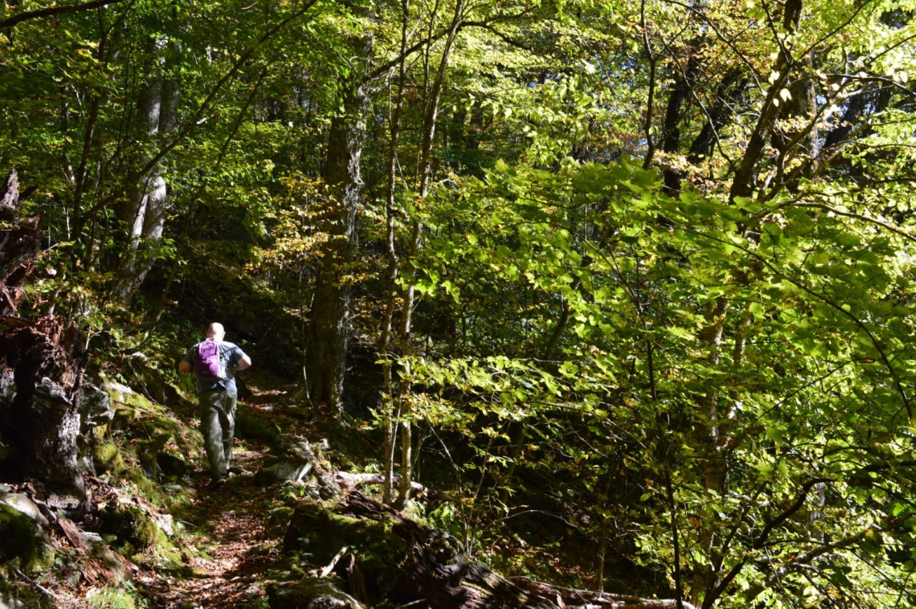
Hiking on the Mountains-to-Sea Trail
Laura White Photo · Public domain (NPS) · NPS
Richland Balsam from Steestachee Bald Overlook
Thomson200 · CC0 · source
Richland Balsam (center) and Lone Bald (far right) from Steestachee Bald Overlook
Thomson200 · CC0 · source
500px provided description: North Carolina span of the Smoky Mountains [#sunset ,#nature ,#blue ,#ridge ,#parkway ,#blue ridge parkway ,#smokies ,#smoky mountians ,#Mountains ,#NC]
John Andersen · CC BY 3.0 · source
Boraria deturkiana , Haywood County, North Carolina
Evan M. Raskin · CC BY 4.0 · source

What you’re looking at

Named terrain inside the view from this overlook, nearest first.

  • Beef Market Top4,982 ftwest · 1.5 mi
  • Fern Mountain4,867 ftsouthwest · 4.5 mi

Light

This overlook faces sunset — 0° off square to it.

DateSunriseSunsetGolden hour
March equinox07:3719:4419:11
June solstice06:1820:5120:14
September equinox07:2119:3118:57
December solstice07:3817:2416:45

Local time (America/New_York). Computed for this exact position.

Where it is

  • Asheville30.6 mi east-northeast
  • Sevierville43.0 mi northwest
  • Berea49.2 mi southeast
Loading map…
Private beta · Free to join

Take the scenic way to Grassy Ridge Mine Overlook.

Byway plans around your taste, verified places, real weather and opening hours — then opens every leg in Google Maps with one tap.

Private beta · Free to join · No card · Invite when a spot opens

Grassy Ridge Mine Overlook Trailhead · National Park Service

Get away from the hustle and bustle by heading toward Balsam Gap, down south on the Blue Ridge Parkway. Enjoy a relaxing and tranquil hike by accessing the Mountains-to-Sea Trail at Grassy Ridge Mine Overlook on the Parkway at Milepost 436.8. The name comes from an old mica mine that was located below the overlook. It operated from the mid-1800’s until the 1920’s. Two different hiking options await you. Walk up behind the picnic table and the trail forks to the left. It traverses north 1.7-miles to Licklog Ridge Overlook. This leisurely walk takes you from the Grassy Ridge Mine Overlook parking area to the Licklog Ridge Overlook and returns for a total of 3.4 miles. A second option is to go straight at the trailhead fork where the trail bends to the right to follow the Mountains-to-Sea Trail south. On this path you can walk as far as you like and return the same way. This part of the Mountains-to-Sea Trail does not stray far from the Parkway but still gives the illusion of being on an “off the grid” walk. The terrain is up and down, but not really steep for long periods. Parts of the trail are rocky, so sturdy footwear is necessary. The trail provides a pleasant hike into the remnants of a high elevation oak forest that are found in spots along the parkway. Awaiting you is an overstory of oak and birch that was logged several years ago, but still has some older trees remaining. This walk is flush with spring and summer wildflowers and has fall color well into October. High elevation birds you may spot in summer include: veery, rose-breasted grosbeak, blue-headed vireo, dark-eyed junco, winter wren, scarlet tanager, black-and-white warbler, least flycatcher and golden-crowned kinglet. This section of the Mountains-to Sea Trail is a pleasant foray into the high elevation forests not far from the Parkway itself that still puts you in a relatively secluded, easy to moderate hiking situation. Check the conditions of the area before you visit.

Read it at National Park Service →

How high is Grassy Ridge Mine Overlook?

Grassy Ridge Mine Overlook sits at about 5,250 feet (1,600 m).

What can you see from Grassy Ridge Mine Overlook?

From Grassy Ridge Mine Overlook: Beef Market Top (W, 1.5 mi); Fern Mountain (SW, 4.5 mi).

Is Grassy Ridge Mine Overlook better at sunrise or sunset?

Sunset. The land falls away from Grassy Ridge Mine Overlook toward the sunset, so at sunrise the light is behind you. Exact times shift through the year; the page shows the current window.

What is the nearest town to Grassy Ridge Mine Overlook?

Asheville, 31 miles ENE of Grassy Ridge Mine Overlook.

What is the next lookout after Grassy Ridge Mine Overlook?

Licklog Gap Overlook is the next surfaced lookout along the same route after Grassy Ridge Mine Overlook.

Drive to Grassy Ridge Mine Overlook with Byway

Byway plans the scenic way there — real places along Blue Ridge Parkway, real weather, zero hallucinations — and hands the turns to the navigation you already use.

Byways with this lookout

Day trips start here

Locals make it Verified.

Grassy Ridge Mine Overlook — confirmed, rated, and photographed by people who actually pulled over. A local confirmation is what upgrades a lookout from Discovered to Verified. Zero hallucinations.

Confirmed by locals

No local confirmations yet. Stood here? Yours is the one that upgrades this lookout to Verified.

Ratings

No ratings yet. Stood at this lookout? Be the first to rate it.

No written reviews yet.

Field notes

No field notes yet. Know the gate hours or the best pull-in? Leave the note you wish you'd had.

Photos

No photos yet.

Sign in to confirm this lookout, rate it, add photos, and leave field notes.

More lookouts on Blue Ridge Parkway

Named places near this lookout