Skip to content

Licklog Ridge Overlook

National Park Service
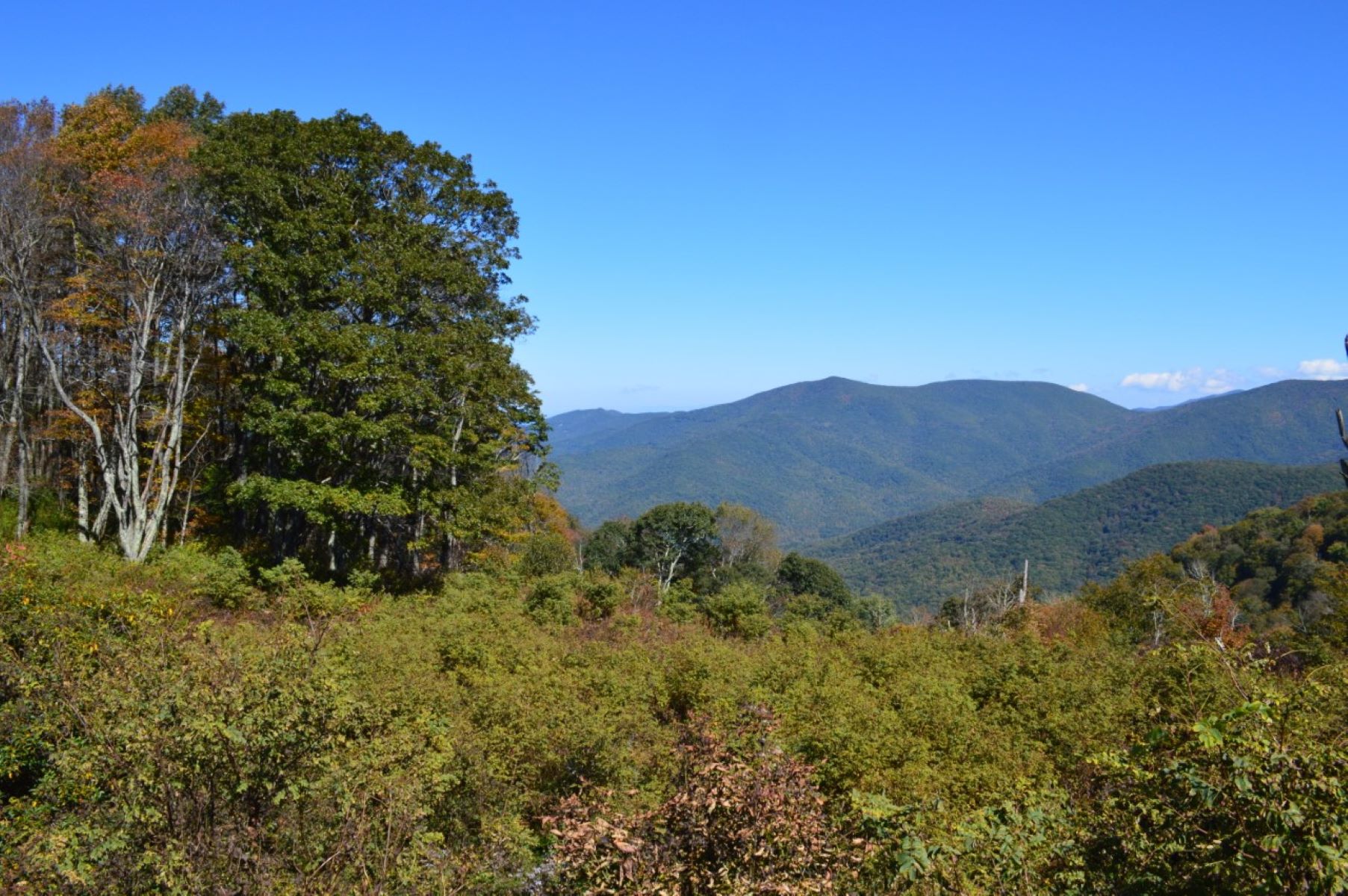
Looking north-east from Licklog Ridge Overlook. Terrain and imagery at true elevation.

Licklog Ridge Overlook sits at 5,130 feet on the Blue Ridge Parkway, facing roughly east-northeast toward sunrise, with terrain dropping 676 feet within 600 meters of the pullout. The view is narrow, framed by close-growing trees and shrubs, and takes in gently rolling mountains rather than a wide panorama. Visible peaks include Laurel Patch Bald to the north at 0.6 miles, Cold Spring Knob to the east at 4.0 miles, Lickstone Bald to the east-northeast at 4.4 miles, and Marg Mountain and Wolfpen Mountain to the northeast at 4.7 and 6.1 miles. A picnic table is set up at the overlook, making it suitable for a lunch stop. The Mountains-to-Sea Trail can be picked up across the Parkway; one option is a 1.7-mile hike south to Grassy Ridge Mine Overlook and back, with hikers reporting birds, wildlife, and stonework along the way. The name comes from the practice of placing salt blocks in log holes, or "licklogs," for cattle to lick, dating to when the surrounding meadows were used for grazing before the Parkway was built. Asheville lies 30.9 miles to the east-northeast. Licklog Gap Overlook precedes this stop, with View Doubletop Mountain next along the route.

Access
On the byway
Elevation
5,130 ft
View
Northeast · 60°
Light
Best at sunrise
Relief
676 ft drop
In view
5 named features
A perfect day at Licklog Ridge Overlook
NPS Photo / Laura White · Public domain (NPS) · NPS
500px provided description: North Carolina span of the Smoky Mountains [#sunset ,#nature ,#blue ,#ridge ,#parkway ,#blue ridge parkway ,#smokies ,#smoky mountians ,#Mountains ,#NC]
John Andersen · CC BY 3.0 · source
Boraria deturkiana , Haywood County, North Carolina
Evan M. Raskin · CC BY 4.0 · source

What you’re looking at

Named terrain inside the view from this overlook, nearest first.

  • Laurel Patch Bald5,531 ftnorth · 0.6 mi
  • Cold Spring Knob5,897 fteast · 4.0 mi
  • Lickstone Bald5,684 fteast-northeast · 4.4 mi
  • Marg Mountain3,999 ftnortheast · 4.7 mi
  • Wolfpen Mountain4,455 ftnortheast · 6.1 mi

Light

This overlook faces sunrise 30° off square to it.

DateSunriseSunsetGolden hour
March equinox07:3719:4419:11
June solstice06:1820:5120:13
September equinox07:2119:3118:57
December solstice07:3817:2416:45

Local time (America/New_York). Computed for this exact position.

Where it is

  • Asheville30.9 mi east-northeast
  • Sevierville43.8 mi northwest
  • Berea48.5 mi southeast
Loading map…
Private beta · Free to join

Take the scenic way to Licklog Ridge Overlook.

Byway plans around your taste, verified places, real weather and opening hours — then opens every leg in Google Maps with one tap.

Private beta · Free to join · No card · Invite when a spot opens

Licklog Ridge Overlook · National Park Service

Historically, there were more large open meadows in the Blue Ridge Mountains before the construction of the Blue Ridge Parkway. Prior to becoming protected lands, these grassy areas were used by farmers for grazing cattle. Blocks of salt were placed in holes fashioned in logs for the cows to lick—hence the name "licklog." Cows have an instinctive need for salt—to produce milk, grow healthy muscles, aid in digestion, and to obtain important minerals for continued health. If they get too little salt, they try to fulfill their need by eating rocks, dirt, and wood to satisfy their cravings. The overlook itself displays a narrow view of gently rolling mountains framed by close growing trees and shrubs. A picnic table makes for a pleasant lunch spot. The Mountains-to-Sea Trail can be accessed across the Parkway from the overlook. Try hiking 1.7 miles south to Grassy Ridge Mine Overlook, then turn around and return. Hikers have noted an abundance of birds, wildlife, and attractive stonework along the trail. Check the conditions of the area before you visit.

Read it at National Park Service

How high is Licklog Ridge Overlook?

Licklog Ridge Overlook sits at about 5,130 feet (1,564 m).

What can you see from Licklog Ridge Overlook?

From Licklog Ridge Overlook: Laurel Patch Bald (N, 0.6 mi); Cold Spring Knob (E, 4.0 mi); Lickstone Bald (ENE, 4.4 mi); Marg Mountain (NE, 4.7 mi).

Is Licklog Ridge Overlook better at sunrise or sunset?

Sunrise. The land falls away from Licklog Ridge Overlook toward the sunrise, so at sunset the light is behind you. Exact times shift through the year; the page shows the current window.

What is the nearest town to Licklog Ridge Overlook?

Asheville, 31 miles ENE of Licklog Ridge Overlook.

What is the next lookout after Licklog Ridge Overlook?

View Doubletop Mountain is the next surfaced lookout along the same route after Licklog Ridge Overlook.

Drive to Licklog Ridge Overlook with Byway

Byway plans the scenic way there — real places along Blue Ridge Parkway, real weather, zero hallucinations — and hands the turns to the navigation you already use.

Byways with this lookout

Locals make it Verified.

Licklog Ridge Overlook — confirmed, rated, and photographed by people who actually pulled over. A local confirmation is what upgrades a lookout from Discovered to Verified. Zero hallucinations.

Confirmed by locals

No local confirmations yet. Stood here? Yours is the one that upgrades this lookout to Verified.

Ratings

No ratings yet. Stood at this lookout? Be the first to rate it.

No written reviews yet.

Field notes

No field notes yet. Know the gate hours or the best pull-in? Leave the note you wish you'd had.

Photos

No photos yet.

Sign in to confirm this lookout, rate it, add photos, and leave field notes.

More lookouts on Blue Ridge Parkway

Named places near this lookout