


Hazeltop Ridge Overlook · National Park Service
Gaze upon the Blue Ridge Mountains from Hazeltop Ridge Overlook. The view from this overlook stretches from the northwest to the southwest.
Hazeltop Ridge Overlook sits at 3,267 feet along Skyline Drive, facing 330 degrees toward the northwest. The terrain drops 457 feet within 600 meters of the overlook, giving a sense of the ridge falling away below the view, which stretches from the northwest to the southwest across the Blue Ridge Mountains. To the north, Huckleberry Cliff rises to 2,951 feet at one mile, with Naked Creek Falls visible at the same distance and direction, sitting at 2,692 feet. Naked Creek Overlook lies north-northeast at 1.1 miles and 3,282 feet, with Tanners Ridge Overlook further along at 2.7 miles and 3,477 feet, and Blackrock Overlook beyond that at 3.5 miles and 3,689 feet. Devils Tanyard is visible to the west-northwest at 4.1 miles, elevation 2,823 feet. Harrisonburg lies 22.4 miles to the west, Charlottesville 31.1 miles south, and Staunton 40.4 miles southwest. Naked Creek Overlook is the previous stop along the drive, with The Point Overlook next.
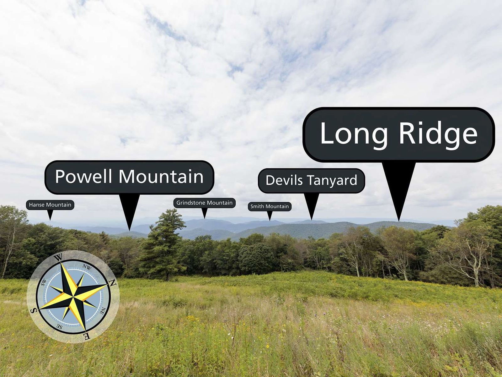
Named terrain inside the view from this overlook, nearest first.
| Date | Sunrise | Sunset | Golden hour |
|---|---|---|---|
| March equinox | 07:18 | 19:26 | 18:51 |
| June solstice | 05:51 | 20:42 | 20:02 |
| September equinox | 07:02 | 19:13 | 18:38 |
| December solstice | 07:28 | 16:57 | 16:15 |
Local time (America/New_York). Computed for this exact position.
Byway plans around your taste, verified places, real weather and opening hours — then opens every leg in Google Maps with one tap.
Gaze upon the Blue Ridge Mountains from Hazeltop Ridge Overlook. The view from this overlook stretches from the northwest to the southwest.
Hazeltop Ridge Overlook sits at about 3,267 feet (996 m).
From Hazeltop Ridge Overlook: Huckleberry Cliff (N, 1.0 mi); Naked Creek Falls (N, 1.0 mi); Naked Creek Overlook (NNE, 1.1 mi); Tanners Ridge Overlook (NNE, 2.7 mi).
Harrisonburg, 22 miles W of Hazeltop Ridge Overlook.
The Point Overlook is the next surfaced lookout along the same route after Hazeltop Ridge Overlook.
Byway plans the scenic way there — real places along Skyline Drive, real weather, zero hallucinations — and hands the turns to the navigation you already use.
Hazeltop Ridge Overlook — confirmed, rated, and photographed by people who actually pulled over. A local confirmation is what upgrades a lookout from Discovered to Verified. Zero hallucinations.
No local confirmations yet. Stood here? Yours is the one that upgrades this lookout to Verified.
No ratings yet. Stood at this lookout? Be the first to rate it.
No written reviews yet.
No field notes yet. Know the gate hours or the best pull-in? Leave the note you wish you'd had.
No photos yet.
Sign in to confirm this lookout, rate it, add photos, and leave field notes.