Skip to content

Moab Fault Viewpoint

National Park Service
Looking south from Moab Fault Viewpoint. Terrain and imagery at true elevation.

Moab Fault Viewpoint sits at the final mile marker, mile 15 of 15, along the Potash-Lower Colorado River Scenic Byway, at an elevation of 4,461 feet and facing south. The land drops 416 feet within 600 meters of the overlook. Highway 191 runs below and parallels part of the Moab Fault, a fracture formed about 240 million years ago when regional pressure lifted and cracked a miles-long section of crust. Repeated uplift raised the rock on the west side of the highway over half a mile relative to the east side, so the layers across the highway are 140 million years older than those on the east side where visitors stand. Smaller fault lines are also visible, marked by rock layers that no longer line up horizontally, including a diagonal line above the Arches Visitor Center separating lower wavy rock from a smooth vertical cliff. Portal Overlook is visible to the south-southeast at 3.3 miles, and the Scott Matheson Wetlands Preserve lies in the same direction at 3.6 miles. A paved roadside pullout holds one to three vehicles, and the overlook and its interpretive sign are set on uneven sandstone. Moab is 4.6 miles southeast.

Position
Mile ~15 of 15
Access
0.9 mi detour
Elevation
4,461 ft
View
South · 180°
Relief
416 ft drop
In view
2 named features
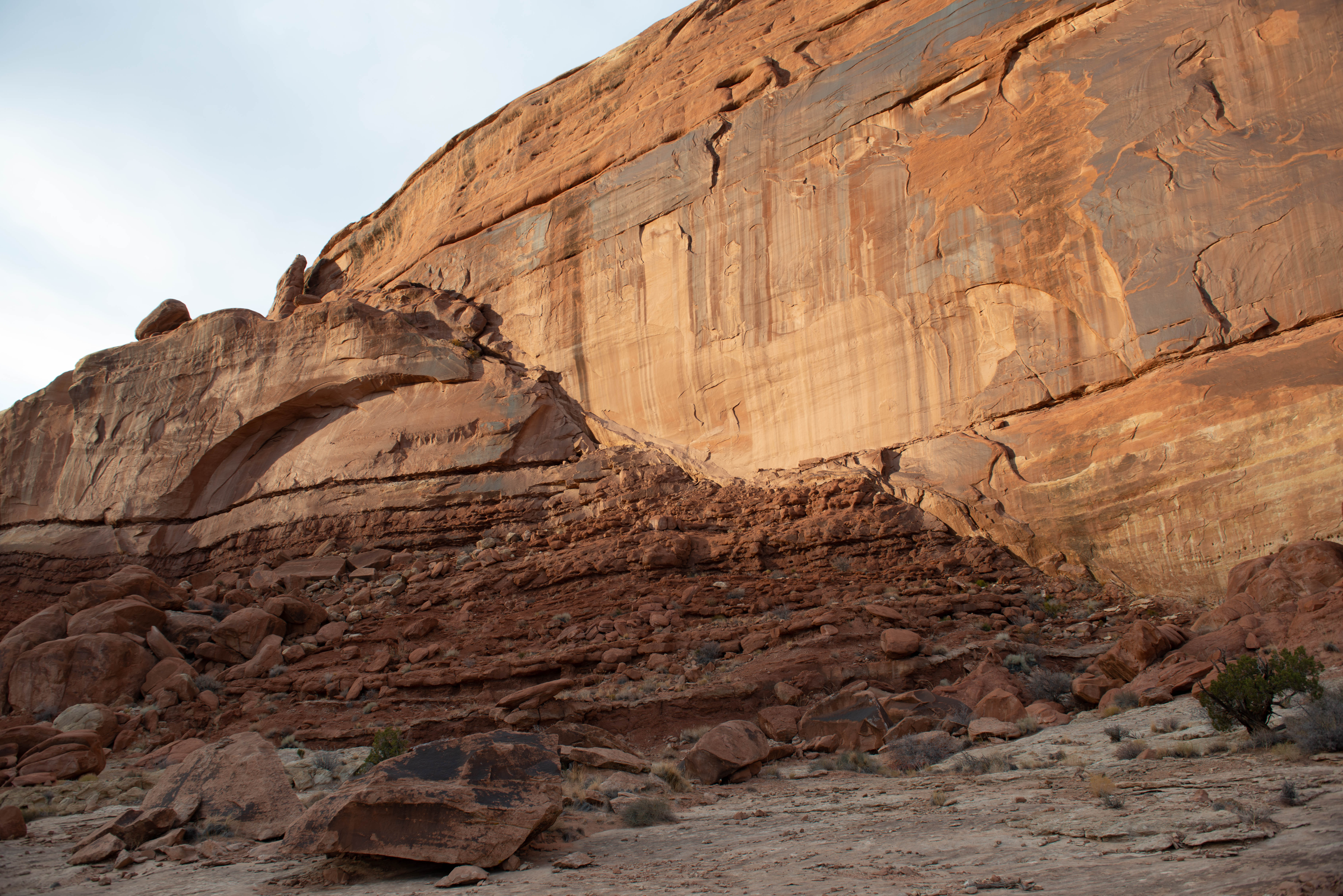
Small slip faults echo the nearby Moab Fault underlying Highway 191.
NPS/ Veronica Verdin · Public domain (NPS) · NPS
View southeast down Moab Canyon from Arches Scenic Drive in Arches National Park
Famartin · CC BY-SA 3.0 · source
View west up Moab Canyon from Arches Scenic Drive in Arches National Park
Famartin · CC BY-SA 3.0 · source
Moab Rim, Park Entrance
Greg Willis from Denver, CO, usa · CC BY-SA 2.0 · source
Arches National Park, Moab UT. This was taken in a photo workshop with Jack Dykinga at the 2013 Moab photosymposium
Sandy Horvath-Dori from Grand Junction, CO, USA · CC BY 2.0 · source
Arches National Park, Moab UT. This was taken in a photo workshop with Jack Dykinga at the 2013 Moab photosymposium
Sandy Horvath-Dori from Grand Junction, CO, USA · CC BY 2.0 · source

What you’re looking at

Named terrain inside the view from this overlook, nearest first.

  • Portal Overlook5,069 ftsouth-southeast · 3.3 mi
  • Scott Matheson Wetlands Preserve3,964 ftsouth-southeast · 3.6 mi

Light

DateSunriseSunsetGolden hour
March equinox07:2319:3118:56
June solstice05:5520:4720:07
September equinox07:0719:1718:42
December solstice07:3317:0116:19

Local time (America/Denver). Computed for this exact position.

Where it is

Mile 15 of 15 along Potash-Lower Colorado River Scenic Byway.

  • Moab4.6 mi southeast
  • Castle Valley11.0 mi east
  • Green River39.5 mi northwest
Loading map…
Private beta · Free to join

Take the scenic way to Moab Fault Viewpoint.

Byway plans around your taste, verified places, real weather and opening hours — then opens every leg in Google Maps with one tap.

Private beta · Free to join · No card · Invite when a spot opens

Moab Fault Viewpoint · National Park Service

Highway 191 isn't just the road to Arches—it's the site of a dramatic shift in the geologic landscape.

Powerful regional forces moved deep underground here. About 240 million years ago, intense upward pressure caused a miles-long section of the earth’s crust to move. It lifted, buckled, shifted, and cracked. The highway below this viewpoint parallels part of this fracture, called the Moab Fault.   

After repeated episodes of uplift, the rock on the other side of the fault had risen over one half-mile (.8 km) compared to the rock on this side. Today, the layers across from you, on the west side of the highway, are 140 million years older than the layers where you’re standing, here on the east side.  

Also visible from here are smaller fault lines, where individual rock layers no longer line up horizontally as they once did. Can you spot any? From this viewpoint, look across the park road and above Arches Visitor Center, where a diagonal line separates lower wavy rock from the smooth vertical cliff above.

Accessibility:  The overlook is located along the roadside and is visible from your car. A paved roadside pullout provides parking for 1-3 vehicles. The overlook and interpretive sign sits on uneven sandstone rock.

Read it at National Park Service

How high is Moab Fault Viewpoint?

Moab Fault Viewpoint sits at about 4,461 feet (1,360 m).

What can you see from Moab Fault Viewpoint?

From Moab Fault Viewpoint: Portal Overlook (SSE, 3.3 mi); Scott Matheson Wetlands Preserve (SSE, 3.6 mi).

What is the nearest town to Moab Fault Viewpoint?

Moab, 4.6 miles SE of Moab Fault Viewpoint.

Drive to Moab Fault Viewpoint with Byway

Byway plans the scenic way there — real places along Potash-Lower Colorado River Scenic Byway, real weather, zero hallucinations — and hands the turns to the navigation you already use.

Byways with this lookout

Day trips start here

Locals make it Verified.

Moab Fault Viewpoint — confirmed, rated, and photographed by people who actually pulled over. A local confirmation is what upgrades a lookout from Discovered to Verified. Zero hallucinations.

Confirmed by locals

No local confirmations yet. Stood here? Yours is the one that upgrades this lookout to Verified.

Ratings

No ratings yet. Stood at this lookout? Be the first to rate it.

No written reviews yet.

Field notes

No field notes yet. Know the gate hours or the best pull-in? Leave the note you wish you'd had.

Photos

No photos yet.

Sign in to confirm this lookout, rate it, add photos, and leave field notes.

More lookouts on Potash-Lower Colorado River Scenic Byway

Named places near this lookout