Skip to content

Deerlick Gap Overlook

VerifiedOpenStreetMap + National Park Service
Looking south from Deerlick Gap Overlook. Terrain and imagery at true elevation.

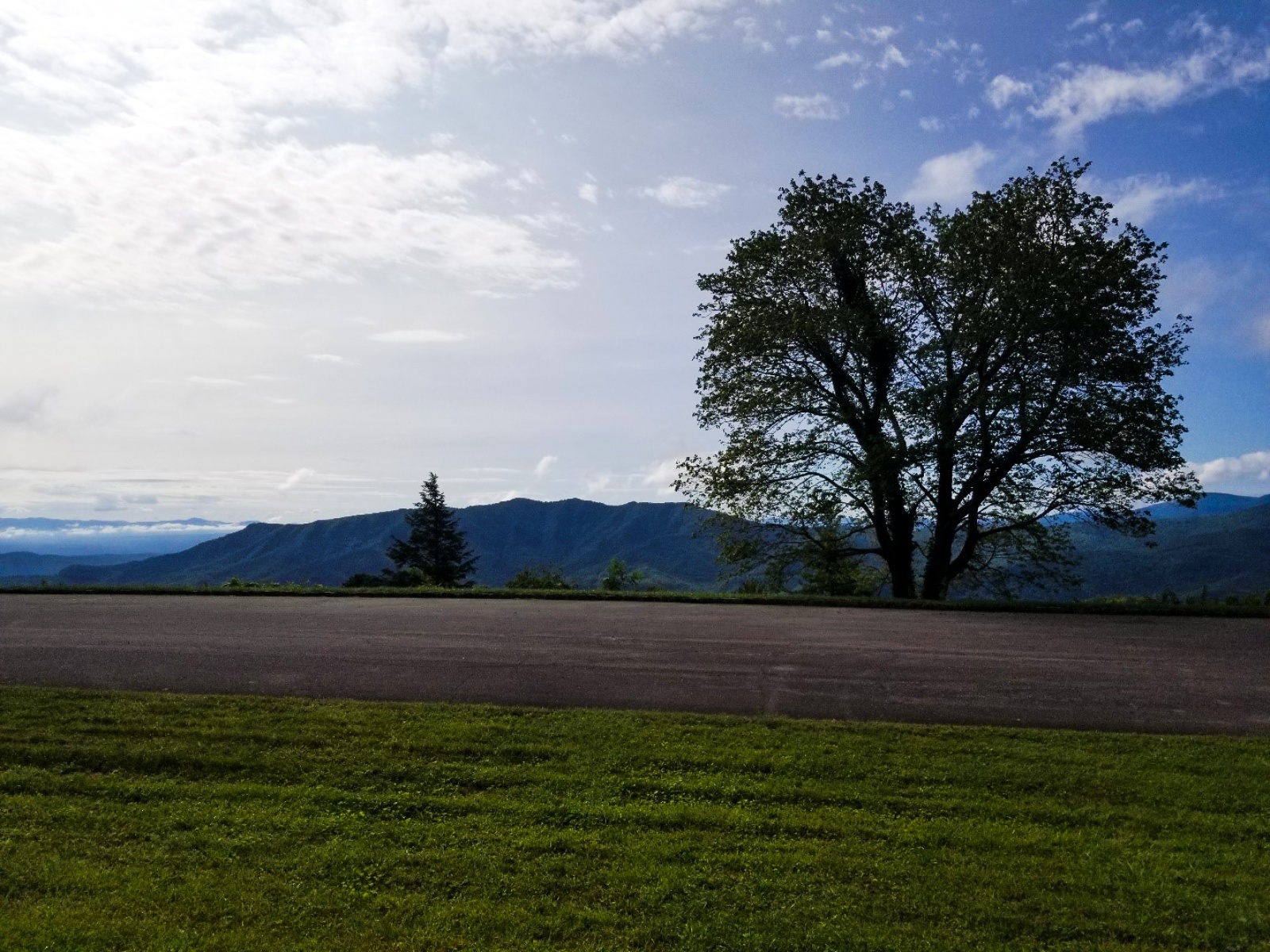
Deerlick Gap Overlook sits at 3,452 feet on the Blue Ridge Parkway, facing south with a drop of 663 feet within 600 meters. The name comes from deer traveling to the rocks here for saltpeter, and the site offers a view of Woods Mountain and the Catawba Valley, with Lake James sometimes visible in the distance on clear days. Oak, birch, ash, maple, and poplar trees grow in the area, and thick mixed forest surrounds the parking lot, with tall trees shading the picnic tables next to it. A wayside at the site provides information on groundhogs, also known as woodchucks. Named peaks and points in view include Woods Mountain to the south-southeast at 3.7 miles, Silver Knob to the southeast at 3.7 miles, Black Mountains Overlook (MP 342.2) to the southwest at 3.7 miles, Graveyard Mountain to the southeast at 6.1 miles, and Big Laurel Mountain to the southwest at 7.0 miles. Asheville lies 28.8 miles west-southwest, Johnson City 36.4 miles north-northwest, and Shelby 49.3 miles southeast. Three Knob Overlook precedes this stop, and Table Rock Overlook follows.

Access
On the byway
Elevation
3,452 ft
View
South · 180°
Relief
663 ft drop
In view
5 named features
Learn about groundhogs, look for deer, enjoy a picnic or a simple scenic view of the Catawba Valley.
NPS Photo · Public domain (NPS) · NPS
Crabtree Falls, near the Crabtree Meadows Campground on the Blue Ridge Parkway, Little Switzerland, North Carolina.
Wncoutdoors · CC BY-SA 3.0 · source
Celo Knob from Three Knobs Overlook, October 2016
Thomson200 · CC0 · source
Gibbs Mountain viewed from Three Knob Overlook
Thomson200 · CC0 · source
From left: Horse Rock and Celo Knob, viewed from the Three Knob Overlook
Thomson200 · CC0 · source
Crabtree Falls, Marion, United States
Brandi Redd brandi1 · CC0 · source

What you’re looking at

Named terrain inside the view from this overlook, nearest first.

  • Woods Mountain3,623 ftsouth-southeast · 3.7 mi
  • Silver Knob3,117 ftsoutheast · 3.7 mi
  • Black Mountains Overlook (MP 342.2)3,925 ftsouthwest · 3.7 mi
  • Graveyard Mountain2,259 ftsoutheast · 6.1 mi
  • Big Laurel Mountain4,141 ftsouthwest · 7.0 mi

Light

DateSunriseSunsetGolden hour
March equinox07:3319:4019:07
June solstice06:1320:4920:11
September equinox07:1719:2718:53
December solstice07:3617:1916:39

Local time (America/New_York). Computed for this exact position.

Where it is

  • Asheville28.8 mi west-southwest
  • Johnson City36.4 mi north-northwest
  • Shelby49.3 mi southeast
Loading map…
Private beta · Free to join

Take the scenic way to Deerlick Gap Overlook.

Byway plans around your taste, verified places, real weather and opening hours — then opens every leg in Google Maps with one tap.

Private beta · Free to join · No card · Invite when a spot opens

Deerlick Gap Overlook · National Park Service

Named for the deer that travel here to lick the rocks containing saltpeter, Deerlick Gap Overlook offers a prominent view of Woods Mountain and the Catawba Valley. One can find oak, birch, ash, maple and poplar trees up here.  The parking area is flanked by thick mixed forests while the tall trees provide shade over the picnic tables that sit next to the lot. Have you spotted a groundhog on the drive up here? Check out the wayside to learn more about the large rodent, commonly known as the woodchuck. On clear days, one may catch a faint glimpse of the blue waters of Lake James far into the distant Catawba Valley. Check the conditions of the area before you visit.

Read it at National Park Service

How high is Deerlick Gap Overlook?

Deerlick Gap Overlook sits at about 3,452 feet (1,052 m).

What can you see from Deerlick Gap Overlook?

From Deerlick Gap Overlook: Woods Mountain (SSE, 3.7 mi); Silver Knob (SE, 3.7 mi); Black Mountains Overlook (MP 342.2) (SW, 3.7 mi); Graveyard Mountain (SE, 6.1 mi).

What is the nearest town to Deerlick Gap Overlook?

Asheville, 29 miles WSW of Deerlick Gap Overlook.

What is the next lookout after Deerlick Gap Overlook?

Table Rock Overlook is the next surfaced lookout along the same route after Deerlick Gap Overlook.

Drive to Deerlick Gap Overlook with Byway

Byway plans the scenic way there — real places along Blue Ridge Parkway, real weather, zero hallucinations — and hands the turns to the navigation you already use.

Byways with this lookout

Day trips start here

Locals make it Verified.

Deerlick Gap Overlook — confirmed, rated, and photographed by people who actually pulled over. A local confirmation is what upgrades a lookout from Discovered to Verified. Zero hallucinations.

Confirmed by locals

No local confirmations yet. Stood here? Yours is the one that upgrades this lookout to Verified.

Ratings

No ratings yet. Stood at this lookout? Be the first to rate it.

No written reviews yet.

Field notes

No field notes yet. Know the gate hours or the best pull-in? Leave the note you wish you'd had.

Photos

No photos yet.

Sign in to confirm this lookout, rate it, add photos, and leave field notes.

More lookouts on Blue Ridge Parkway

Named places near this lookout