Skip to content

North Cove Overlook

National Park Service
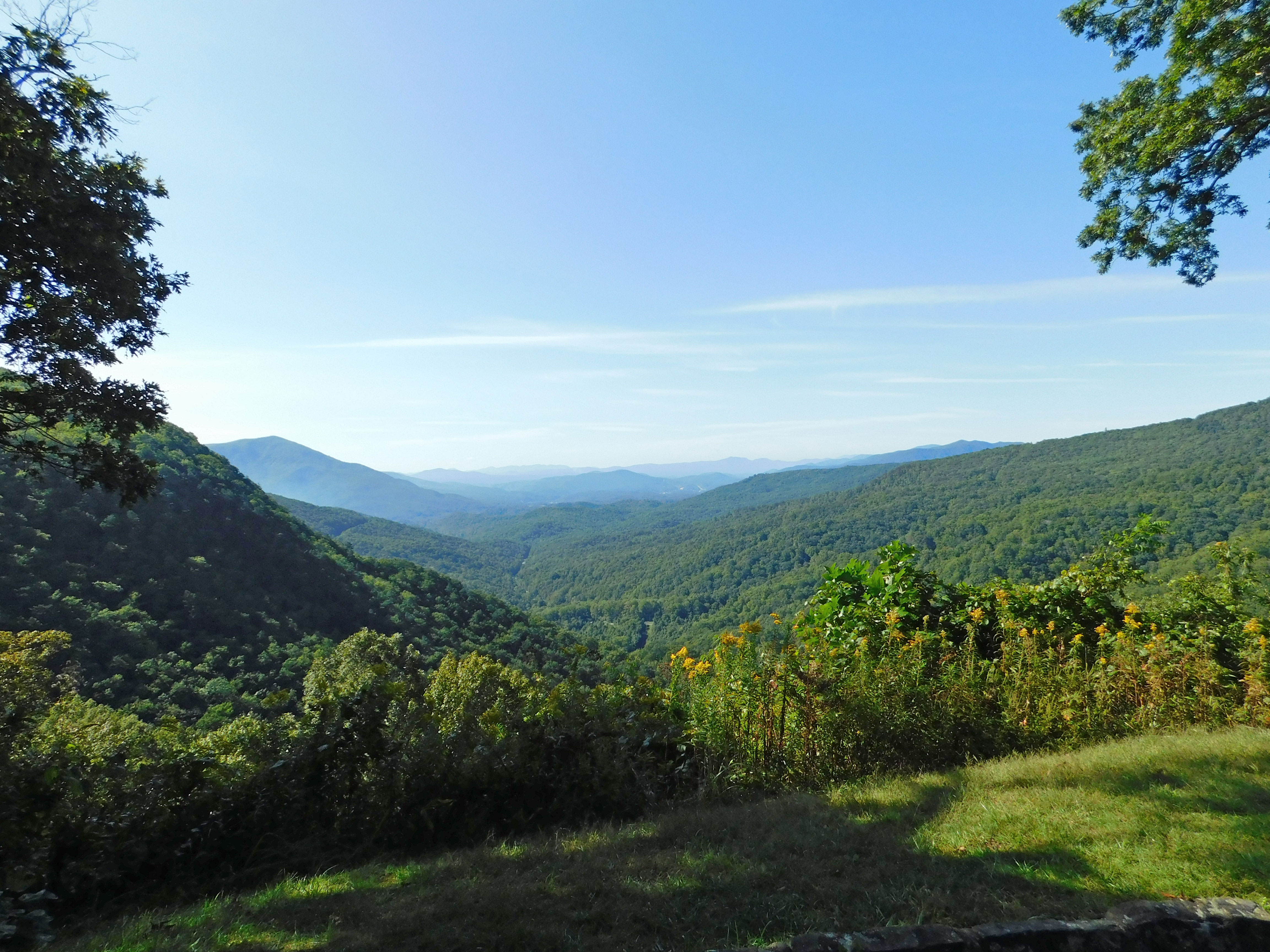
Looking south-west from North Cove Overlook. Terrain and imagery at true elevation.
Access
On the byway
Elevation
2,815 ft
View
Southwest · 210°
Relief
594 ft drop
In view
2 named features
North Cove Overlook
NPS Photo · Public domain (NPS) · NPS
The terraced hillside of an apple orchard on the Blue Ridge Parkway near Altapass. Photo taken with a Panasonic Lumix DMC-FZ50 in McDowell County, NC, USA . Cropping and post-processing performed with The GIMP .
Ken Thomas · Public domain · source
View of Earth from Skylab 2 . Taken on Kodak B&W infrared film with 700-800 nm bandpass filter using the Skylab Multispectral camera.
Earth Science and Remote Sensing Unit, NASA Johnson Space Center · Public domain · source
View of Earth from Skylab 2 . Taken on Kodak B&W infrared film with 800-900 nm bandpass filter using the Skylab Multispectral camera.
Earth Science and Remote Sensing Unit, NASA Johnson Space Center · Public domain · source
View of Earth from Skylab 2 . Taken on Kodak Panatomic-X B&W film with 600-700 nm bandpass filter using the Skylab Multispectral camera.
Earth Science and Remote Sensing Unit, NASA Johnson Space Center · Public domain · source
View of Earth from Skylab 2 . Taken on Kodak Panatomic-X B&W film with 500-600 nm bandpass filter using the Skylab Multispectral camera.
Earth Science and Remote Sensing Unit, NASA Johnson Space Center · Public domain · source

What you’re looking at

Named terrain inside the view from this overlook, nearest first.

  • The Loops Overlook3,078 ftsouthwest · 1.1 mi
  • Dobson Knob3,690 ftsouth-southeast · 5.5 mi

Light

DateSunriseSunsetGolden hour
March equinox07:3319:4019:06
June solstice06:1320:4820:10
September equinox07:1719:2718:53
December solstice07:3517:1816:39

Local time (America/New_York). Computed for this exact position.

Where it is

  • Boone29.5 mi northeast
  • Johnson City35.5 mi north-northwest
  • Asheville36.3 mi west-southwest
Loading map…
Private beta · Free to join

Take the scenic way to North Cove Overlook.

Byway plans around your taste, verified places, real weather and opening hours — then opens every leg in Google Maps with one tap.

Private beta · Free to join · No card · Invite when a spot opens

North Cove Overlook · National Park Service

The North Cove Overlook is located at an elevation of 2,815 feet in McKinney Gap on the Blue Ridge Parkway. It provides long range views to the south and southeast of North Cove, Peppers Creek Valley, Dobson Knob, and distant views of Wolf Pen, Hickory Nut Mountain, Sugarloaf, Piney Mountain, Graveyard Mountain and more. Close up views of the Historic Orchard at Altapass face west from the overlook. The overlook has two picnic tables and parking for 15 cars. A wayside exhibit tells the history of the original Crest of the Blue Ridge Highway. Joseph Hyde Pratt, a North Carolina State Geologist, first proposed the scenic highway in 1906. His proposal anticipated the growth of the automobile industry and the subsequent boom it would bring in tourists flocking to see the natural beauty of the Blue Ridge Mountains. Eight miles of the scenic highway were built from this location running north towards Linville Falls, but the outbreak of World War I brought the construction to an end. The idea of a scenic highway would be revived more than a decade later in the 1930s—becoming today’s Blue Ridge Parkway.  The wayside has a historic photograph of a group of workmen and two teams of mules grading the roadbed for the Crest of the Blue Ridge Highway in 1913. It also has a map of the proposed route of the road beginning in Marion, Virginia running through Western North Carolina and ending at Tullulah Falls, Georgia. Railroad enthusiasts prize the North Cove Overlook because it provides views of the trains ascending from the valley below, up the slopes of the Blue Ridge mountains on the railroad engineering marvel known as "The Loops."  Constructing a railroad with a sufficiently low grade to cross the steep slopes of the Blue Ridge Mountains was a daunting task. Construction began in 1905 and was completed in 1908. It is 13.5 miles long, contains 18 tunnels and many switchback curves that give “The Loops” its name. It required the labor of 4,000 workmen, most of whom were immigrants from Italy, Russia and Germany. Accidents and violence are believed to have cost more than 200 of these workers their lives. Once completed the railroad forever changed the lives of the mountain families as timber and mining companies offering steady wages flocked to the area. Trains pass just below the Orchard at Altapass and disappear into a tunnel below McKinney Gap to emerge on the other side of the Blue Ridge. The Loops are best viewed after the leaves fall from the trees.  The overlook also provides views to the west of the Historic Orchard at Altapass. The Orchard was created in 1908 by the Clinchfield Railroad and has been in operation for well over a century. It was considered to be an ideal location for an orchard because it could take advantage of the largely frost-free thermal layer found on the slopes of the Blue Ridge Mountains.   McKinney Gap is named for Charles McKinney (1780-1852) who lived here with his very large family in the 1800s. Check the conditions of the area before you visit.

Read it at National Park Service

How high is North Cove Overlook?

North Cove Overlook sits at about 2,815 feet (858 m).

What can you see from North Cove Overlook?

From North Cove Overlook: The Loops Overlook (SW, 1.1 mi); Dobson Knob (SSE, 5.5 mi).

What is the nearest town to North Cove Overlook?

Boone, 30 miles NE of North Cove Overlook.

What is the next lookout after North Cove Overlook?

North Cove Valley Overlook is the next surfaced lookout along the same route after North Cove Overlook.

Drive to North Cove Overlook with Byway

Byway plans the scenic way there — real places along Blue Ridge Parkway, real weather, zero hallucinations — and hands the turns to the navigation you already use.

Byways with this lookout

Locals make it Verified.

North Cove Overlook — confirmed, rated, and photographed by people who actually pulled over. A local confirmation is what upgrades a lookout from Discovered to Verified. Zero hallucinations.

Confirmed by locals

No local confirmations yet. Stood here? Yours is the one that upgrades this lookout to Verified.

Ratings

No ratings yet. Stood at this lookout? Be the first to rate it.

No written reviews yet.

Field notes

No field notes yet. Know the gate hours or the best pull-in? Leave the note you wish you'd had.

Photos

No photos yet.

Sign in to confirm this lookout, rate it, add photos, and leave field notes.

More lookouts on Blue Ridge Parkway

Named places near this lookout