


Panorama Point Overlook · National Park Service
Panorama Point offers a wide view of the Badlands landscape, downward towards the White River Valley. The view is similar to what is seen in the Big Foot Pass area.
Panorama Point sits at 2,734 feet on the Badlands Loop Scenic Byway, facing southeast (150°), with the land dropping 208 feet within 600 meters of the overlook. This elevation change opens a wide view down toward the White River Valley. Several other viewpoints are visible from here: White River Valley Overlook lies 1.4 miles east-southeast at 2,697 feet, while Door and Window sit 7.1 miles east-southeast at 2,659 and 2,672 feet respectively. Big Badlands Overlook is visible 8.0 miles to the east at 2,606 feet. The NPS notes that the scene resembles the view found in the Big Foot Pass area. The nearest town is Wall, 16.3 miles north-northwest, followed by Philip at 25.9 miles northeast and Kadoka at 27.6 miles east. On the byway, Panorama Point follows Prairie Wind Overlook and precedes Bigfoot Pass Overlook. Daylight hours vary across the year: sunrise runs from about 05:07 at the June solstice to 07:20 at the December solstice, with sunset ranging from 16:14 in December to 20:35 in June.
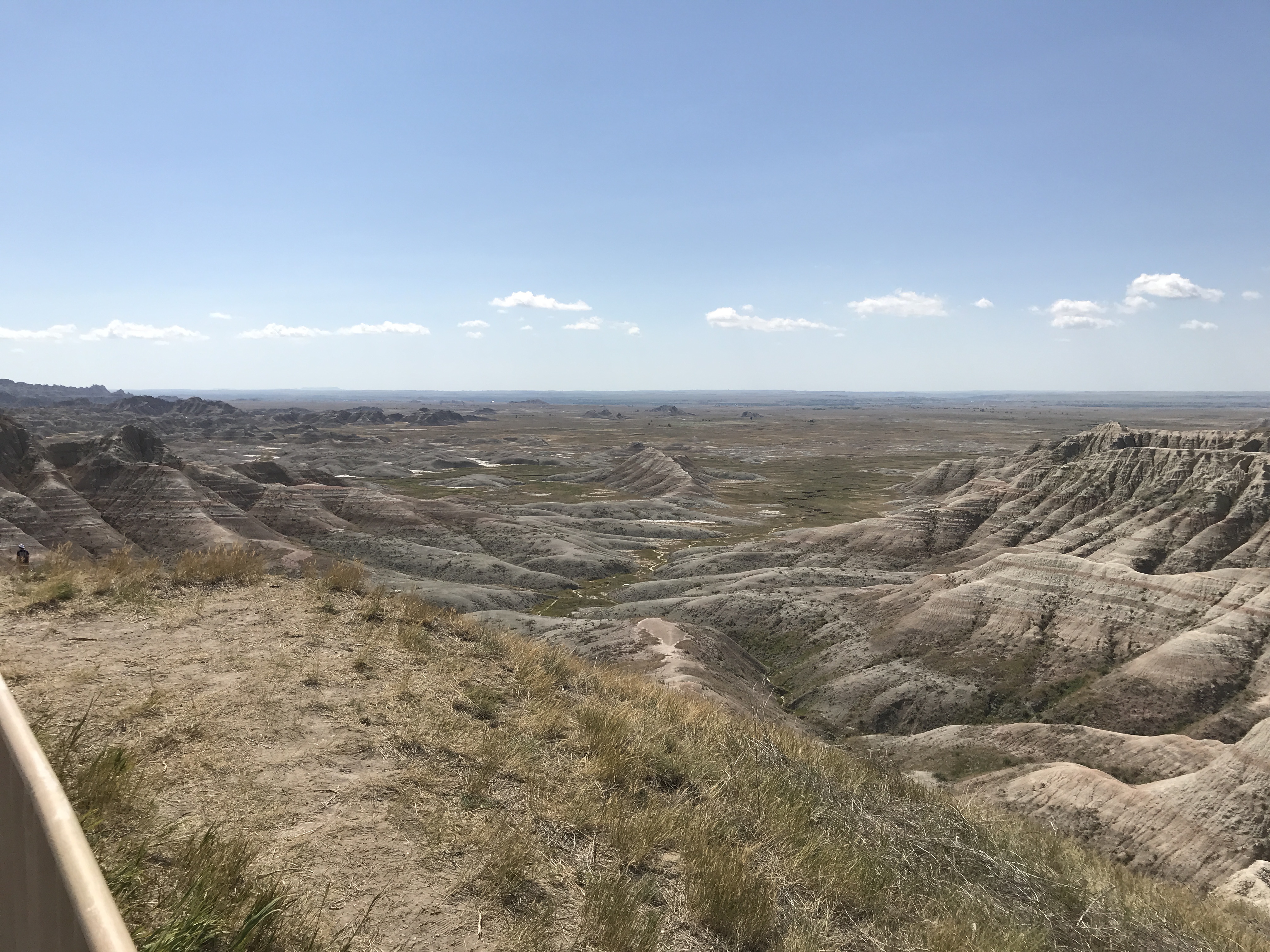
Named terrain inside the view from this overlook, nearest first.
| Date | Sunrise | Sunset | Golden hour |
|---|---|---|---|
| March equinox | 06:52 | 19:01 | 18:23 |
| June solstice | 05:07 | 20:35 | 19:51 |
| September equinox | 06:36 | 18:47 | 18:10 |
| December solstice | 07:20 | 16:14 | 15:27 |
Local time (America/Denver). Computed for this exact position.
Byway plans around your taste, verified places, real weather and opening hours — then opens every leg in Google Maps with one tap.
Panorama Point offers a wide view of the Badlands landscape, downward towards the White River Valley. The view is similar to what is seen in the Big Foot Pass area.
Panorama Point sits at about 2,734 feet (833 m).
From Panorama Point: White River Valley Overlook (ESE, 1.4 mi); Door (ESE, 7.1 mi); Window (ESE, 7.1 mi); Big Badlands Overlook (E, 8.0 mi).
Wall, 16 miles NNW of Panorama Point.
Bigfoot Pass Overlook is the next surfaced lookout along the same route after Panorama Point.
Byway plans the scenic way there — real places along Badlands Loop Scenic Byway, real weather, zero hallucinations — and hands the turns to the navigation you already use.
Panorama Point — confirmed, rated, and photographed by people who actually pulled over. A local confirmation is what upgrades a lookout from Discovered to Verified. Zero hallucinations.
No local confirmations yet. Stood here? Yours is the one that upgrades this lookout to Verified.
No ratings yet. Stood at this lookout? Be the first to rate it.
No written reviews yet.
No field notes yet. Know the gate hours or the best pull-in? Leave the note you wish you'd had.
No photos yet.
Sign in to confirm this lookout, rate it, add photos, and leave field notes.