Skip to content

Prairie Wind Overlook

VerifiedOpenStreetMap + National Park Service
Prairie Wind Overlook — direction of view not recorded. Terrain and imagery at true elevation.

Prairie Wind Overlook sits at 2,663 feet along the Badlands Loop Scenic Byway, with the land dropping 44 feet within 600 meters of the site. The overlook faces mixed-grass prairie, part of an ecosystem type divided across short-grass, mixed-grass, and tall-grass prairie based on the dominant grasses present. From this point, Panorama Point is visible east-northeast at 1.4 miles (2,734 ft), Homestead Overlook lies west-northwest at 4.9 miles (2,891 ft), and Kelier Butte rises southwest at 7.8 miles (2,538 ft). Seasonal daylight varies through the year, with sunrise and sunset ranging from 05:07 and 20:35 at the June solstice to 07:20 and 16:15 at the December solstice. The towns of Wall (15.8 mi north-northwest), Philip (27.2 mi northeast), and Kadoka (29.0 mi east) are the nearest population centers. Along the byway, Burns Basin Overlook precedes this stop, and Panorama Point follows it. Native mixed-grass prairie now covers only about 2% of its original range, and invasive plants continue to displace remaining native species, prompting management efforts such as prescribed fires and herbicide spraying within the park.

Access
On the byway
Elevation
2,663 ft
Relief
44 ft drop
In view
3 named features
Although famous for its geology, the park also preserves the largest mixed-grass prairie in the USA.
NPS Photo / Serena Rosales · Public domain (NPS) · NPS
Cumulus clouds towering over yellow prairie. At Prairie Wind Overlook, Badlands National Park, South Dakota, USA
Wing-Chi Poon , colors adjusted by Kjetil r · CC BY-SA 2.5 · source
4185
John Menard from Phoenix, USA · CC BY-SA 2.0 · source
At Badlands National Park
Eekim · CC0 · source
The image depicts a curious ram captured amongst the stunning land formations in the beautifully scenic Castle Butte, South Dakota, near Badlands National Park
Ryan Barrios · CC BY 4.0 · source
View of Earth taken during ISS Expedition 53.
Earth Science and Remote Sensing Unit , Lyndon B. Johnson Space Center · Public domain · source

What you’re looking at

Named terrain around this overlook, nearest first. No view direction is recorded, so every bearing is listed.

  • Panorama Point2,734 fteast-northeast · 1.4 mi
  • Homestead Overlook2,891 ftwest-northwest · 4.9 mi
  • Kelier Butte2,538 ftsouthwest · 7.8 mi

Light

DateSunriseSunsetGolden hour
March equinox06:5219:0118:23
June solstice05:0720:3519:51
September equinox06:3618:4818:10
December solstice07:2016:1515:27

Local time (America/Denver). Computed for this exact position.

Where it is

  • Wall15.8 mi north-northwest
  • Philip27.2 mi northeast
  • Kadoka29.0 mi east
Loading map…
Private beta · Free to join

Take the scenic way to Prairie Wind Overlook.

Byway plans around your taste, verified places, real weather and opening hours — then opens every leg in Google Maps with one tap.

Private beta · Free to join · No card · Invite when a spot opens

Prairie Wind Overlook · National Park Service

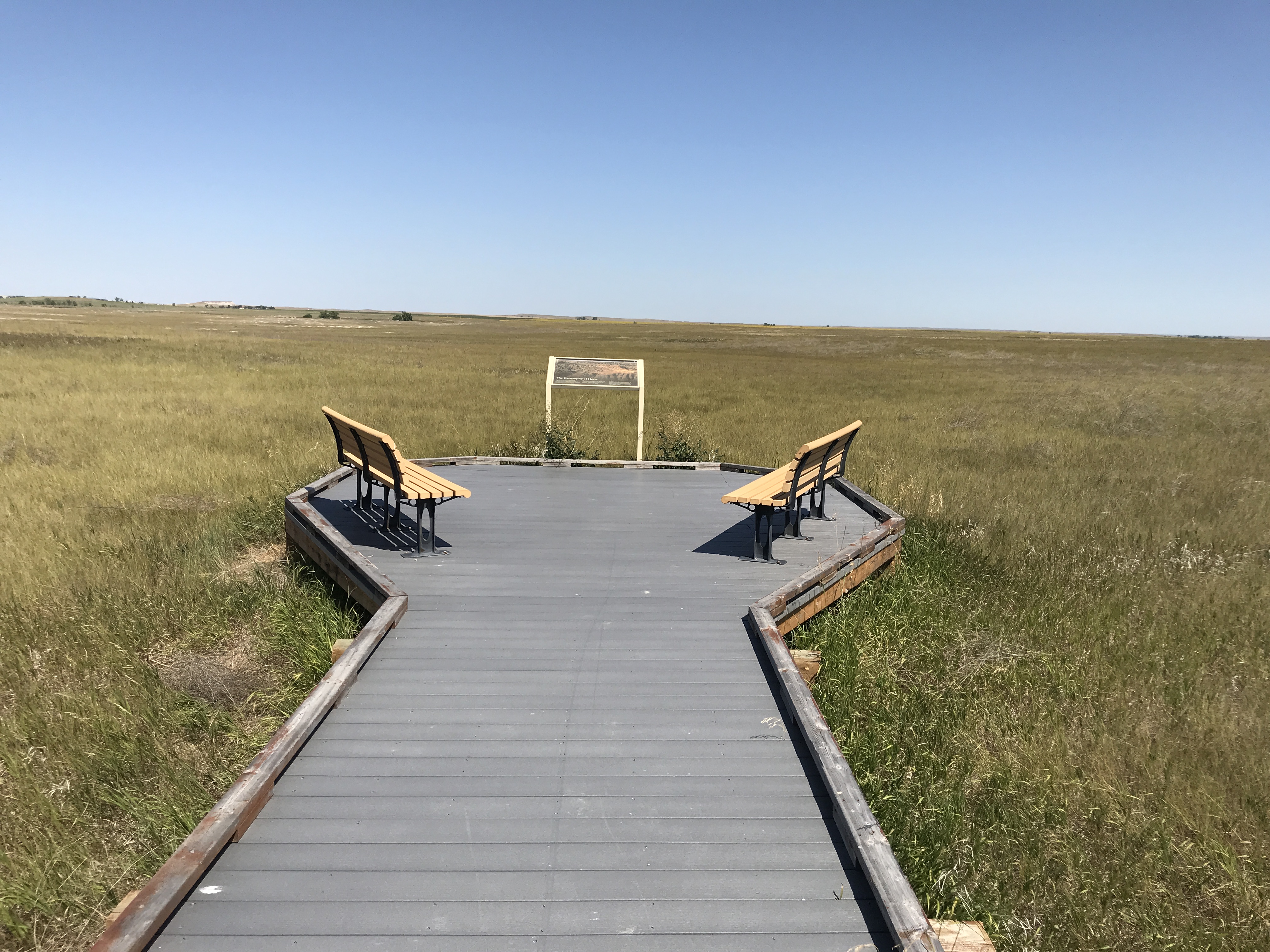
This overlook provides a serene view of the mixed-grass prairie at Badlands National Park. The North American prairie ecosystem is separated into three major components, based on which type of grass dominates the ecology: short-grass prairie, mixed-grass prairie, and tall-grass prairie. The short-grass prairie runs along the rain shadow of the Rocky Mountains, where short grasses receive little moisture. The tall-grass prairie ecosystem Badlands hosts the largest preserved mixed-grass prairie in the United States.  Today, the native prairie only retains about 2% of its original range. Invasive plants further threaten what little is left, pushing out native plants virtually unchallenged. Badlands National Park does what it can to manage these invaders with various tactics, including prescribed fires and spraying herbicides.

Read it at National Park Service

How high is Prairie Wind Overlook?

Prairie Wind Overlook sits at about 2,663 feet (812 m).

What can you see from Prairie Wind Overlook?

From Prairie Wind Overlook: Panorama Point (ENE, 1.4 mi); Homestead Overlook (WNW, 4.9 mi); Kelier Butte (SW, 7.8 mi).

What is the nearest town to Prairie Wind Overlook?

Wall, 16 miles NNW of Prairie Wind Overlook.

What is the next lookout after Prairie Wind Overlook?

Panorama Point is the next surfaced lookout along the same route after Prairie Wind Overlook.

Drive to Prairie Wind Overlook with Byway

Byway plans the scenic way there — real places along Badlands Loop Scenic Byway, real weather, zero hallucinations — and hands the turns to the navigation you already use.

Byways with this lookout

Day trips start here

Locals make it Verified.

Prairie Wind Overlook — confirmed, rated, and photographed by people who actually pulled over. A local confirmation is what upgrades a lookout from Discovered to Verified. Zero hallucinations.

Confirmed by locals

No local confirmations yet. Stood here? Yours is the one that upgrades this lookout to Verified.

Ratings

No ratings yet. Stood at this lookout? Be the first to rate it.

No written reviews yet.

Field notes

No field notes yet. Know the gate hours or the best pull-in? Leave the note you wish you'd had.

Photos

No photos yet.

Sign in to confirm this lookout, rate it, add photos, and leave field notes.

More lookouts on Badlands Loop Scenic Byway

Named places near this lookout