Skip to content

Point Supreme Overlook

VerifiedOpenStreetMap + National Park Service
Looking north-west from Point Supreme Overlook. Terrain and imagery at true elevation.

Point Supreme Overlook sits at mile 7 of 8 along the Cedar Breaks Scenic Byway, at 10,320 feet, facing 300°. The terrain drops 915 feet within 600 meters of the overlook. To the west, Spectra Point rises at 0.4 mile with its viewpoint slightly beyond, followed by Wasatch Rampart and the Ramparts Viewpoint within a mile. Farther west lie The Bartizan and Bartizan Arch at 1.4 miles, with Cedar Breaks peak visible to the north at the same distance. Additional features include Meadow Hill to the northwest, The Highleap to the north, and Wood Knoll to the west at 3.6 miles. The facing direction looks toward sunset, angled 30° off square, with sunset times ranging from 17:17 in December to 20:57 in June. Cedar City lies 13.0 miles west-northwest, while Hurricane and Washington are both to the southwest at greater distances. The previous stop along the byway is Chessmen Ridge Overlook.

Position
Mile ~7 of 8
Access
On the byway
Elevation
10,320 ft
View
Northwest · 300°
Light
Best at sunset
Relief
915 ft drop
In view
10 named features
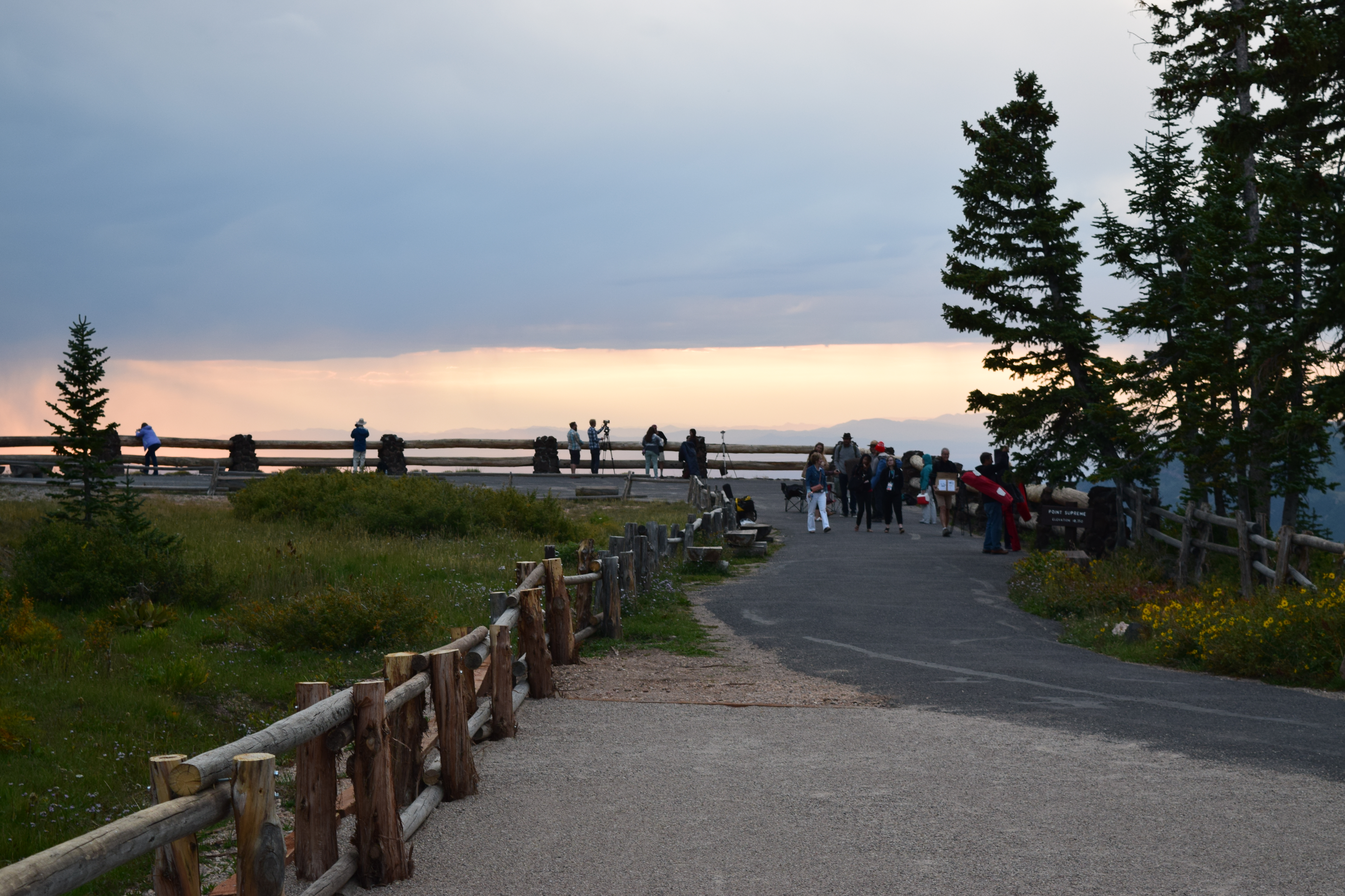
The Point Supreme Overlook
NPS Photo · Public domain (NPS) · NPS
Panoramic of Cedar Breaks
runt35 · CC BY 3.0 · source
Sunset View at Cedar Breaks
The Dye Clan · CC BY-SA 3.0 · source
Sunset View at Cedar Breaks
The Dye Clan · CC BY-SA 3.0 · source
(1 in a multiple picture set) This was our first glimpse of the kind of rock formations we would be seeing all week as we explored Bryce Canyon. When these outcroppings wear down more, they separate into hoodoos, or thin spires of colored rock.
inkknife_2000 (7.5 million views +) · CC BY-SA 2.0 · source
(1 in a multiple picture set) The day before, we'd driven close to a forest fire south of Cedar City, UT. When we got to Cedar Breaks, some of the smoke had drifted into the canyon. I was a bit upset, thinking it would hinder good photos, but the haze added some interest. This picture is taken with
inkknife_2000 (7.5 million views +) · CC BY-SA 2.0 · source

What you’re looking at

Named terrain inside the view from this overlook, nearest first.

  • Spectra Point10,118 ftwest · 0.4 mi
  • Spectra Point Viewpoint10,271 ftwest-southwest · 0.4 mi
  • Wasatch Rampart9,929 ftwest · 0.8 mi
  • Ramparts Viewpoint9,903 ftwest · 0.9 mi
  • The Bartizan9,768 ftwest · 1.4 mi
  • Bartizan Arch9,734 ftwest · 1.4 mi
  • Cedar Breaks9,720 ftnorth · 1.4 mi
  • Meadow Hill8,591 ftnorthwest · 1.7 mi
  • The Highleap9,342 ftnorth · 2.4 mi
  • Wood Knoll9,419 ftwest · 3.6 mi

Light

This overlook faces sunset 30° off square to it.

DateSunriseSunsetGolden hour
March equinox07:3619:4419:09
June solstice06:1120:5720:18
September equinox07:2019:3018:55
December solstice07:4317:1716:36

Local time (America/Denver). Computed for this exact position.

Where it is

Mile 7 of 8 along Cedar Breaks Scenic Byway.

  • Cedar City13.0 mi west-northwest
  • Hurricane39.1 mi southwest
  • Washington49.7 mi southwest
Loading map…
Private beta · Free to join

Take the scenic way to Point Supreme Overlook.

Byway plans around your taste, verified places, real weather and opening hours — then opens every leg in Google Maps with one tap.

Private beta · Free to join · No card · Invite when a spot opens

Point Supreme Overlook · National Park Service

Since its establishment in 1933, Point Supreme Overlook has served as the primary scenic viewpoint for visitors to the rim of the Cedar Breaks Amphitheater. From this point, at 10,350ft, visitors can see the incredible formations created by the weathering and erosion over thousands of years. As the primary overlook, this point offers several visitor services including a restroom, information booth, park store, and public programming. These services are available during the summer season, traditionally between June and September each year. The overlook is accessible by private vehicles from a small parking lot. The area is always open, but access does vary throughout the year depending upon weather. Once the park road is closed to vehicle access (normally in November each year), the overlook is only accessible by snowshoe, cross-country skies, or snowmobiles.

Read it at National Park Service

How high is Point Supreme Overlook?

Point Supreme Overlook sits at about 10,320 feet (3,145 m).

What can you see from Point Supreme Overlook?

From Point Supreme Overlook: Spectra Point (W, 0.4 mi); Spectra Point Viewpoint (WSW, 0.4 mi); Wasatch Rampart (W, 0.8 mi); Ramparts Viewpoint (W, 0.9 mi).

Is Point Supreme Overlook better at sunrise or sunset?

Sunset. The land falls away from Point Supreme Overlook toward the sunset, so at sunrise the light is behind you. Exact times shift through the year; the page shows the current window.

What is the nearest town to Point Supreme Overlook?

Cedar City, 13 miles WNW of Point Supreme Overlook.

Drive to Point Supreme Overlook with Byway

Byway plans the scenic way there — real places along Cedar Breaks Scenic Byway, real weather, zero hallucinations — and hands the turns to the navigation you already use.

Byways with this lookout

Day trips start here

Locals make it Verified.

Point Supreme Overlook — confirmed, rated, and photographed by people who actually pulled over. A local confirmation is what upgrades a lookout from Discovered to Verified. Zero hallucinations.

Confirmed by locals

No local confirmations yet. Stood here? Yours is the one that upgrades this lookout to Verified.

Ratings

No ratings yet. Stood at this lookout? Be the first to rate it.

No written reviews yet.

Field notes

No field notes yet. Know the gate hours or the best pull-in? Leave the note you wish you'd had.

Photos

No photos yet.

Sign in to confirm this lookout, rate it, add photos, and leave field notes.

More lookouts on Cedar Breaks Scenic Byway

Named places near this lookout