Carbon River Ranger Station
46.9871, -121.9614 · Park boundary: National Park Service
Take the scenic way to Carbon River Ranger Station.
Byway plans around your taste, verified places, real weather and opening hours — then opens every leg in Google Maps with one tap.
Located in the northwest corner of the park, the ranger station is staffed by rangers or volunteers. Building hours may vary so call ahead for hours 360-829-9639. When open, rangers and volunteers provide park information, wilderness camping, and climbing permits. Wilderness camping permits available by self-registration when closed.
Closed all week
Until further notice, there is NO access to Carbon River & Mowich Lake due to the closure of the SR165 Carbon River Fairfax Bridge outside of the park. The bridge is closed to pedestrians, bicyclists, and vehicles and there is no alternate route. Hours vary greatly according to season, staffing, and weather conditions. Please call ahead for hours as well as road and trail conditions: 360-829-9639.
Located on the Carbon River Road, 5.5 miles east of its junction with the Mowich Lake Road (State Route 165), the ranger station is just over 2 miles before the road ends at the park boundary.
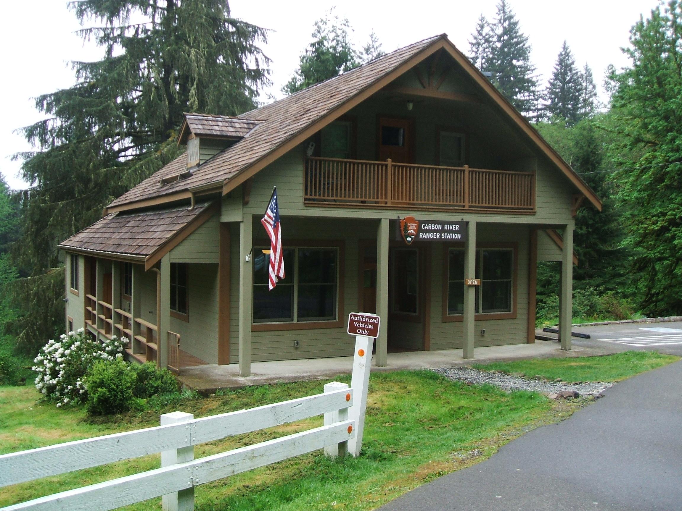
The Carbon River Ranger Station is housed in a remodeled farmhouse with an angled roof and a covered porch. There is angled parking along the main road on either side of the ranger station driveway, which curves down a short hill to reach the building. The interior of the building consists of one large room, with a long wooden desk directly across from the front door. A fire place is on the right side wall, flanked by two iPad kiosks, which play videos and interactive exhibits about the natural and cultural history of the Carbon River area. Various informational signs are attached to the walls in between large windows. A small table in front of one of the windows to the right of the door holds books, maps and other merchandise.
Location, hours, and facility details confirmed against the National Park Service registry.
National Park Service registryChecked 2026-08-04
Where is Carbon River Ranger Station?
Carbon River Ranger Station in Mount Rainier National Park is at 35415 Fairfax Forest Reserve Rd E, Carbonado, WA.
What services does Carbon River Ranger Station offer?
Carbon River Ranger Station in Mount Rainier National Park lists automated external defibrillator (aed), entrance passes for sale, first aid kit available, gifts/souvenirs/books, historical/interpretive information/exhibits, information, information - maps available, information - park newspaper available, information - ranger/staff member present, information kiosk/bulletin board, parking - auto, permits issued, trash/litter receptacles, wheelchair accessible.
What is the phone number for Carbon River Ranger Station?
Carbon River Ranger Station in Mount Rainier National Park can be reached on 360-829-9639.
- JCT MT RAINIER NATIONAL PARK TO JCT SR 162 VIC SOUTH PRAIRIE2 mi away
- Chinook Scenic BywayNationally designated · 12 mi away
- JCT MUD MTN RD VIC ENUMCLAW TO JCT SR 12 VIC NACHES12 mi away
- JCT SCATTER CREEK CROSSING TO JCT SR 12 VIC NACHES13 mi away
- JCT SR 7 VIC ELBE TO JCT ENTRANCE MT RAINIER NATIONAL PARK16 mi away
- JCT SR 7 VIC ELBE TO MT RAINIER NAT PARK BOUNDARY16 mi away
Drive to Carbon River Ranger Station
Byway plans the scenic way in — real places, real weather, every stop verified. Zero hallucinations. Google Maps for turns. Byway for soul.