Longmire Wilderness Information Center
46.7501, -121.8117 · Park boundary: National Park Service
Take the scenic way to Longmire Wilderness Information Center.
Byway plans around your taste, verified places, real weather and opening hours — then opens every leg in Google Maps with one tap.
Open during the summer, the Longmire Wilderness Information Center (WIC) is located in the lobby of the historic Longmire Administration Building, a picturesque example of National Park Service rustic architecture in Longmire. The WIC features a 3D model map of Mount Rainier National Park and has an information desk staffed by wilderness rangers. Rangers at the WIC assist with wilderness permits, trip planning, and providing maps and trail condition updates.
- Every day
- 7:30AM - 5:00PM
Generally open late May through mid-October. Hours and days of operation may change suddenly due to staffing demands.
- Winter Season · Oct 1, 2026 – May 2, 2027 · Closed
The Longmire WIC has no physical address. It is in Longmire, on the south side of the mountain, about 9 miles east of the town of Ashford on State Route 706.
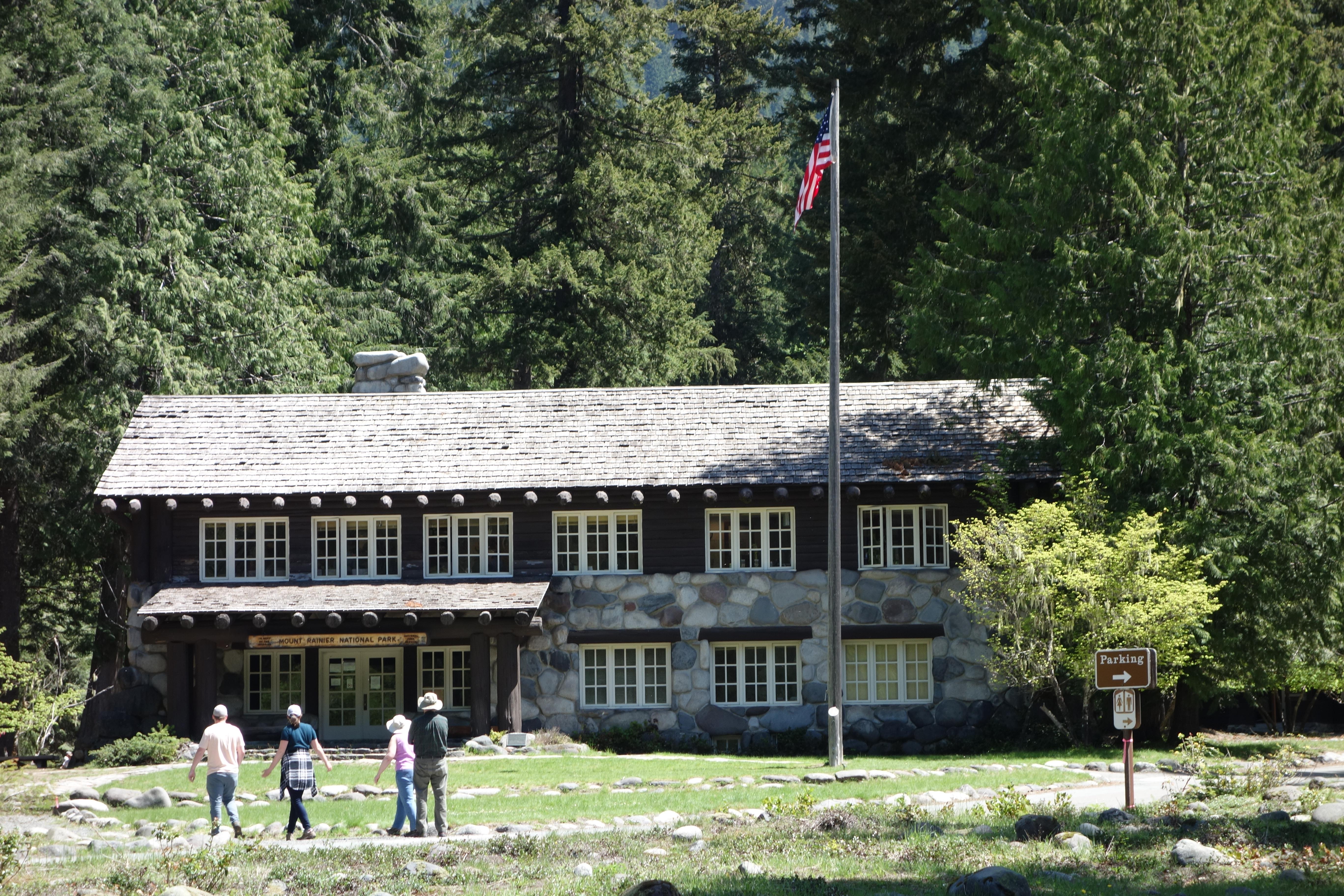
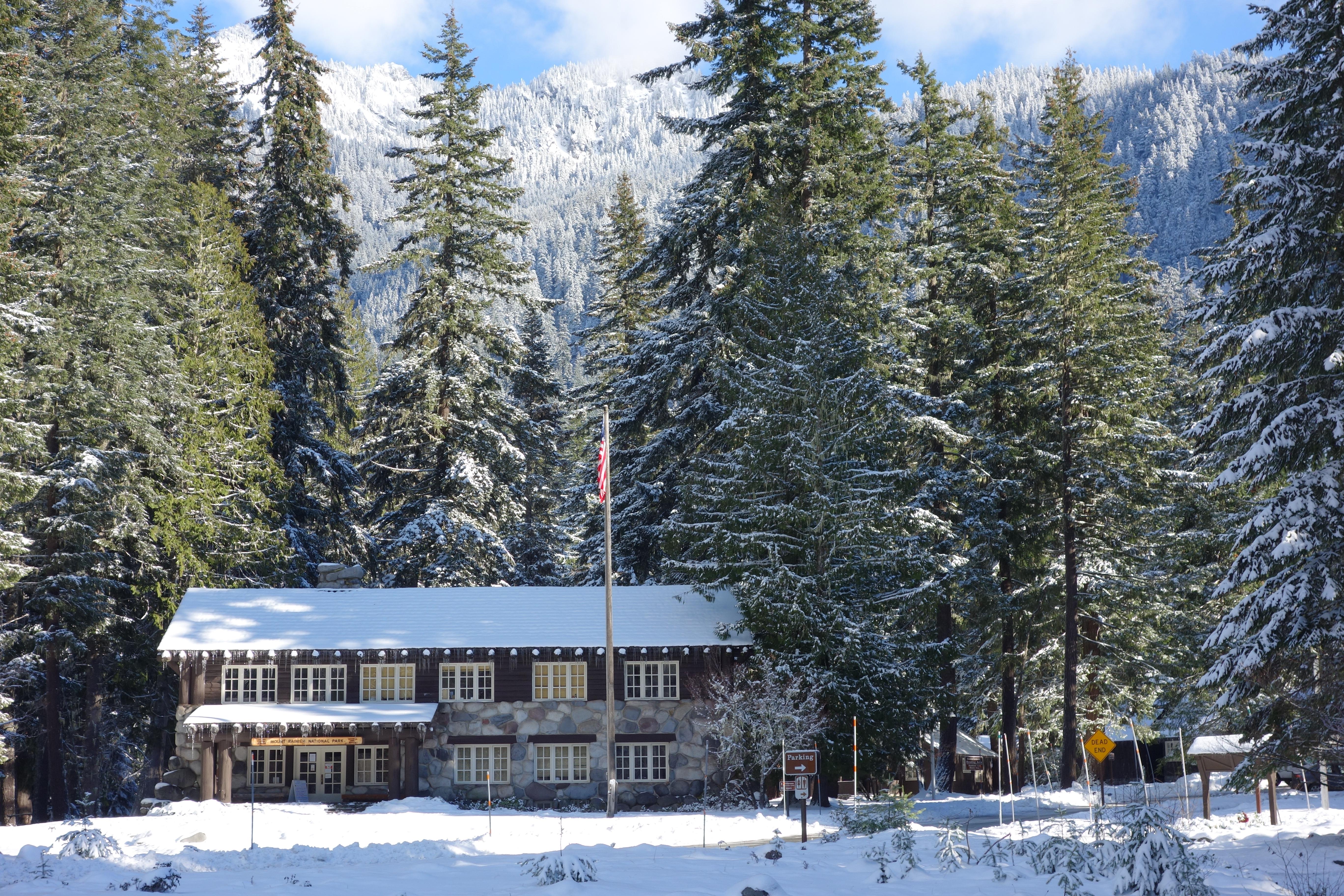
The Longmire Administration Building is a two-story building near the main road as you travel through Longmire. The building is framed by tall evergreen trees and there is a small lawn with a flagpole in front. The bottom story of the building is built from large rounded boulders, while the top story is built of wood logs, with a wood shingled roof. Both stories have rows of windows with white trim. The entrance is shaded by a porch with large log beams supporting the wood-shingled porch roof. A yellow log sign reading “Mount Rainier National Park” hangs from underneath the porch roof. A gravel path leads to the entrance across the lawn. The lobby of the building, a single rustic room, is the location of the Longmire Wilderness Information Center. Directly across from the entrance doors is a fireplace built of large boulders. A wood-paneled information desk is on the right side of the room, while a large three-dimensional map of the park fills a table on the left side of the room.
Location, hours, and facility details confirmed against the National Park Service registry.
National Park Service registryChecked 2026-08-04
Where is Longmire Wilderness Information Center?
Longmire Wilderness Information Center in Mount Rainier National Park is at Mount Rainier National Park, Longmire, WA.
What services does Longmire Wilderness Information Center offer?
Longmire Wilderness Information Center in Mount Rainier National Park lists accessible rooms, automated external defibrillator (aed), fire extinguisher, first aid kit available, historical/interpretive information/exhibits, information, information - maps available, information - park newspaper available, information - ranger/staff member present, permits issued, recycling, trailhead/hiker register, trash/litter receptacles, wheelchair accessible.
What is the phone number for Longmire Wilderness Information Center?
Longmire Wilderness Information Center in Mount Rainier National Park can be reached on (360) 569-6650.
- JCT SR 7 VIC ELBE TO JCT ENTRANCE MT RAINIER NATIONAL PARK5 mi away
- JCT SR 7 VIC ELBE TO MT RAINIER NAT PARK BOUNDARY5 mi away
- White Pass Scenic BywayNationally designated · 11 mi away
- JCT KOSMOS RD VIC MORTON TO JCT SR 410 VIC NACHES11 mi away
- JCT SR 12 OHANAPECOSH JCT VIC WHITE PASS TO JCT SR 410 VIC CHINOOK PASS11 mi away
- JCT SR 12 VIC MORTON TO JCT SR 410 VIC CHINOOK PASS11 mi away
Drive to Longmire Wilderness Information Center
Byway plans the scenic way in — real places, real weather, every stop verified. Zero hallucinations. Google Maps for turns. Byway for soul.