Ohanapecosh Visitor Center
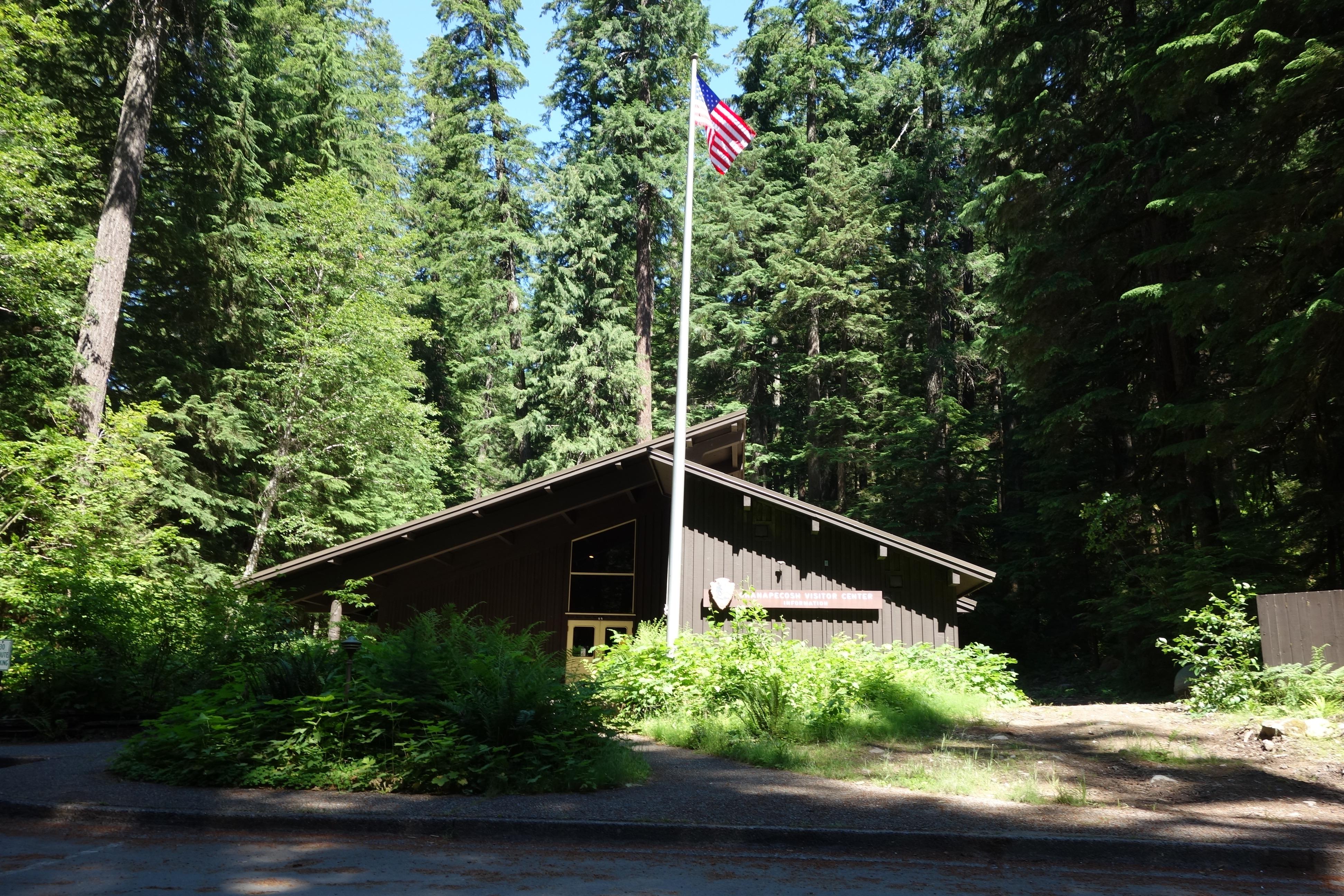
46.7360, -121.5659 · Park boundary: National Park Service
Take the scenic way to Ohanapecosh Visitor Center.
Byway plans around your taste, verified places, real weather and opening hours — then opens every leg in Google Maps with one tap.
NOTE: The Ohanapecosh Visitor Center is CLOSED for the summer of 2026 as part of the Ohanapecosh Campground rehabilitation project. This visitor center is located in the southeast corner of the park on State Route 123, 12 miles north of the town of Packwood. It is next to the Ohanapecosh Campground and near the trailhead for the natural Hot Springs and Silver Falls Trails. There are restrooms, exhibits, and a ranger or volunteer on duty to answer questions when it is open for the summer season.
- Every day
- 9:00AM - 5:00PM
Only open in the summer, this visitor center generally opens in late June and closes early September. Staffed by rangers and volunteers, days and hours of operation can vary and are posted on Ohanapecosh kiosks and bulletin boards, and in park newspaper's summer edition. Exhibits, books for sale, and rangers or volunteers on duty to answer questions during open hours.
- Closed for construction · Jan 1, 2026 – Nov 30, 2026 · Closed
- Closed Seasonally · Sep 16, 2026 – Jun 16, 2027 · Closed
Ohanapecosh Visitor Center is a Passport To Your National Parks stamp location.
Ohanapecosh Visitor Center is on State Route 123, 12 miles north of the town of Packwood. It has no physical address. GPS users can enter 46.914466,-121.643404 for its location.
The Ohanapecosh Visitor Center consists of bathrooms and information boards outside the building. Inside, the visitor center consists of one large room with exhibit panels educating visitors on the history and natural resources of the area. There is an information desk to the right upon entering and a small seating area to the left. There is a small book store behind the desk where visitors can purchase books and maps. The rest of the room has exhibits. The building itself is Mission 66 style, and surrounded by tall fir and cedar trees. There are also numerous types of smaller plants that can be found here, including alder and various wildflowers. There is parking in front of the building to the left. A path to the left of the building leads visitors to a large tree round with various world events marked on the tree like a timeline. There is a covered area with a few benches underneath. A path behind the building connects visitors to various hiking trails, including the Hot Springs Trail and the Silver Falls Trail.
Location, hours, and facility details confirmed against the National Park Service registry.
National Park Service registryChecked 2026-08-04
Where is Ohanapecosh Visitor Center?
Ohanapecosh Visitor Center in Mount Rainier National Park is at Mount Rainier National Park, Ashford, WA.
What services does Ohanapecosh Visitor Center offer?
Ohanapecosh Visitor Center in Mount Rainier National Park lists amphitheater, animal-safe food storage, beach/water access, fire pit, historical/interpretive information/exhibits, information, information - maps available, information - park newspaper available, information - ranger/staff member present, information kiosk/bulletin board, parking - auto, picnic table, recycling, restroom, restroom - seasonal, telephone, trailhead, trash/litter receptacles, water - bottle-filling station.
Is there a passport stamp at Ohanapecosh Visitor Center?
Yes. Ohanapecosh Visitor Center in Mount Rainier National Park is a National Park Passport stamp location.
What is the phone number for Ohanapecosh Visitor Center?
Ohanapecosh Visitor Center in Mount Rainier National Park can be reached on 3605692211.
- JCT SR 12 OHANAPECOSH JCT VIC WHITE PASS TO JCT SR 410 VIC CHINOOK PASSPasses here
- JCT SR 12 VIC MORTON TO JCT SR 410 VIC CHINOOK PASSPasses here
- White Pass Scenic BywayNationally designated · 3 mi away
- JCT KOSMOS RD VIC MORTON TO JCT SR 410 VIC NACHES3 mi away
- JCT SR 5 VIC MORTON TO JCT SR 410 VIC NACHES3 mi away
- Chinook Scenic BywayNationally designated · 9 mi away
Drive to Ohanapecosh Visitor Center
Byway plans the scenic way in — real places, real weather, every stop verified. Zero hallucinations. Google Maps for turns. Byway for soul.